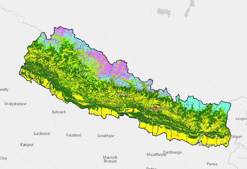
The land cover data for the years 1990 have been derived from Landsat TM 30m images using object based image analysis. The study estimated that 45.15% of Nepal is covered by forests and 25.41% by agr..
Local projections of future sea-level change are important for understanding climate change risks and informing coastal management decisions. Reliable and relevant coastal risk information is especia..
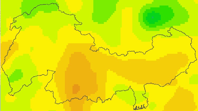
Precipitaton(%) and temperature(delta T(K)) for RCP4.5 and RCP 8.5 for 4 GCM, monthly change grids at a resolution of 25km covering the whole model domain, grids showing the average monthly value dur..
Digital table data of population and population density between 2001 and 2011 of Koshi Basin. This dataset is created using population census at district level and comprise demographic information o..
Digital table data of Livestock and livestock products of Koshi Basin. This dataset is compiled using data sources from Statistical information on Nepalese agriculture, MoAD(2012); Economic Survey (..
Digital table data of Socio-economic Characteristics of Koshi Basin. This dataset is created using population census at district level and comprise major socio-economic indicators captured in this s..
Digital table data of Livestock population of Koshi Basin. The dataset is compiled using data sources from Statistical information on Nepalese agriculture, MoAD(2012); Economic Survey (2011/2012), G..
Digital table data of forest-cover, irrigated and rain-fed agriculture, fertilizer use and cropping intensity of Koshi Basin. This dataset is compiled using data sources from Statistical information ..
Digital table data of Major Agricultural crop production of Koshi Basin. This dataset consists related to area and production of major agricultural crops such as cereals, vegetables, cash crops, oil..
Digital point dataset of Location Mountain Peaks of Koshi Basin. This dataset is created using Topographic sheet data at scale of 25,000/50,000, of 1995 acquired from National Geographic Information..