This occurrence database contains records of the mushrooms based on the herbarium specimens deposited at the Tribhuvan University Central Herbarium (TUCH) managed by the Central Department of Botany,..
This occurrence database contains records of the lichens based on the herbarium specimens deposited at the Tribhuvan University Central Herbarium (TUCH) managed by the Central Department of Botany, T..
This occurrence database contains records of the mushrooms based on the herbarium specimens deposited at the Natural History Museum (NHM), Tribhuvan University Nepal. Situated on the lap of a world h..
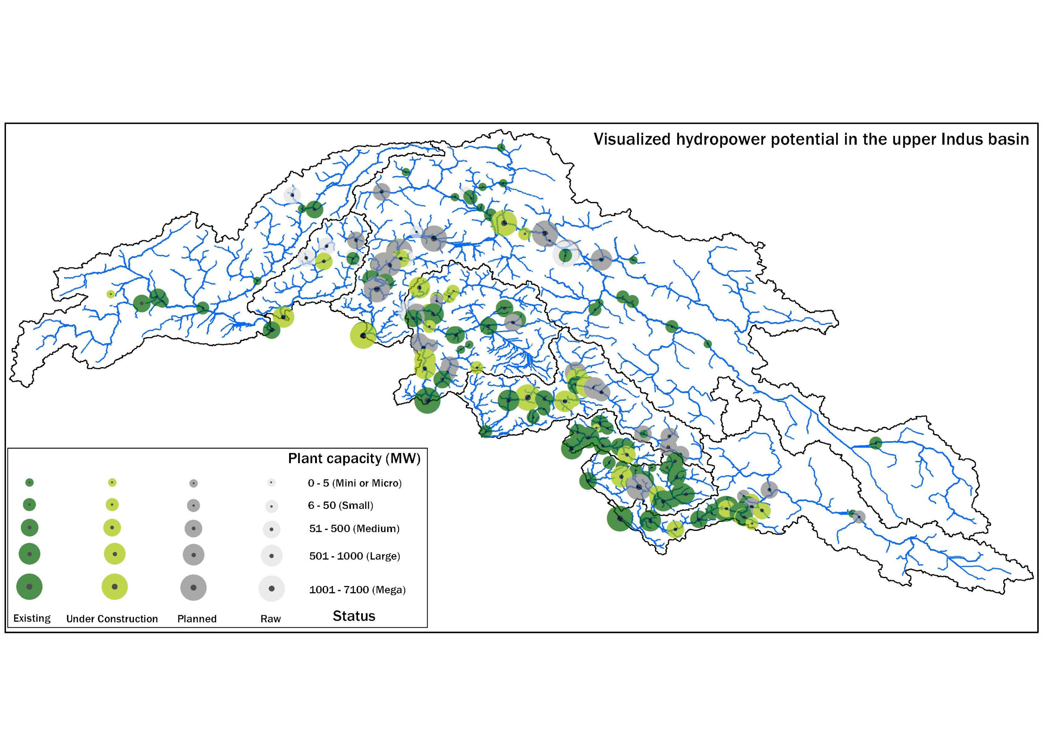
This database was compiled under WP-2 of the SustainIndus project between August 2019 and August 2021 to consolidate publicly available information on hydropower projects in various stages of develop..
The assessment of meltwater sourcing from the clean and debris-covered glaciers is scarce in High Mountain Asia (HMA). The melting rate varies with the debris cover thickness and glacier orientation...
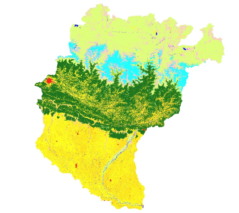
Land cover and its change analysis across Hindu Kush Himalayan region is realized as an urgent need to support diverse issues of environmental conservation. This study presents the first and most com..
This dataset presents the findings of a springshed management initiative conducted across seven municipalities in the Kavrepalanchok district of Nepal, addressing critical water stress caused by the ..
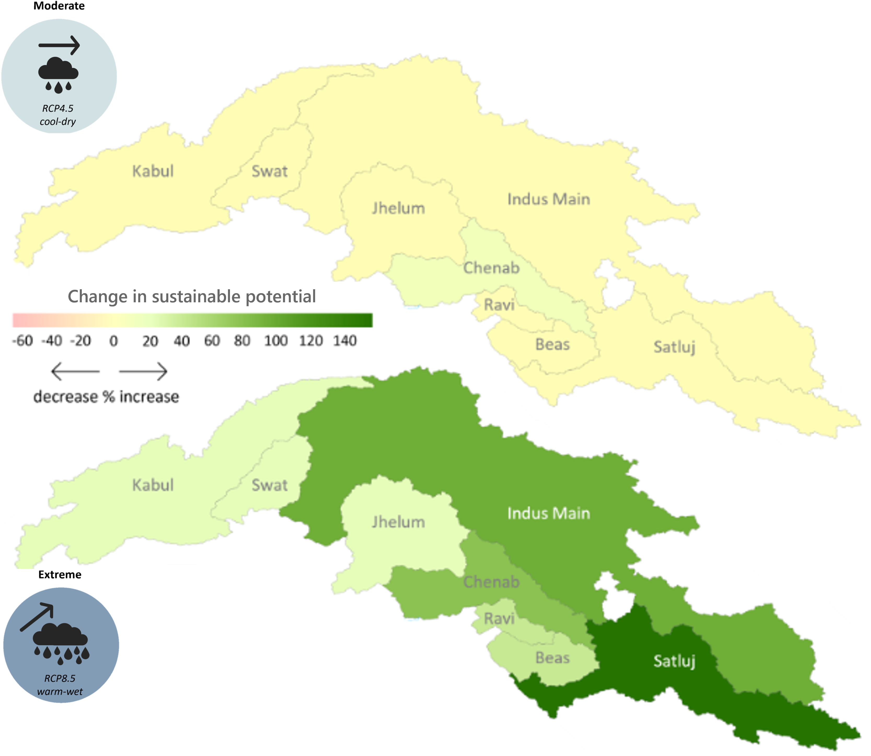
The hydropower potential in the upper Indus basin under future hydro-climatology was prepared using the Hydropower Potential Exploration (HyPE) as part of Work Package 2 in the SustainIndus project. ..
This study investigated the socio-economic factors leading to open agricultural burning in Nawalparasi, Kapilvastu and Rupandehi districts in Nepal. The data set consists of survey data from 388 farm..
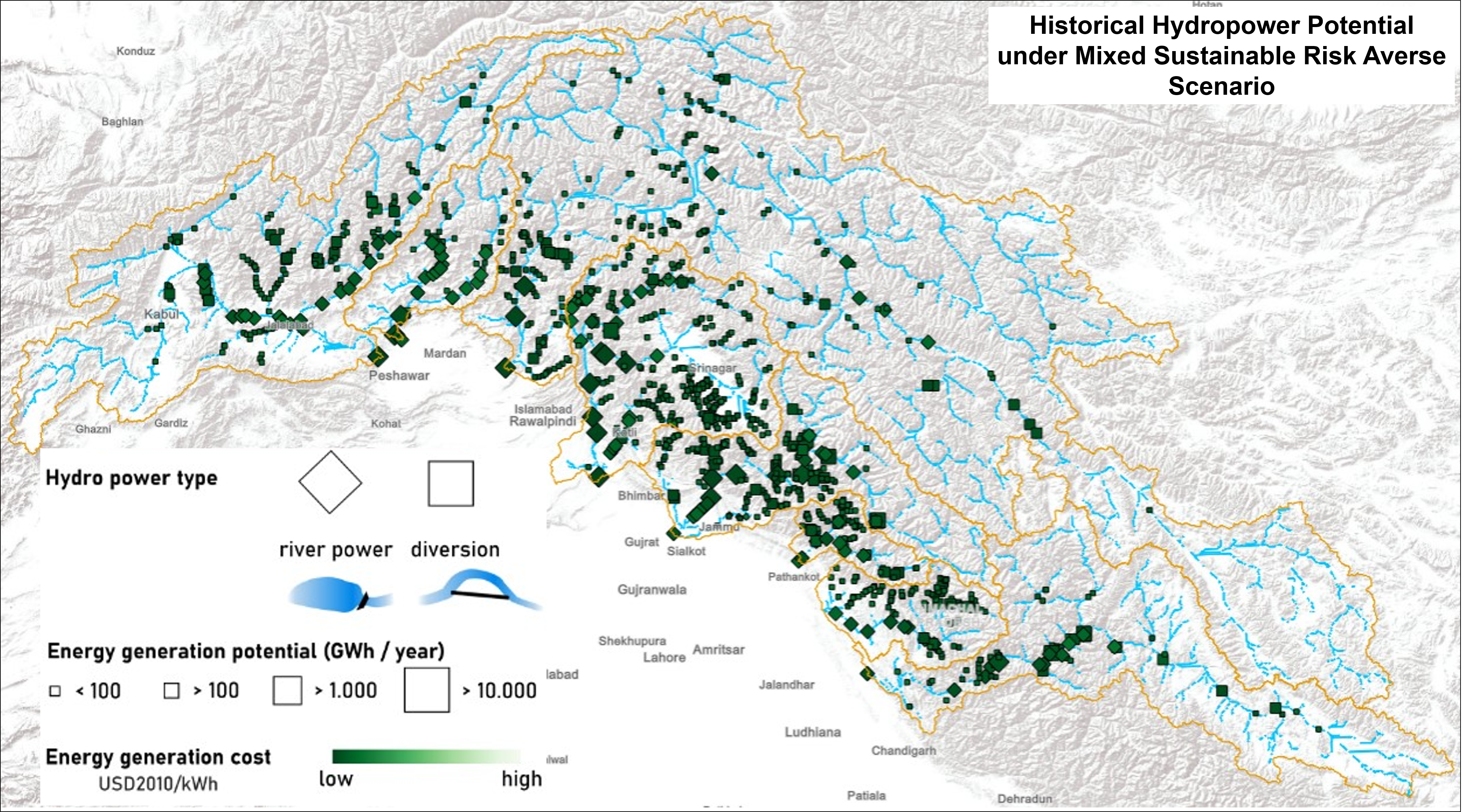
The hydropower potential in the upper Indus basin under historical hydro-climatology was prepared using the Hydropower Potential Exploration (HyPE) model. Under historical hydro-climatology, the HyPE..