Poverty and Vulnerability Assessment (PVA) is a district level household survey to understand vulnerability of households to environmental and socioeconomic changes with focus on mountain specificity..
Poverty and Vulnerability Assessment (PVA) is a district level household survey to understand vulnerability of households to environmental and socioeconomic changes with focus on mountain specificity..
Poverty and Vulnerability Assessment (PVA) is a district level household survey to understand vulnerability of households to environmental and socioeconomic changes with focus on mountain specificity..
Poverty and Vulnerability Assessment (PVA) is a district level household survey to understand vulnerability of households to environmental and socioeconomic changes with focus on mountain specificity..
Eddy Covariance Station measuring turbulent fluxes on Yala Glacier to study sublimation of snow and ice. The setup was installed at the main AWS on Yala Glacier.
The dataset provides second level or sub-basin river boundaries of ten major river basins in the Hindu Kush Himalaya (HKH) region – the Amu Darya, Brahmaputra (Yarlungtsanpo), Ganges, Indus, Irrawadd..
The dataset provides third level river basin boundaries of ten major river basins in the Hindu Kush Himalaya (HKH) region – the Amu Darya, Brahmaputra (Yarlungtsanpo), Ganges, Indus, Irrawaddy, Mekon..
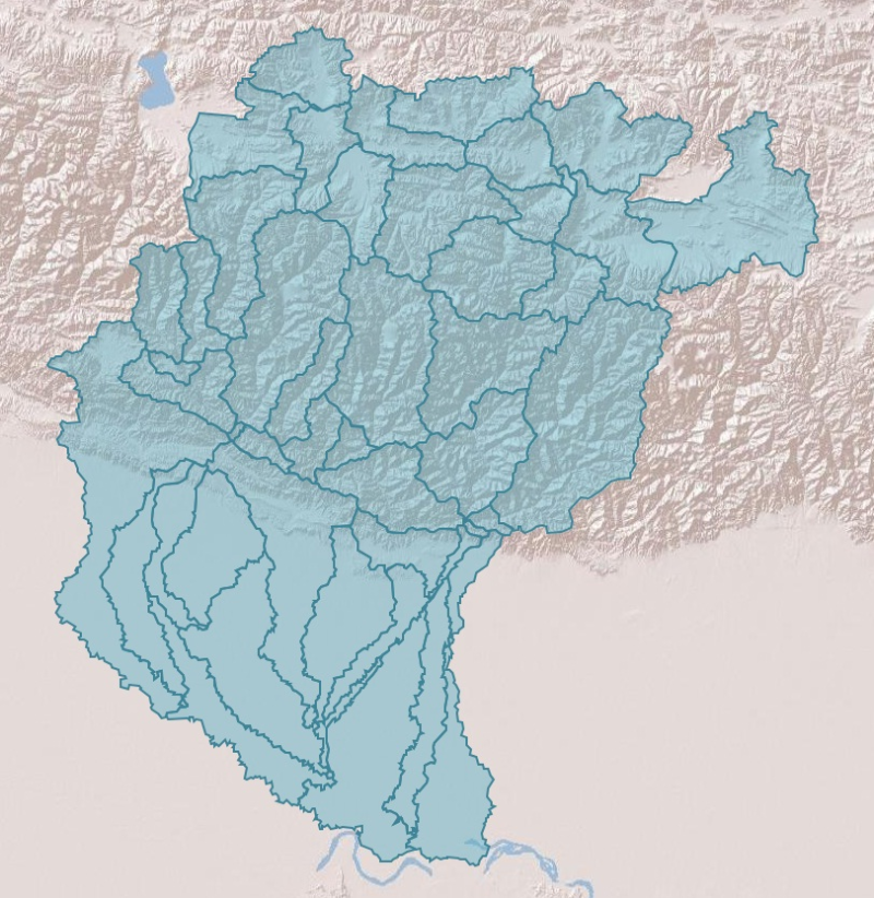
Digital polygon dataset of Sub Basin Boundary of Koshi Basin. This dataset is created using Topographic sheet data at scale of 25,000/50,000 of 1995 acquired from National Geographic Information Infr..