Digital line dataset of Basin Boundary of Koshi Basin. This dataset is created using Topographic sheet data at scale of 25,000/50,000, of 1995 acquired from National Geographic Information Infrastruc..
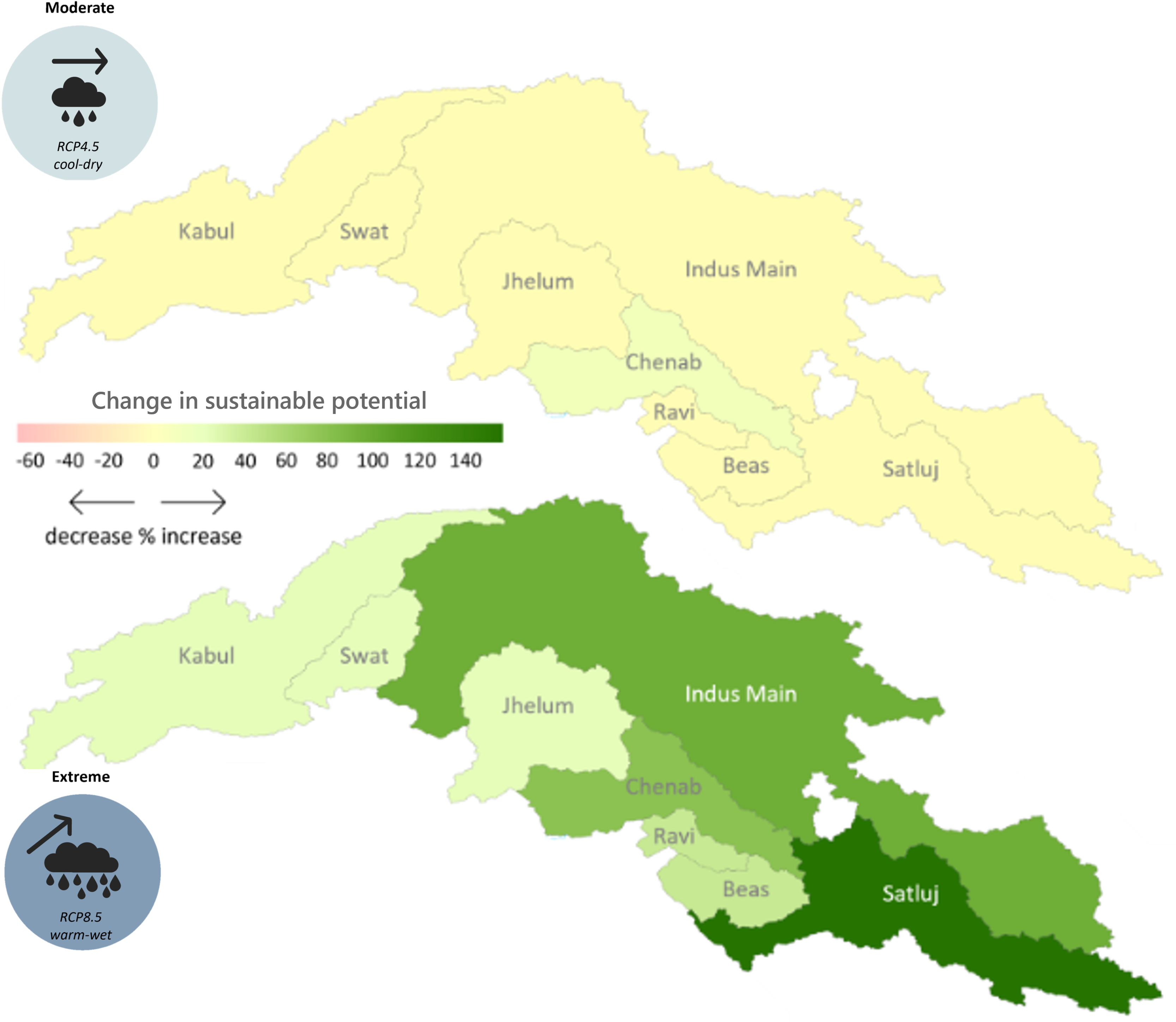
The hydropower potential in the upper Indus basin under future hydro-climatology was prepared using the Hydropower Potential Exploration (HyPE) as part of Work Package 2 in the SustainIndus project. ..
Gamma Ray Station close to Yala Basecamp measuring Snow Water Equivalent as well as radiation (shortwave and longwave radiation) and distance to surface/snow depth
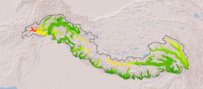
Average contribution of glacier melt, snow melt, and glacier and snow melt combined to total flow during and the average discharge at different stages in major stream. During 1998- 2007 from HI-SPHY ..
Main AWS in Langtang catchment, measuring all atmospheric variables. The station is run in collaboration with DHM and maintained at the main monitoring compound of DHM in Kyanjing.
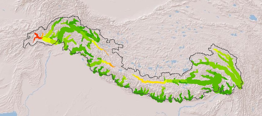
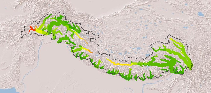
Average contribution of glacier melt, snow melt, glacier and snow melt combined to total flow and average discharge during 2041-2050 in major streams in the model domain results are for HI-SPHY model..
Average contribution of glacier melt, snow melt, glacier and snow melt combined to total flow and average discharge during 2041-2050 in major streams in the model domain results are for HI-SPHY model..
The Poverty and Vulnerability Assessment (PVA) dataset was developed to capture the micro-level perspective of people's experiences with poverty and vulnerability and to monitor poverty and vulnerabi..
The Poverty and Vulnerability Assessment Tool (PVAT) dataset was developed to capture the micro-level perspective of people's experiences with poverty and vulnerability and to monitor poverty and vul..