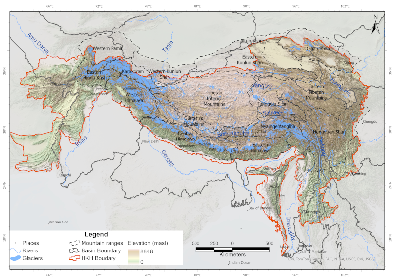
Glaciers are an indispensable component of the Hindu Kush Himalayan (HKH) region, acting as a vast “water tower” that stores large volumes of freshwater and sustains Asia’s ten major river systems, s..
The product contains improved MODIS 8-day Terra (MOD10A2) and Aqua (MYD10A2) collection 6.1 snow-cover composite product. The product is generated using MODIS Terra and Aqua 8-day snow cover products..
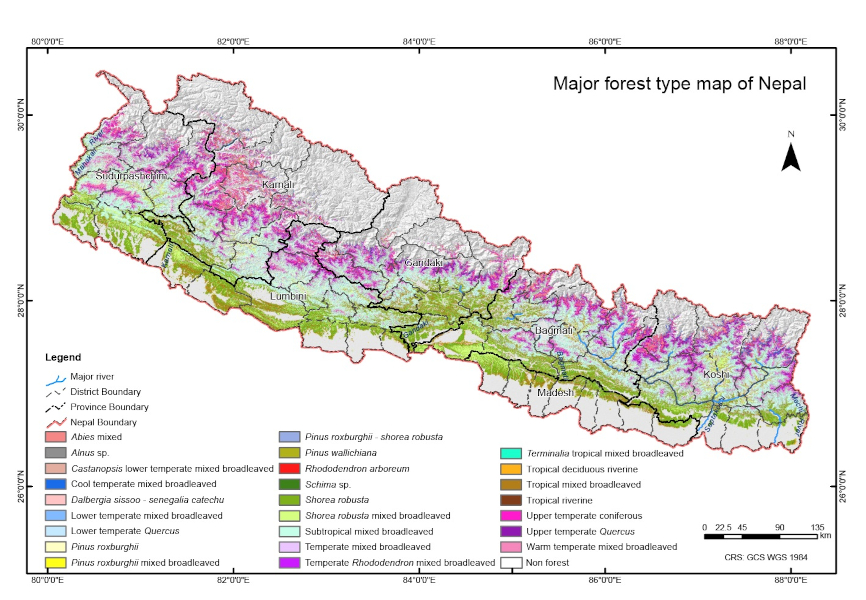
The dataset on forest types of Nepal for 2022 is jointly developed by the Forest Research and Training Centre (FRTC) and International Centre for Integrated Mountain Development (ICIMOD) with financi..
Digital polygon dataset of District Boundary of Afghanistan. This dataset is created from Afghanistan Information Management Systems (AIMS), Afghanistan and ESRI Data and Maps 2001.
The product contains improved MODIS 8-day Terra (MOD10A2) and Aqua (MYD10A2) collection 6.1 snow-cover composite product merged with Randolph Glacier Inventory (RGI6.0). The product is generated usin..
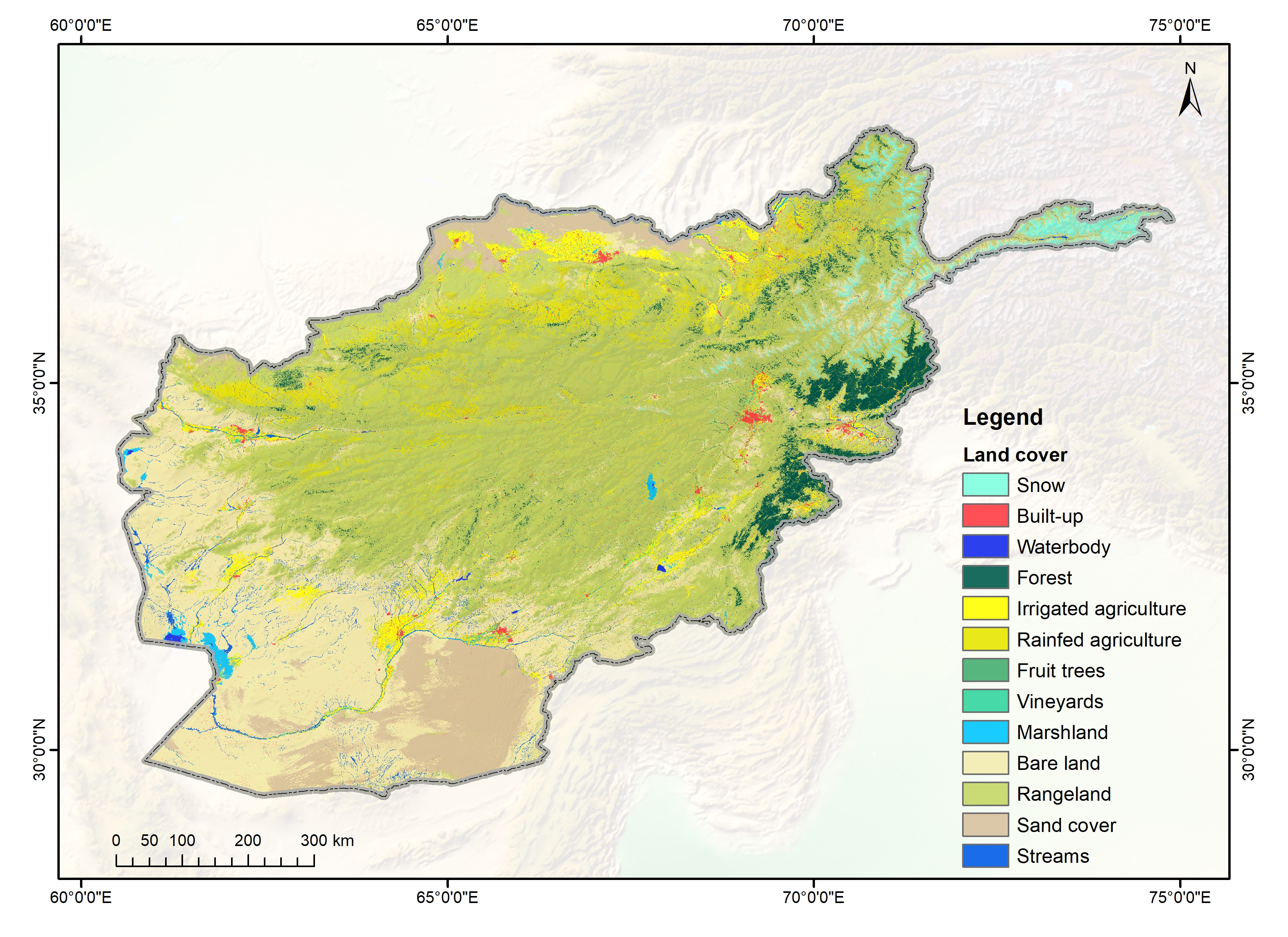
The annual land cover data of Afghanistan (2000-2018) have been created through the National Land Cover Monitoring System (NLCMS) for Afghanistan. The system uses freely available remote-sensing data..
This checklist contains a total of 52 species of amphibians documented from the Kangchenjunga Landscape.This checklist is based on information obtained from the country level feasibility assessment r..
This checklist contains a total of 120 species of reptiles documented from the Kangchenjunga Landscape. This checklist is based on information obtained from the country level feasibility assessment r..
This checklist contains a total of 732 NTFPs species documented from the Kangchenjunga Landscape. This information has been collated from the Kangchenjunga Landscape country level feasibility assessm..