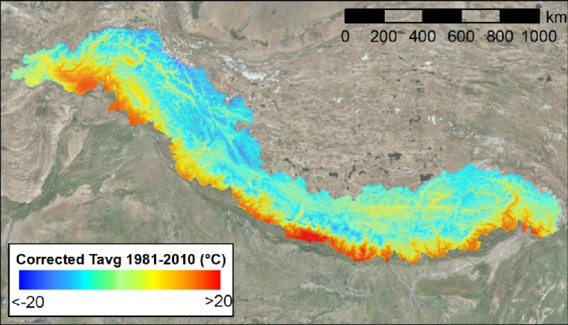
Bias-corrected reference climate dataset for daily mean air temperature (Tavg), daily maximum air temperature (Tmax), daily minimum air temperature (Tmin) and daily precipitation (P). This dataset ha..
This Meteorological station shows the measurement of Temperature, Wind Direction, Wind Speed, Pressure, Relative Humidity and Rainfall at Korilla, Bhutan.
The dataset shows a layer of rock glaciers mapped comprehensively by a first person, using the polygon tool in Google Earth. Therefore, 4000 randomly distributed sample polygons have been created ov..
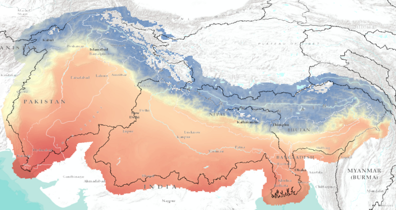
Bias-corrected future climate dataset for daily mean air temperature (Tavg), daily maximum air temperature (Tmax), daily minimum air temperature (Tmin) and daily precipitation (P). This dataset has a..
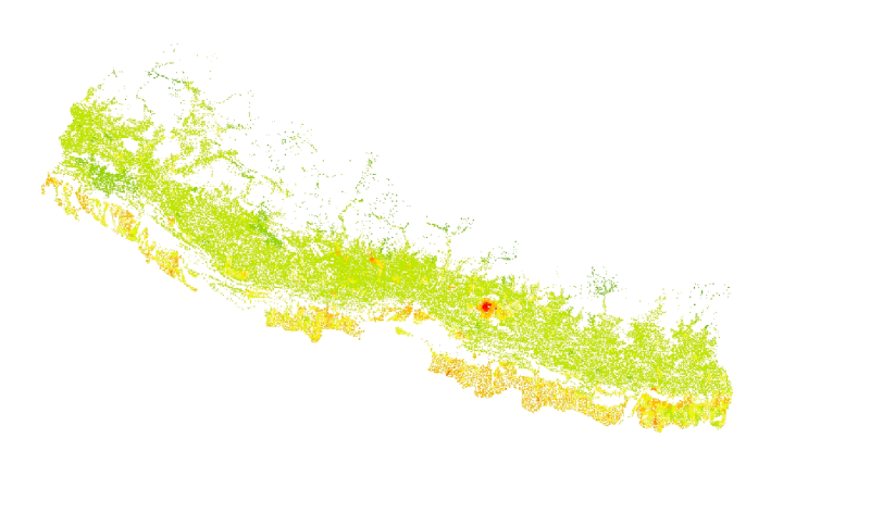
The feature layer has been extracted from the 1x1 km grid data of the population distribution of Nepal. The data has been generated using the population census 2011 of Nepal and the landuse 2010 dat..
This Meteorological station shows the measurement of Temperature, Relative Humidity, Wind Direction, Wind Speed, Pressure and Rainfall at Chainpur, Nepal.