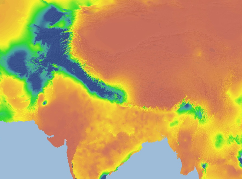
The HKH Region Climate data were derived from WorldClim(http://www.worldclim.org/), This map layer shows precipitation of coolest quarter for the period of 1950-2000.
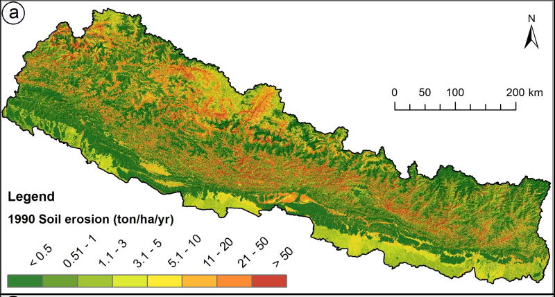
Land cover change is a critical driver for enhancing the soil erosion risk in Nepal. Losing of the topsoil has a direct and indirect effect on human life and livelihoods. The present study provides a..
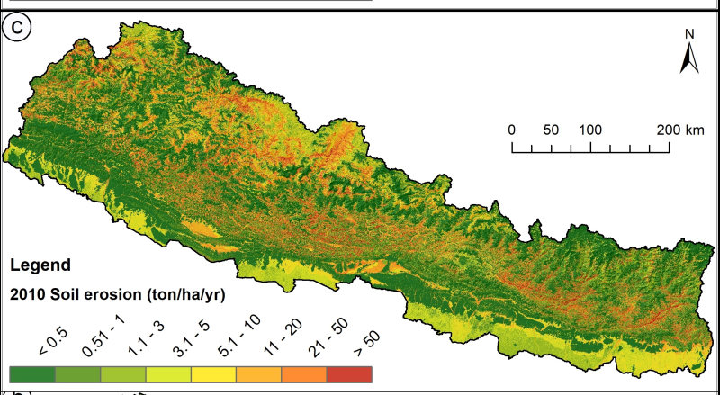
Land cover change is a critical driver for enhancing the soil erosion risk in Nepal. Losing of the topsoil has a direct and indirect effect on human life and livelihoods. The present study provides a..
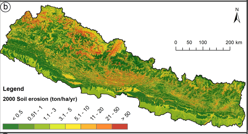
Land cover change is a critical driver for enhancing the soil erosion risk in Nepal. Losing of the topsoil has a direct and indirect effect on human life and livelihoods. The present study provides a..