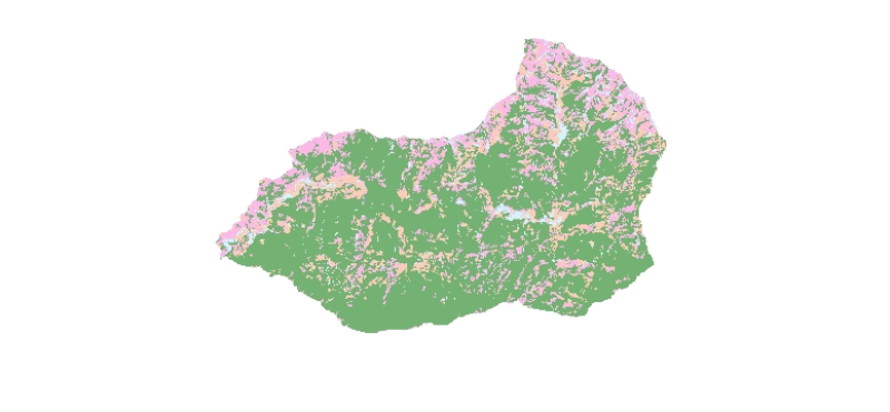
Digital dataset of Land cover of Ludhi Khola Watershed, Gorkha, Nepal. This dataset is created using GeoEye 0.5 meter spatial resolution satellite image of November 2009 and field verified in 2010. T..
Average data for Whole Indus from year 1971 to 1980 for the month of May in ASCII format. It is an Aphrodite data with 0.25 resolution in x and y direction.
The APHRODITE project develops state-of-t..
Average data for Whole Indus from year 2001 to 2007 for the month of October in ASCII format. It is an Aphrodite data with 0.25 resolution in x and y direction.
The APHRODITE project develops state-..
Average data for Whole Indus from year 1961 to 1970 for the month of December in ASCII format. It is an Aphrodite data with 0.25 resolution in x and y direction.
The APHRODITE project develops state..
Average data for Whole Indus from year 2001 to 2007 for the month of April in ASCII format. It is an Aphrodite data with 0.25 resolution in x and y direction.
he APHRODITE project develops state-of-..
Average data for Whole Indus from year 1961 to 1970 for the month of May in ASCII format. It is an Aphrodite data with 0.25 resolution in x and y direction.
The APHRODITE project develops state-of-t..
Average data for Whole Indus from year 1951 to 1960 for the month of February in ASCII format. It is an Aphrodite data with 0.25 resolution in x and y direction.
The APHRODITE project develops state..
Average data for Whole Indus from year 1971 to 1980 for the month of November in ASCII format. It is an Aphrodite data with 0.25 resolution in x and y direction.
The APHRODITE project develops state..
Average data for Whole Indus from year 1981 to 1990 for the month of November in ASCII format. It is an Aphrodite data with 0.25 resolution in x and y direction.
The APHRODITE project develops state-..
Average data for Whole Indus from year 1951 to 1960 for the month of August in ASCII format. It is an Aphrodite data with 0.25 resolution in x and y direction.
The APHRODITE project develops state-o..