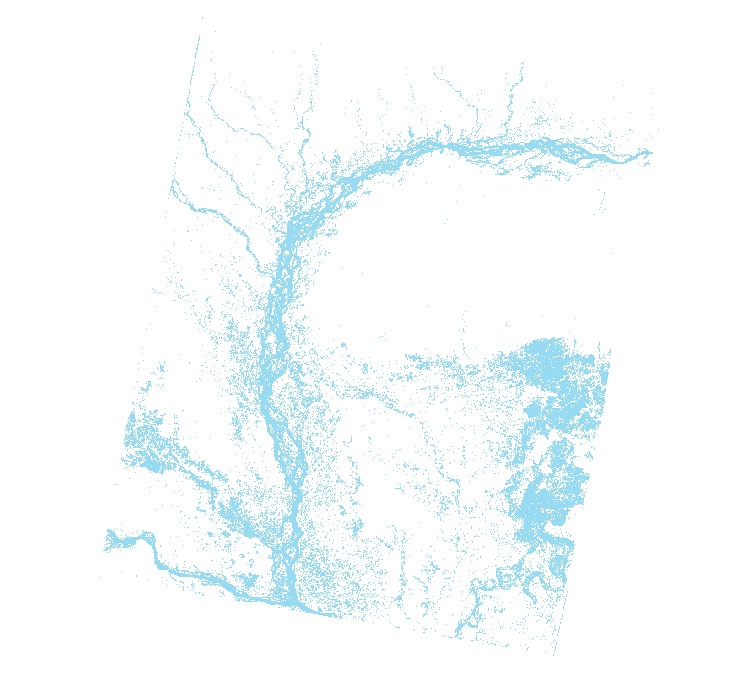
Digital dataset of Land cover of Kayar Khola Watershed, Chitwan, Nepal. This dataset is created using GeoEye 0.5 meter spatial resolution satellite image of November 2009 and field verified in 2010. ..
Digital dataset of vegetation change analysis between 1992 and 2000 in Sagarmatha National Park, Nepal. The vegetation change analysis has been done based on satellite image interpretations using Lan..
Digital dataset of Land Cover of Charnawati Watershed, Dolakha, Nepal. This dataset is created using GeoEye 0.5 meter spatial resolution satellite image of November 2009 and field verified in 2010. T..
Digital polygon dataset of Park Boundary of Central Karakoram National Park (CKNP) area, Pakistan. This dataset is created using topographic sheet maps at scale of 20000.
The annual land cover data of Nepal (2000-2022) have been created through the National Land Cover Monitoring System (NLCMS) for Nepal. The system uses freely available remote-sensing data (Landsat) a..
This is a checklist of flowering plant diversity in the Far eastern Himalayan Landscape comprising parts of China, India and Myanmar. It contains a total of 5283 species collated from published resou..
The product contains improved MODIS 8-day Terra (MOD10A2) and Aqua (MYD10A2) collection 6.1 snow-cover composite product merged with Randolph Glacier Inventory (RGI6.0). The product is generated usin..
The glacial lakes of Afghanistan were mapped using Landsat image that were selected based in a one-year buffer surrounding a representative year. For instance, the Landsat images from 1989 to 1991 we..
Local projections of future sea-level change are important for understanding climate change risks and informing coastal management decisions. Reliable and relevant coastal risk information is especia..
Coupled Model Intercomparison Project Phase 6 (CMIP6) data sets assist the science community in conducting studies on climate change impacts at regional scales, and enhance public understanding of po..