This sensor measures precipitation volume and intensity with a bucket. Additionally, air temperature and snow height are recorded. It is located in Langtang Valley on the ridge between Kyanjing Ri an..
This sensor measures soil moisture at three depths in the soil. It is located in the Langtang Valley, between Langshisha and Shalbachum Glacier at Langshisha Basecamp, next to an existing Tipping Buc..
This sensor measures soil moisture at three depths in the soil. It is located in the Langtang Valley, next to the Langshisha Pluviometer on the left moraine of Langshisha Glacier.
This sensor measures soil moisture at three depths in the soil. It is located in the Langtang Valley, on Yala Plateau, just north of and below Tserko Ri peak.
This sensor measures precipitation volumes with the tipping technique, where each signal is a fixed volume of water. It is located below Ganja La Pass in Langtang
This dataset provides discharge measurements at the outlet or the terminus lake at Lirung Glacier in Langtang Valley. The station is no longer operational. Discharge calculated from stage height meas..
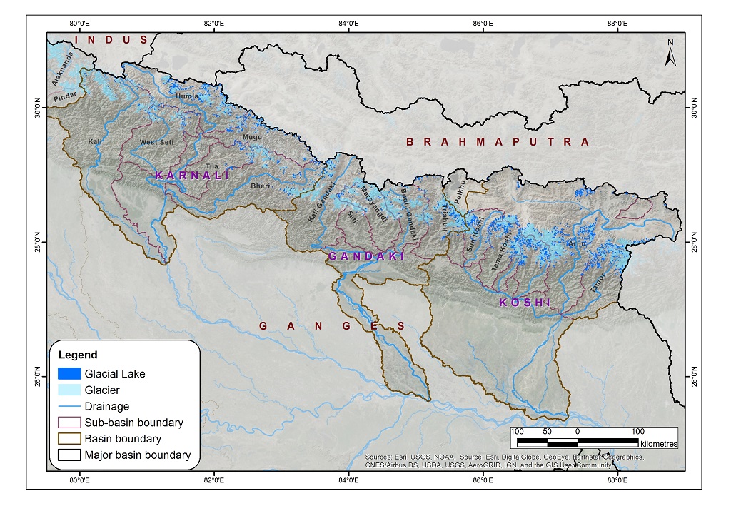
The data on glacial lakes in 2015 were derived through a semi-automatic method using Landsat imagery from 2015 to 2016. The Normalized Difference Water Index threshold value was used for classificati..
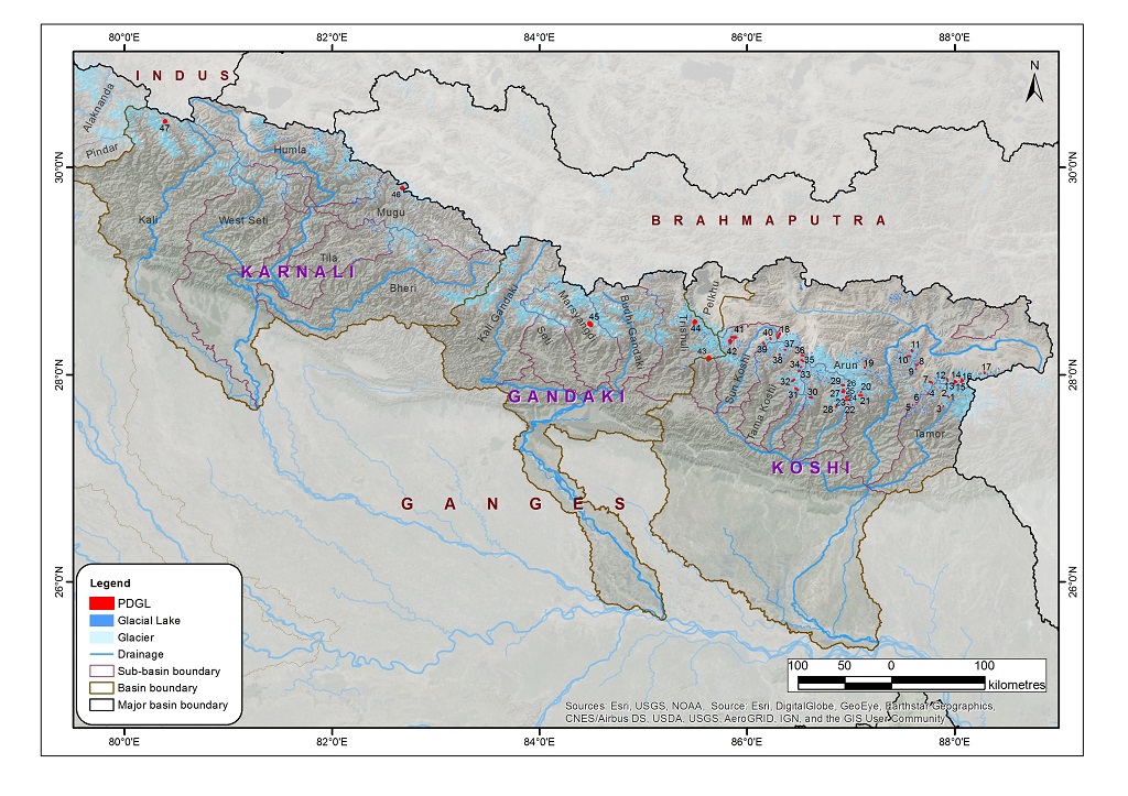
The potentially dangerous glacial lakes were identified on the basis of the glacial lake inventory dataset using Landsat imagery from 2015. The following criteria were used for classifying the lakes:..
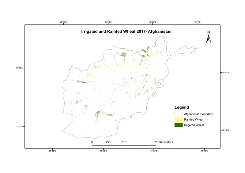
Wheat is cultivated on more than 2.7 million hectares in Afghanistan annually, yet the country is dependent on imports to meet domestic demand. The timely estimation of domestic wheat production is h..
Point thickness data of Rikha Samba glacier in Nepal collected with an impulse GPR transmitter (Ohio State University) with a set of half-wavelength 5 MHz dipole antennas in 2010. Data are published ..