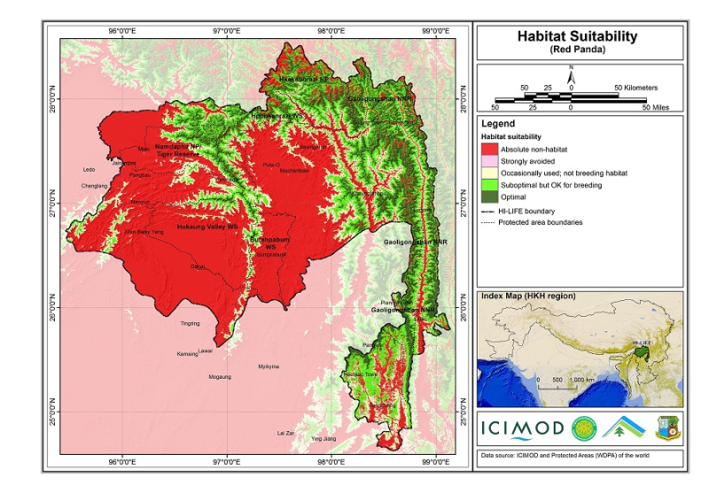
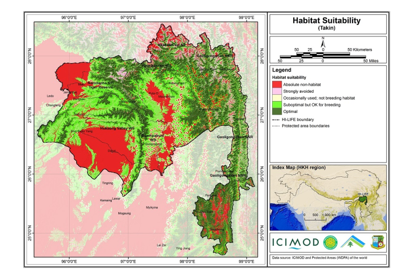
The Hindu Kush Himalayan region (HKH) is an important biodiversity hotspot with more than 488 protected areas covering 39% of the region's geographical coverage. A majority of the protected areas are..
The Hindu Kush Himalayan region (HKH) is an important biodiversity hotspot with more than 488 protected areas covering 39% of the region's geographical coverage. A majority of the protected areas are..
The Hindu Kush Himalayan region (HKH) is an important biodiversity hotspot with more than 488 protected areas covering 39% of the region's geographical coverage. A majority of the protected areas are..
The Hindu Kush Himalayan region (HKH) is an important biodiversity hotspot with more than 488 protected areas covering 39% of the region's geographical coverage. A majority of the protected areas are..
Mala GeoScience ProEx ground penetrating radar (GPR) with a 30 MHz Rough Terrain Antenna (RTA) to measure the ice thickness and thermal regime of Rikha Samba Glacier in 2015.
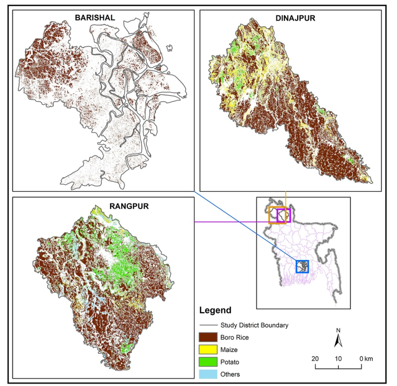
Raster data of Crop type maps of three pilot district of Bangladesh in 2019. This dataset was created using Sentinel 1 and 2 time series images from November 2018- April 2019. Boro-rice, Maize, Potat..
This is the ensemble average annual mean temperature data from 1981 to 2100 for 77 districts of Nepal. This data was prepared using four RCP4.5 and four RCP8.5 models with spatial coverage of whole N..
This is the ensemble average annual precipitation sum data from 1981 to 2100 for 77 districts of Nepal. This data was prepared using four RCP4.5 and four RCP8.5 models with spatial coverage of whole ..
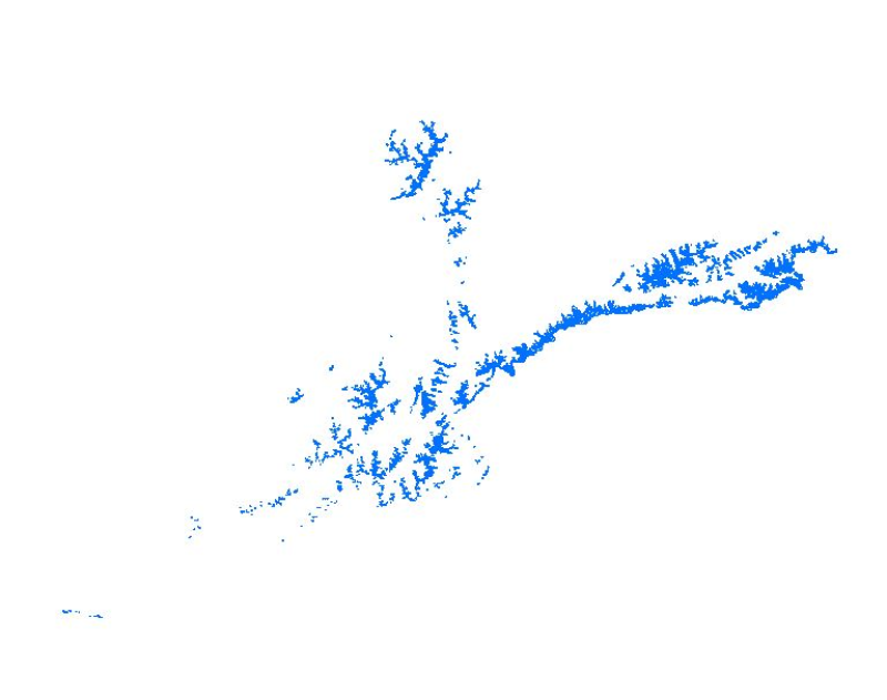
Glacier data of Afghanistan were prepared on the basis of Landsat imageries from 2015. The glacier outlines were derived semi-automatically using object-based image classification (OBIC) separately f..
Glacier data of Afghanistan were prepared on the basis of Landsat imageries from 2010. The glacier outlines were derived semi-automatically using object-based image classification (OBIC) separately f..