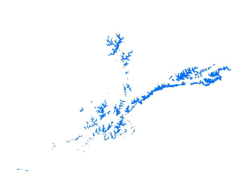
Glacier data of Afghanistan were prepared on the basis of Landsat imageries from 2000. The glacier outlines were derived semi-automatically using object-based image classification (OBIC) separately f..
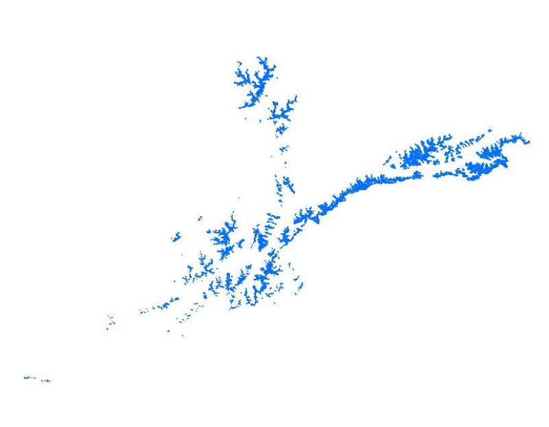
Glacier data of Afghanistan were prepared on the basis of Landsat imageries from 1990. The glacier outlines were derived semi-automatically using object-based image classification (OBIC) separately f..
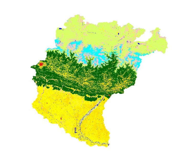
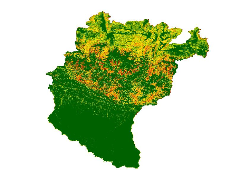
High levels of water-induced erosion in the transboundary Himalayan river basins are contributing to substantial changes in basin hydrology and inundation. Basin-wide information on erosion dynamics ..
High levels of water-induced erosion in the transboundary Himalayan river basins are contributing to substantial changes in basin hydrology and inundation. Basin-wide information on erosion dynamics ..
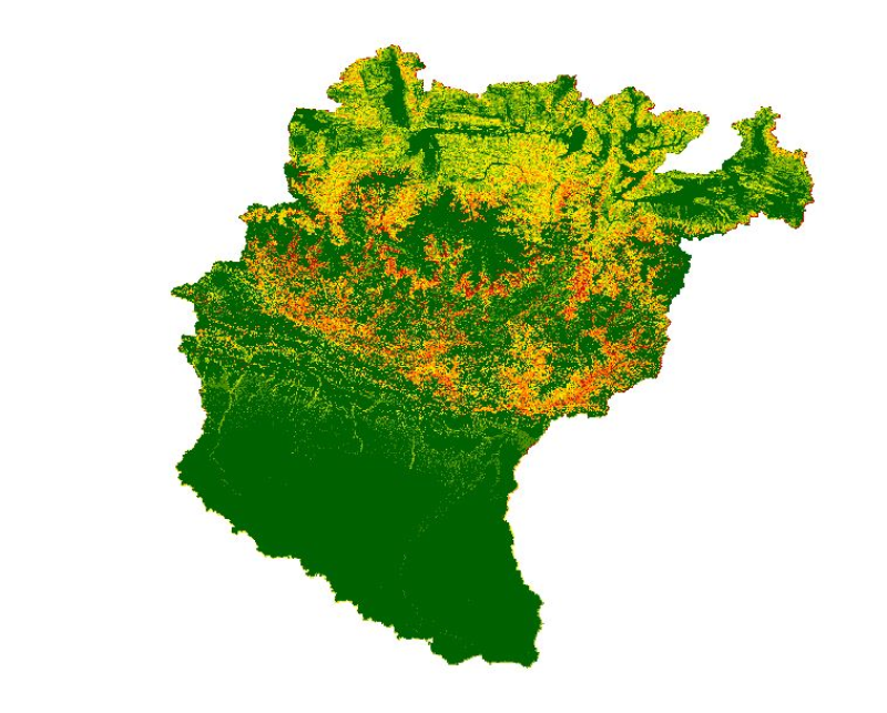
High levels of water-induced erosion in the transboundary Himalayan river basins are contributing to substantial changes in basin hydrology and inundation. Basin-wide information on erosion dynamics ..
High levels of water-induced erosion in the transboundary Himalayan river basins are contributing to substantial changes in basin hydrology and inundation. Basin-wide information on erosion dynamics ..
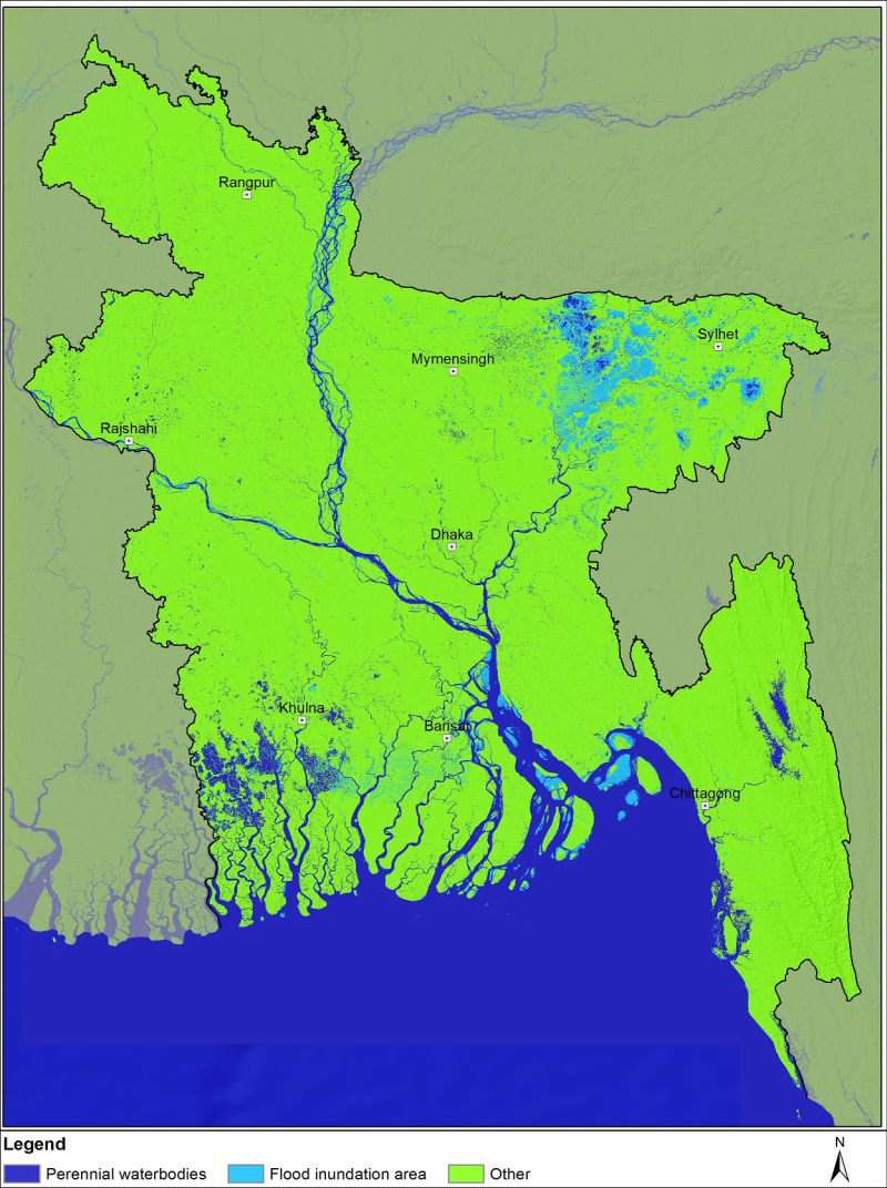
Bangladesh is one of the most flood-affected countries in the world. In the last few decades, flood frequency, intensity, duration, and devastation have increased in Bangladesh. Identifying flood-dam..
Bangladesh is one of the most flood-affected countries in the world. In the last few decades, flood frequency, intensity, duration, and devastation have increased in Bangladesh. Identifying flood-dam..
Bangladesh is one of the most flood-affected countries in the world. In the last few decades, flood frequency, intensity, duration, and devastation have increased in Bangladesh. Identifying flood-dam..