Digital grid data of Hill-shade of Kayar Khola Watershed, Chitwan, Nepal. This dataset is created using
Topographic sheet data at scale of 25,000/50,000, of 1995 acquired from National Geographic Inf..
Digital point dataset of Settlement Locations of Charnawati River Watershed, Dolakha, Nepal. This dataset is created using Topographic sheet data at scale of 25,000/50,000, of 1995 acquired from Nati..
Digital point data of Telecommunication Facilities Location of Sagarmatha National Park, Nepal. This dataset is created using Topographic sheet data at scale of 25,000/50,000, of 1995 acquired from N..
Digital polygon dataset of Students Teacher Ration per District of Afghanistan. This dataset is basic Vector layer derived from Afghanistan Information Management Systems (AIMS), Afghanistan.
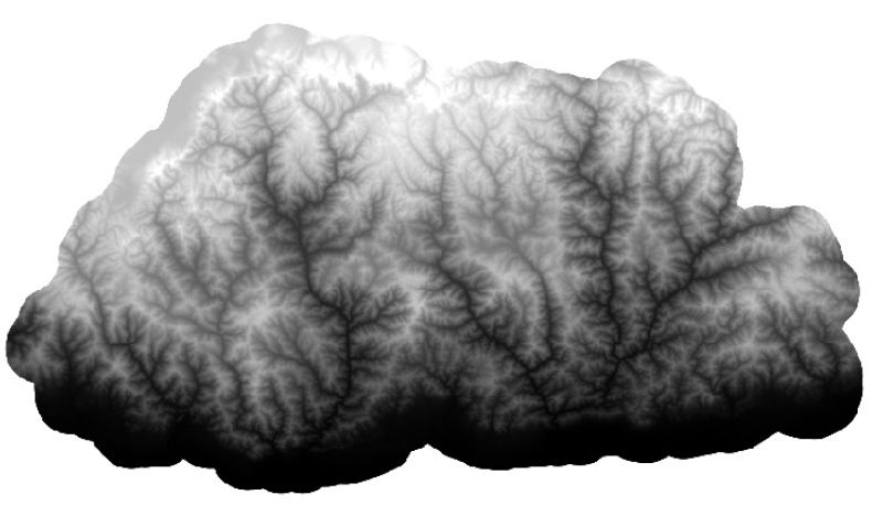
Digital Elevation Model (DEM) of Bhutan. This dataset is created using ASTER image with 30 m spatial resolution. The data was prepared for the analysis of attitudinal Variation and Land Cover Classes.
Digital table data of Decadal Population Growth Estimates of Koshi Basin. This dataset is created using population census (2001 and 2011) at district level and comprise estimates at district, nationa..
Digital polygon data of Village Development Committee, VDC Boundary of Kayar Khola Watershed, Chitwan, Nepal. This dataset is created using Topographic sheet data at scale of 25,000/50,000, of 1995 a..
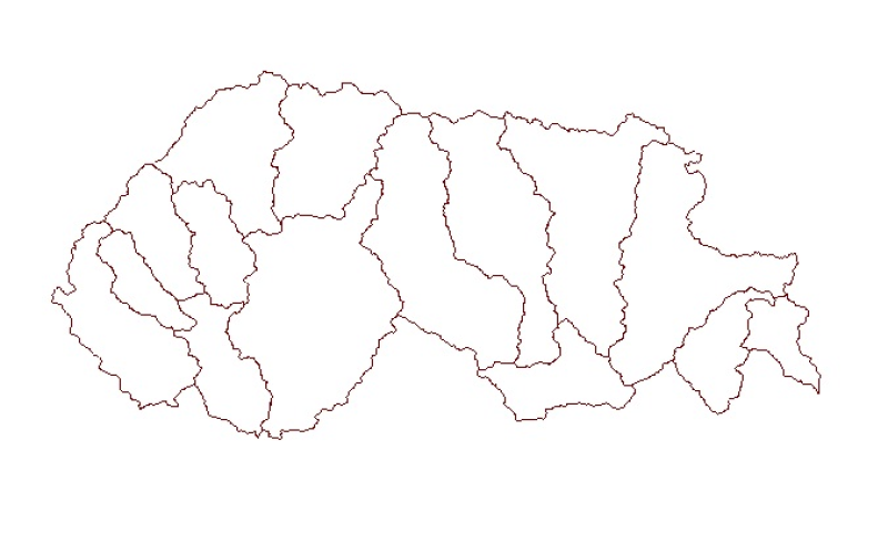
Digital polygon dataset of Sub Watershed boundaries of Bhutan. This dataset is extracted using the SRTM DEM. The boundaries were refined using LandSat images of 30m resolution. The watershed boundari..