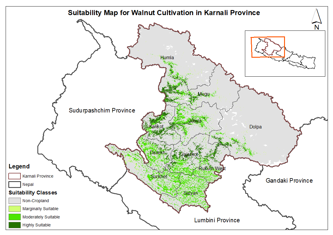
This dataset provides potential suitable area for cultivating walnut in the Karnali Province, Nepal. It is one of the datasets produced through a land suitability analysis conducted for high value ag..
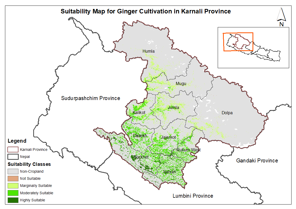
This dataset provides potential suitable area for cultivating ginger in the Karnali Province, Nepal. It is one of the datasets produced through a land suitability analysis conducted for high value ag..
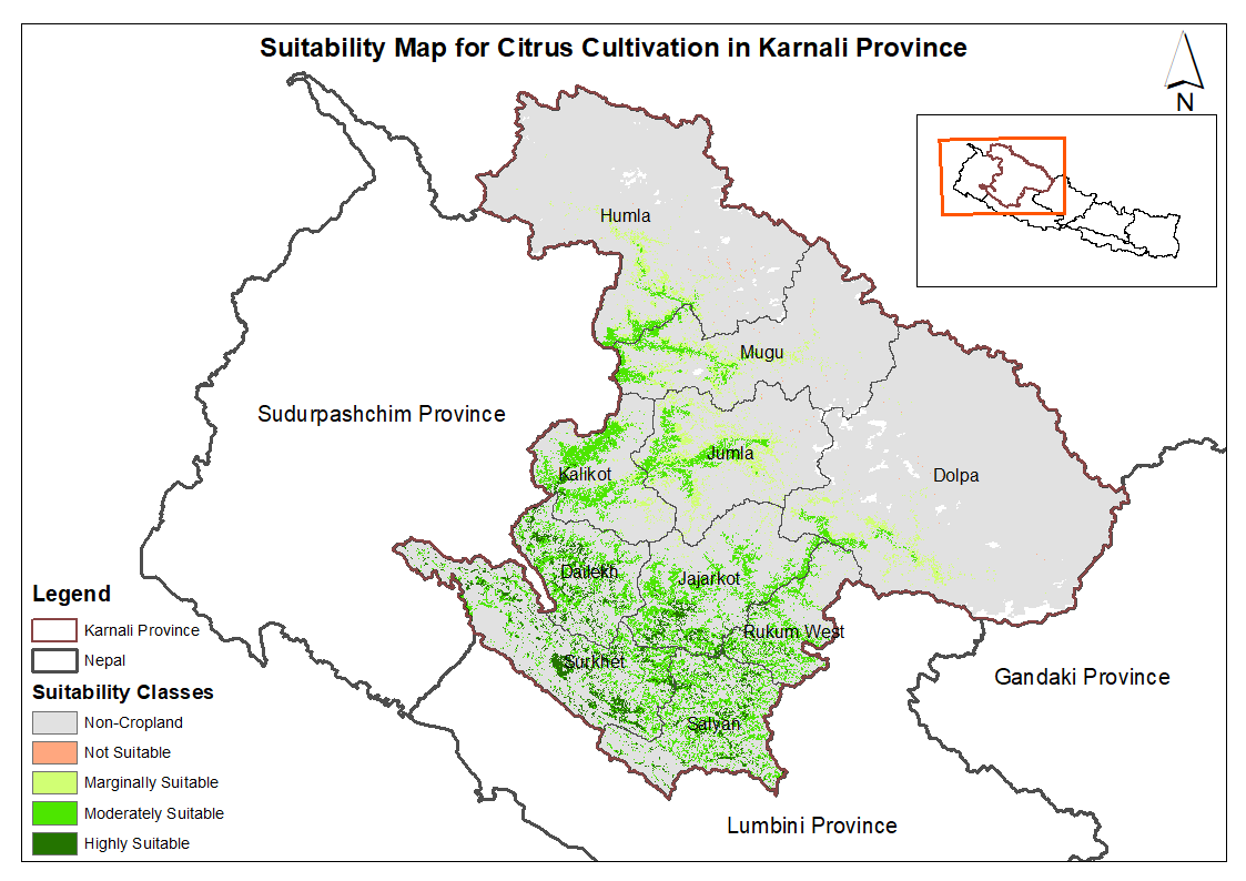
This dataset provides potential suitable area for cultivating citrus in the Karnali Province, Nepal. It is one of the datasets produced through a land suitability analysis conducted for high value ag..
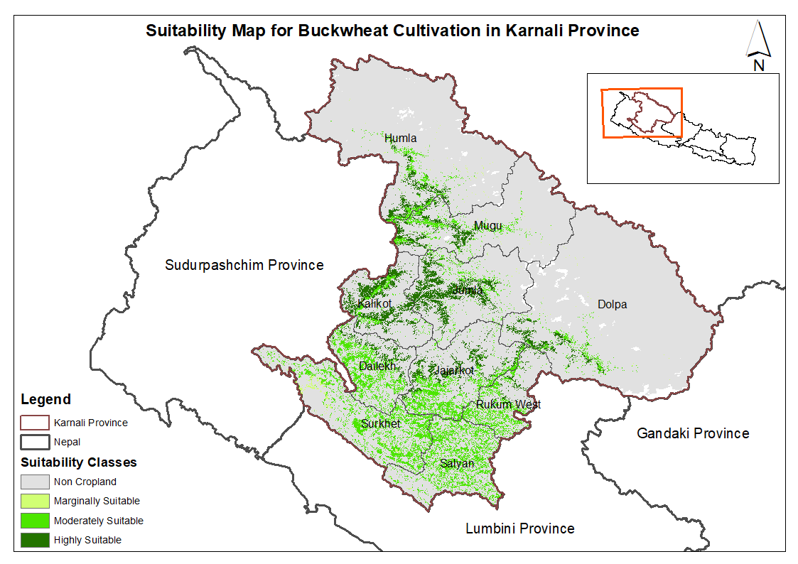
This dataset provides potential suitable area for cultivating buckwheat in the Karnali Province, Nepal. It is one of the datasets produced through a land suitability analysis conducted for high value..
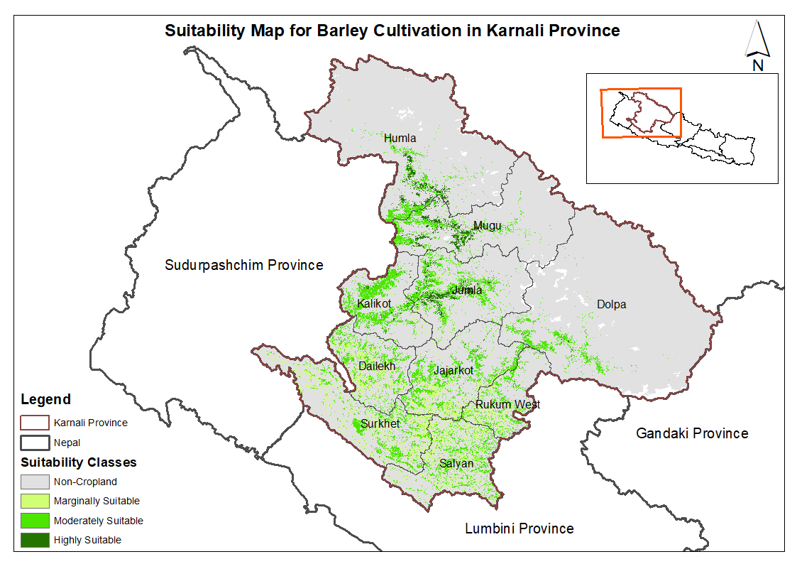
This dataset provides potential suitable area for cultivating barley in the Karnali Province, Nepal. It is one of the datasets produced through a land suitability analysis conducted for high value ag..
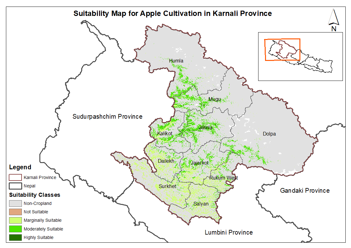
This dataset provides potential suitable area for cultivating apple in the Karnali Province, Nepal. It is one of the datasets produced through a land suitability analysis conducted for high value agr..
Landslide inventory is polygon of every landslide for landslide characterization and analsysis to understand landslide distribution pattern, and identify areas susceptible to landslide events in futu..
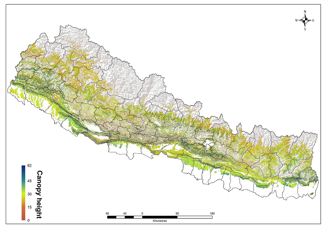
Leaf Area Index (LAI) generated based on Landsat-8 the OLI cloud free images. To generate tree canopy height map, a density scatter graph between the Geoscience Laser Altimeter System (GLAS) on the I..
The Above Ground Biomass(AGB) data obtained from the model was converted into carbon stock by applying a conversion factor of 0.47, as suggested by IPCC.