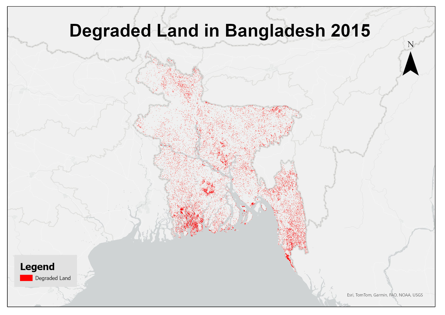
This dataset assesses land degradation in Bangladesh in 2015 based on SDG Indicator 15.3.1 by analyzing changes in land cover, land productivity, and soil organic carbon stocks. The 1OAO principle is..
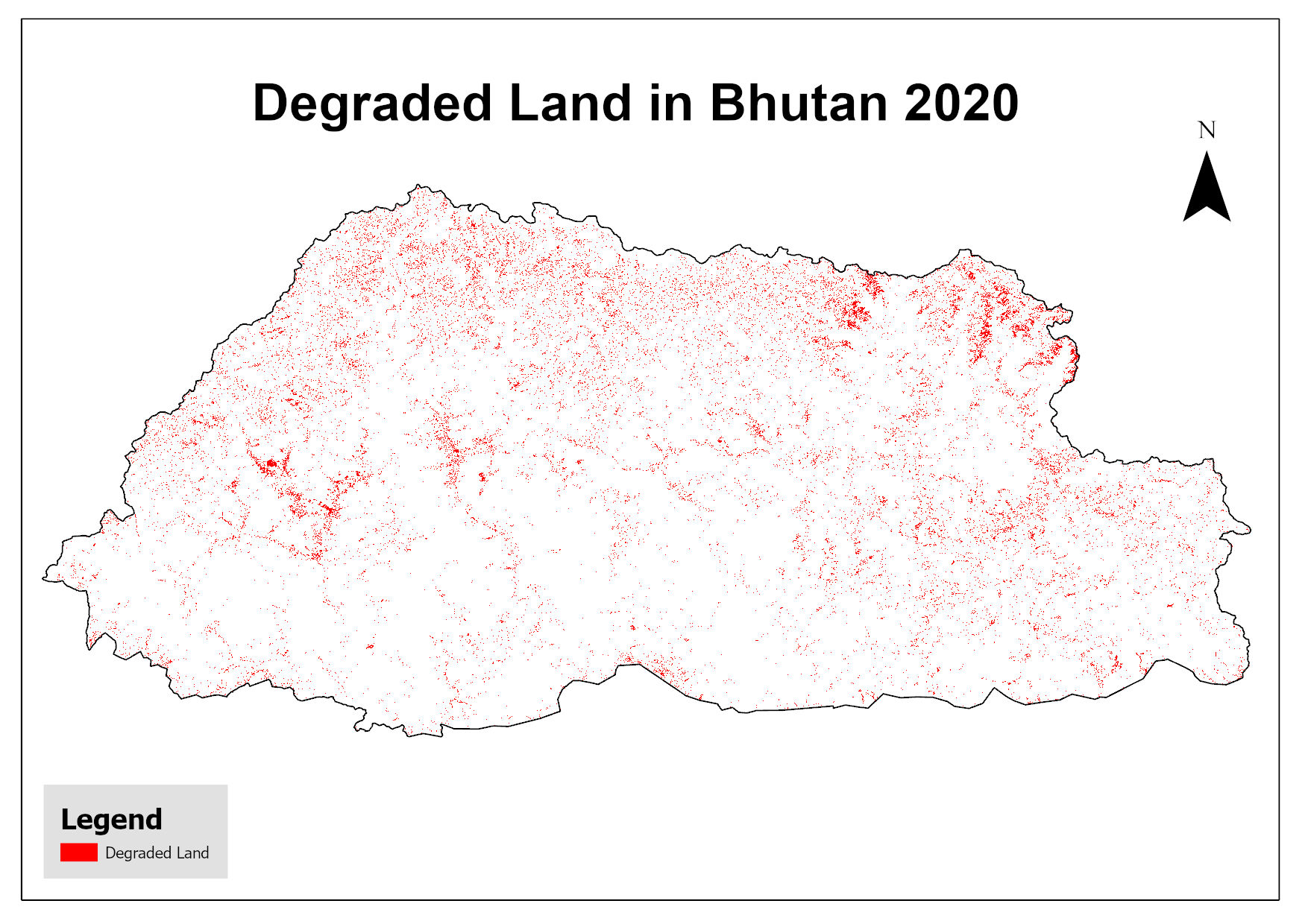
This dataset assesses land degradation in Bhutan in 2020 based on SDG Indicator 15.3.1 by analyzing changes in land cover, land productivity, and soil organic carbon stocks. The 1OAO principle is app..
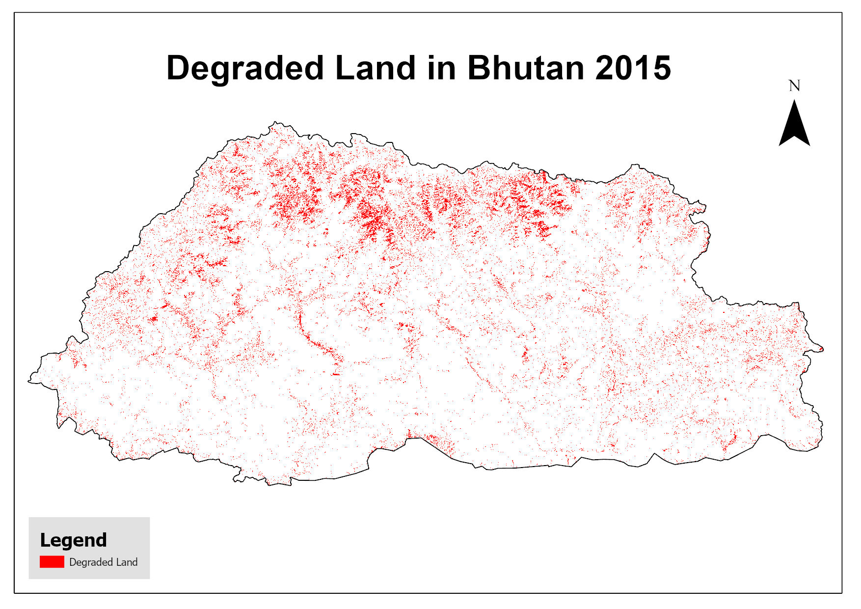
This dataset assesses land degradation in Bhutan in 2015 based on SDG Indicator 15.3.1 by analyzing changes in land cover, land productivity, and soil organic carbon stocks. The 1OAO principle is app..
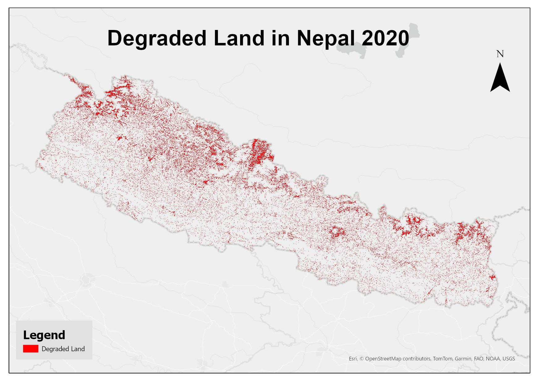
This dataset assesses land degradation in Nepal in 2020 based on SDG Indicator 15.3.1 by analyzing changes in land cover, land productivity, and soil organic carbon stocks. The 1OAO principle is appl..
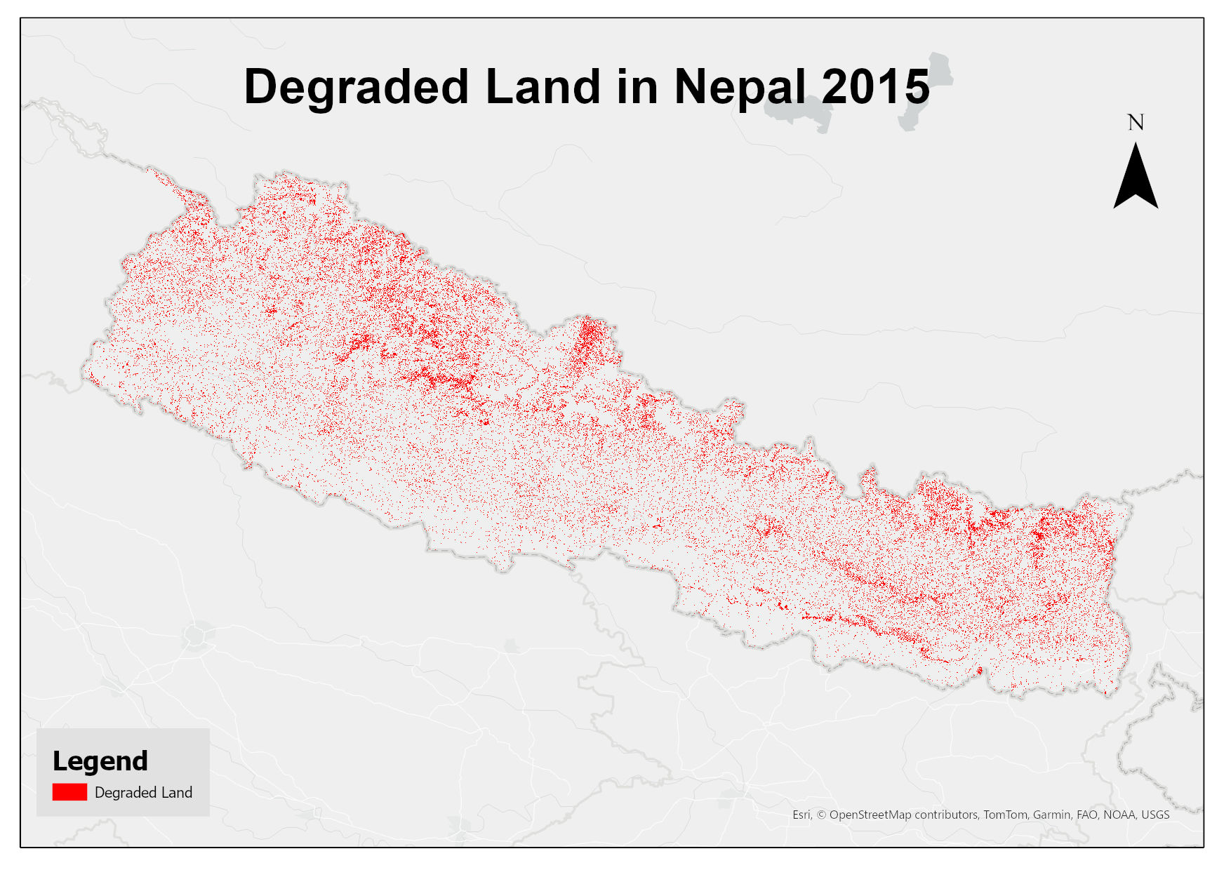
This dataset assesses land degradation in Nepal in 2015 based on SDG Indicator 15.3.1 by analyzing changes in land cover, land productivity, and soil organic carbon stocks. The 1OAO principle is appl..
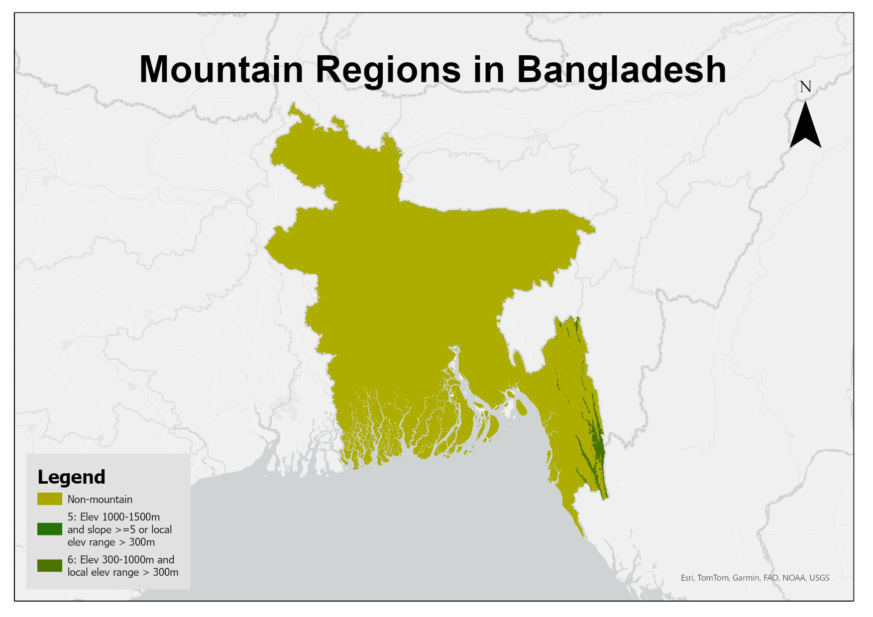
Digital raster dataset of mountain regions in Bangladesh. This dataset is prepared based on SRTM 30m resolution DEM showing different classes of mountains in the country defined by the Kapos et al. (..
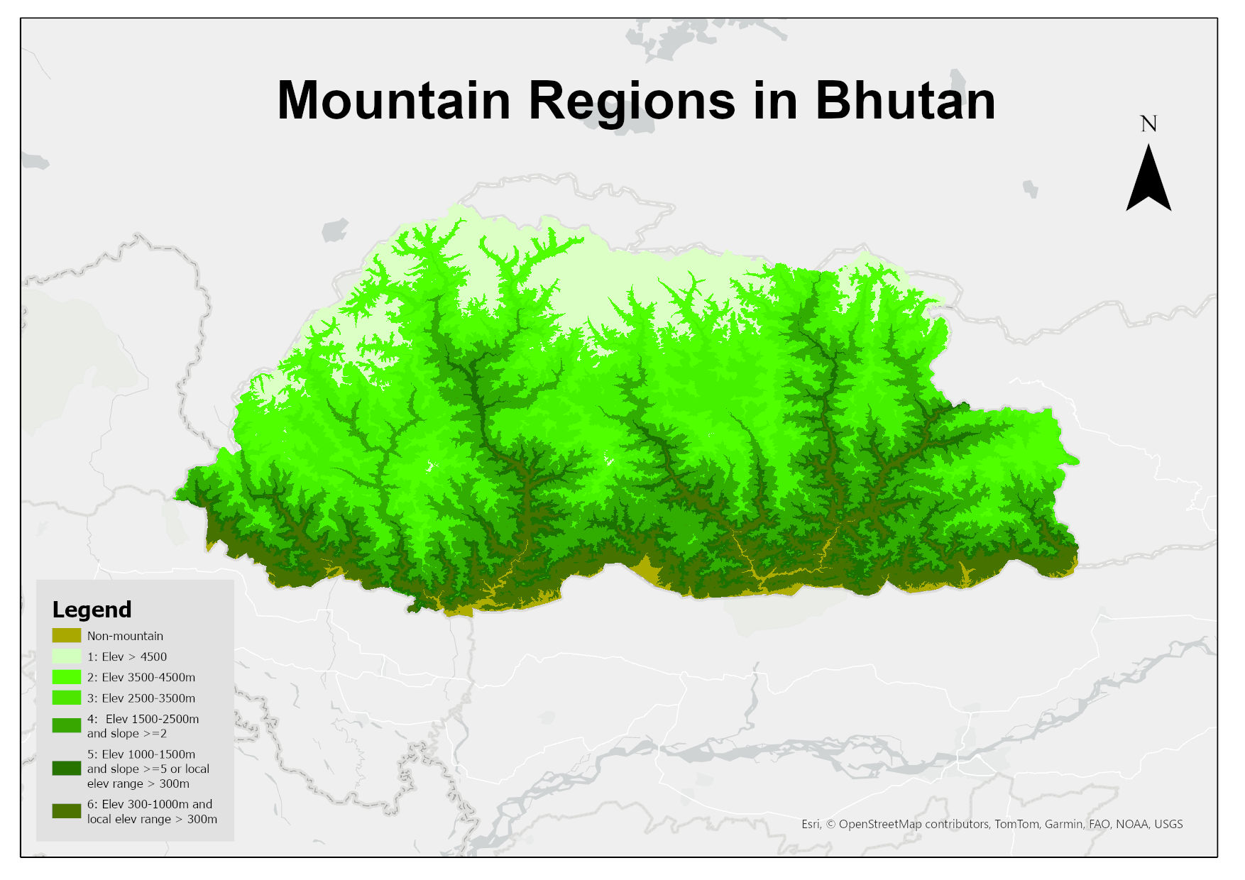
Digital raster dataset representing the mountain regions in Bhutan. This dataset is prepared based on SRTM 30m resolution DEM showing different classes of mountains in the country defined by the Kapo..
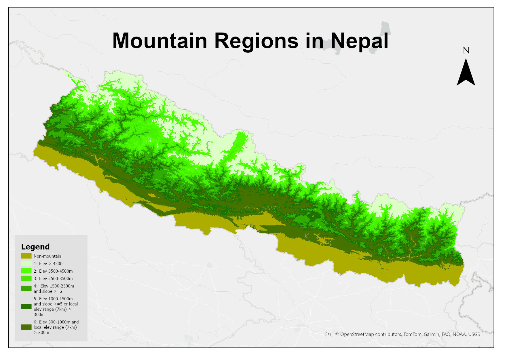
Digital 30m resolution raster dataset of mountain regions in Nepal. This dataset is prepared based on SRTM 30m resolution DEM showing different classes of mountains in the country defined by the Kapo..
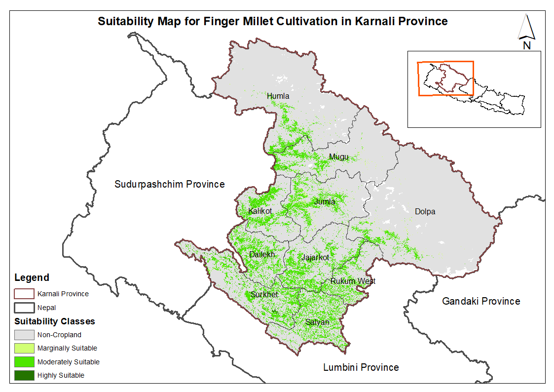
This dataset provides potential suitable area for cultivating finger millet in the Karnali Province, Nepal. It is one of the datasets produced through a land suitability analysis conducted for high v..
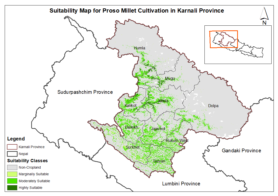
This dataset provides potential suitable area for cultivating proso millet in the Karnali Province, Nepal. It is one of the datasets produced through a land suitability analysis conducted for high va..