This sensor measures wind speed, direction, air temperature and relative humidity. It was placed for a short period on Yala Glacier in Langtang Valley.
This sensor measures wind speed, direction, air temperature and relative humidity. It was placed for a short period on the Yala Plateau, below Yala Base Camp in Langtang Valley.
This dataset provides discharge measurements at the main arm of the Langtang River in Langtang Valley. Additionally, the water temperature is recorded. The station is located where previously measure..
This dataset provides discharge measurements at terminus of Langshisha Glacier in Langtang Valley. The station is no longer operational. Discharge calculated from stage height measurements over multi..
This dataset provides discharge measurements at terminus of Langshisha Glacier in Langtang Valley. The station is no longer operational. Discharge calculated from stage height measurements over multi..
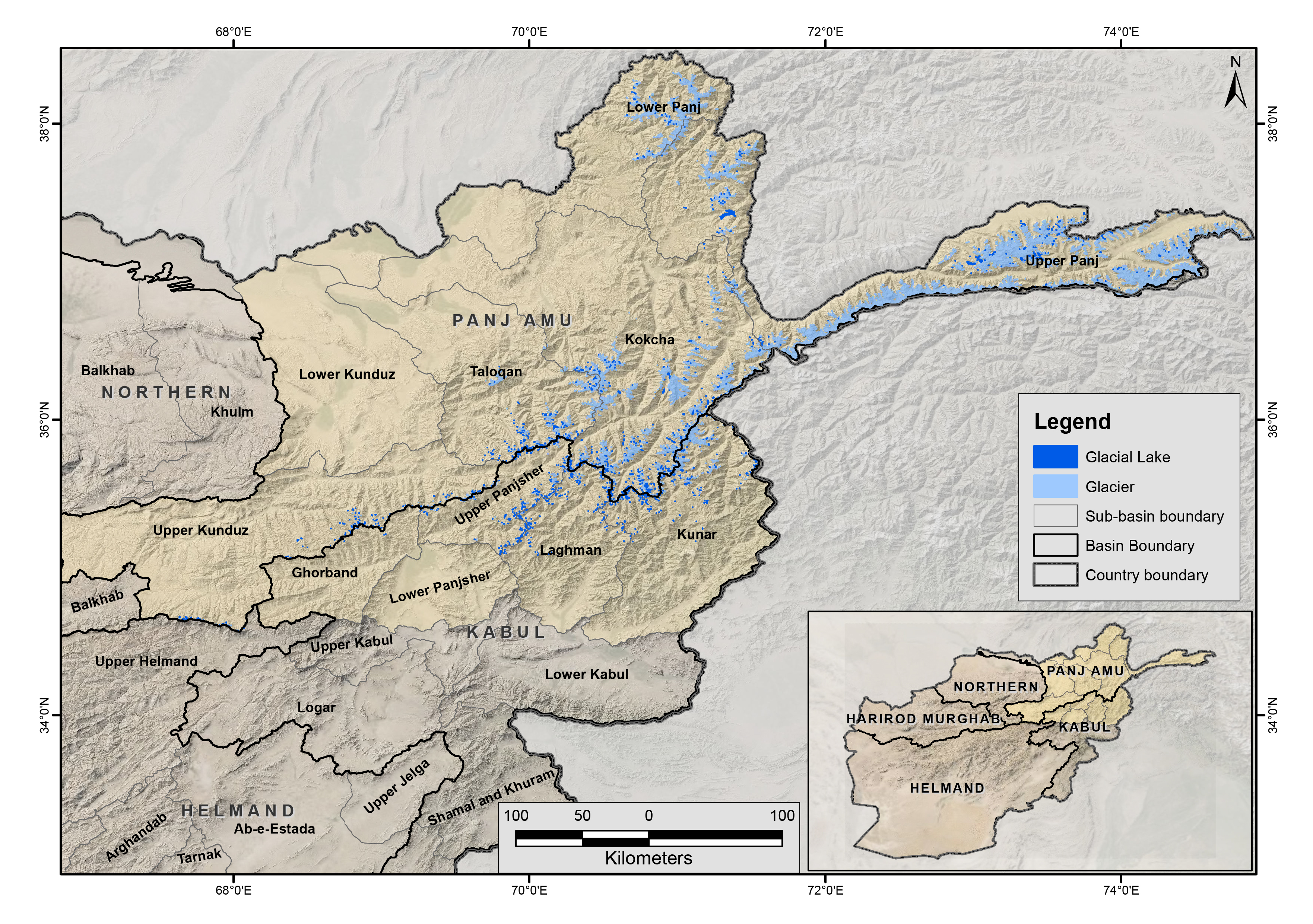
The glacial lakes of Afghanistan were mapped using Landsat image that were selected based in a one-year buffer surrounding a representative year. For instance, the Landsat images from 2009 to 2011 we..
The glacial lakes of Afghanistan were mapped using Landsat image that were selected based in a one-year buffer surrounding a representative year. For instance, the Landsat images from 1989 to 1991 we..
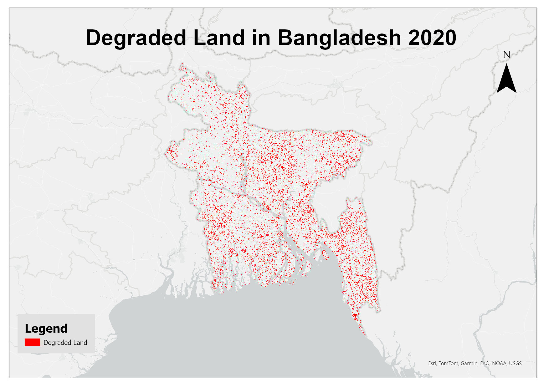
This dataset assesses land degradation in Bangladesh in 2020 based on SDG Indicator 15.3.1 by analyzing changes in land cover, land productivity, and soil organic carbon stocks. The 1OAO principle is..