Digital line dataset of Elevation Contours of Dang and Salyan district, Nepal. This dataset is created using Topographic sheet data at scale of 50,000, of 1995 acquired from Department of Survey, Kat..
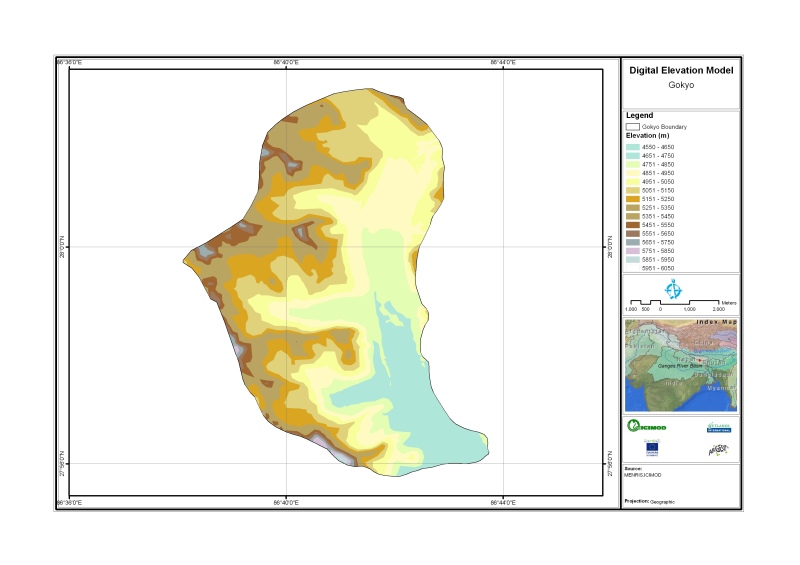
Digital Elevation Model of Gyoko, Nepal is based on Topographic map scale 1:25,000/50,000 acquired from National Geographic Information Infrastructure Project (NGIIP), Dept. of Survey Kathmandu Nepal.
Digital polygon dataset of Land capability of Lamjung district, Nepal. The dataset includes details of potential land uses, soil type, drainage conditions etc. This dataset is created using 1:50,000 ..
Monthly mean precipitation of Mayl 2001 of Nepal. This dataset is created using actual averages precipitation using Win-surfer and GIS-arc/info software packages. The mean values were derived from da..