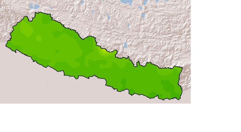
Monthly mean precipitation of January, 2001 of Nepal. This dataset is created using actual averages precipitation using Win-surfer and GIS-arc/info software packages. The mean values were derived fro..
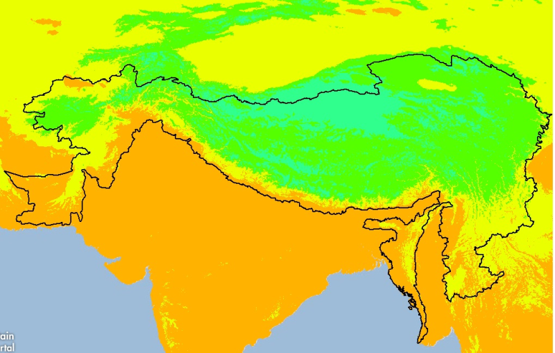
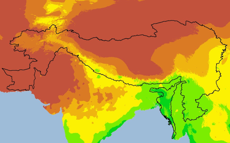
Digital grid dataset of minimum monthly temperature (August) for the period of 1950-2000 of Hindu Kush Himalayan (HKH) Region. The dataset is derived from WorldClim (http://www.worldclim.org/), and m..
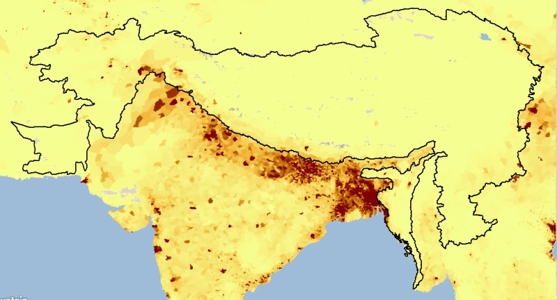
Digital Grid dataset of Population density estimates in 2010 for HKH region. This dataset is downloaded from the Center for International Earth Science Information Network (CIESIN), Columbia Universi..
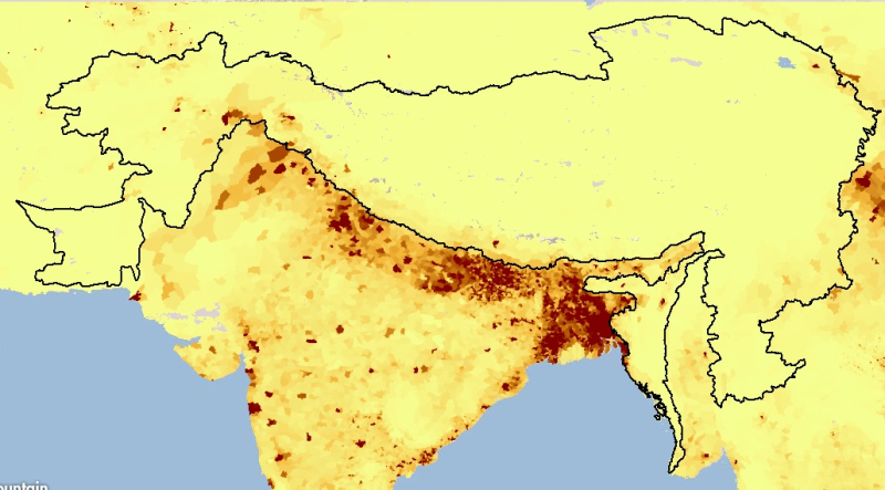
Digital Grid dataset of Population density estimates in 1995 in HKH region. This dataset is downloaded from the Center for International Earth Science Information Network (CIESIN), Columbia Universit..
Digital grid dataset of monthly precipitation (October) for the period of 1950-2000 of Hindu Kush Himalayan (HKH) Region. The dataset is derived from WorldClim (http://www.worldclim.org/), and major ..