Digital point data of VDC centroid locations of Nepal. This dataset is created using Topographic sheet maps of 25000/50000 scale published by Department of Survey Nepal in 1995 & onward and is in geo..
Digital line dataset of River Network of Phobjikha Valley, Bhutan. This dataset is created using topographic sheet maps at scale of 50000 and prepared by ICIMOD.
Digital grid dataset of monthly precipitation (August) for the period of 1950-2000 of Hindu Kush Himalayan (HKH) Region. The dataset is derived from WorldClim (http://www.worldclim.org/), and major c..
Digital point dataset of Settlements of Phobjikha valley, Bhutan. This dataset is created using topographic sheet maps at scale of 50000 and prepared by ICIMOD.
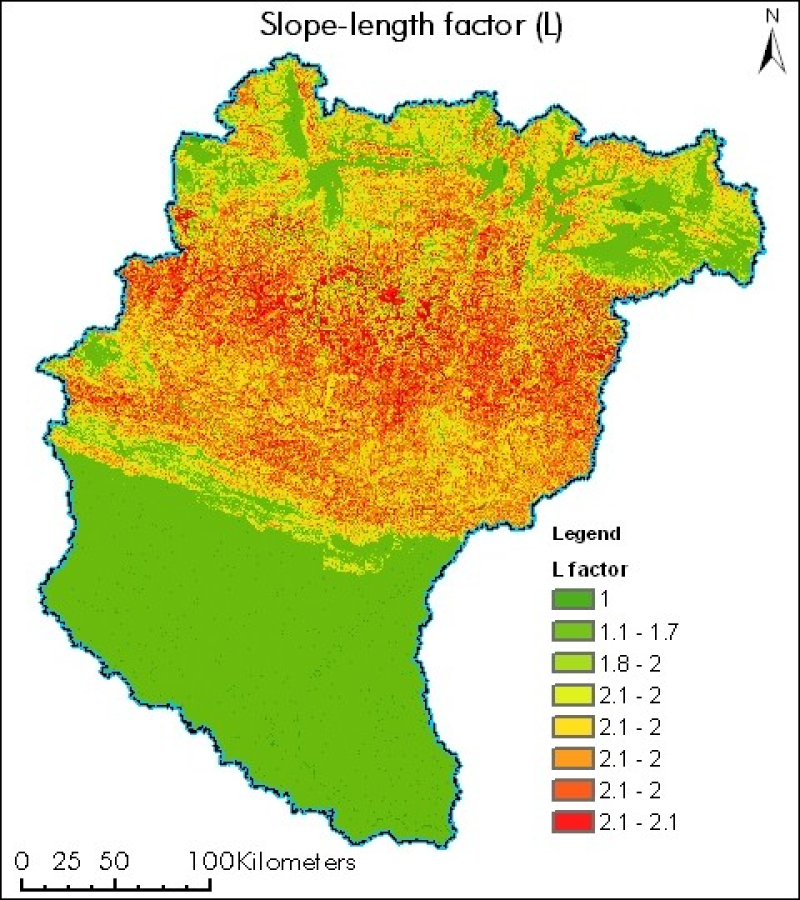
Digital grid dataset of Slope length factor (S) of Koshi basin. It represents the slope length factor and the effect of slope length on erosion of Koshi basin. Slope length factor is derived from SRT..