Bangladesh is one of the most flood affected country in the world. The frequency, intensity and duration of floods has been increased during last few decades. Due to increased population settlements ..
Nepal is one of the most flood affected country in the world. The frequency, intensity and duration of floods has been increased during last few decades. Due to increased population settlements in fl..
Nepal is one of the most flood affected country in the world. The frequency, intensity and duration of floods has been increased during last few decades. Due to increased population settlements in fl..
Data on ambient PM 10 levels from six locations in the Kathmandu Valley recorded by means of continuous sampling using low volume air samplers from October 2002 to March 2007 were used to investigate..
Vegetation layer gives the information about the different types of vegetaion class, its spatial distribution and coverage in Kailash Sacred Landscape.
The comprehensive baseline information on the glaciers of the HKH region was generated semi-automatically using more than 200 Landsat 7 ETM+ images of 2005 ± 3 years with minimum cloud and snow cover..
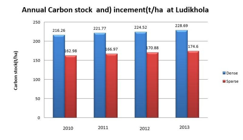
Biophysical (Forest carbon) data of community forest in Ludi Khola watershed, Nepal under “Design and setting up of a governance and payment system for Nepal’s Community Forest Management under Reduc..