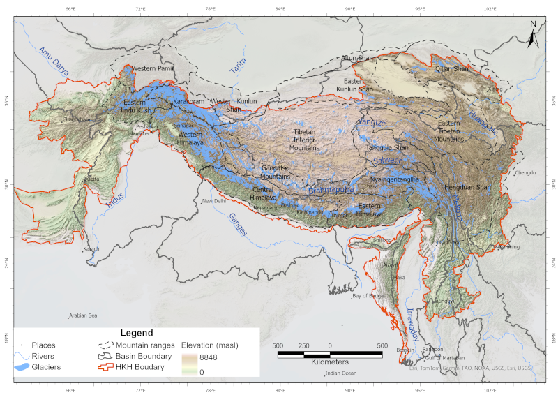
Glaciers are an indispensable component of the Hindu Kush Himalayan (HKH) region, acting as a vast “water tower” that stores large volumes of freshwater and sustains Asia’s ten major river systems, s..
The comprehensive baseline information on the glaciers of the HKH region was generated semi-automatically using more than 200 Landsat 7 ETM+ images of 2005 ± 3 years with minimum cloud and snow cover..
This sensor measures precipitation volume and intensity with a bucket. Additionally air temperature and snow height are recorded. It is located in Langtang Valley below Ganja La Pass. It is no longer..
This sensor measures precipitation volume and intensity with a bucket. Additionally air temperature, relative humidity and snow height are recorded. It is located in Langtang Valley on left moraine (..
This sensor measures precipitation volume and intensity with a bucket. Additionally air temperature, relative humidity and snow height are recorded. It is located in Langtang Valley on the ridge belo..
This sensor measures wind speed, direction, air temperature and relative humidity. It was placed for a short period on Yala Glacier in Langtang Valley.
This sensor measures wind speed, direction, air temperature and relative humidity. It was placed for a short period on Yala Glacier in Langtang Valley.
This sensor measures wind speed, direction, air temperature and relative humidity. It was placed for a short period on the Yala Plateau, below Yala Base Camp in Langtang Valley.