Digital polygon data of Status of Glaciers in Panjnad Basin during 2005 ± 3 (2002-2008) years. This dataset is created using Landsat ETM+ imageries of respective years. The glacier outlines was deriv..
Digital polygon data of Status of Glaciers in Gandaki Basin during 2005 ± 3 (2002-2008) years. This dataset is created using Landsat ETM+ imageries of respective years. The glacier outlines was deriv..
Digital polygon data of Status of Glaciers in Koshi Basin, Nepal during 2005 ± 3 (2002-2008) years. This dataset is created using Landsat ETM+ imageries of respective years. The glacier outlines was ..
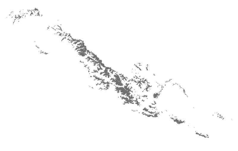
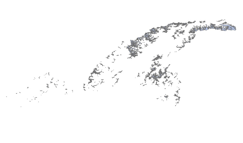
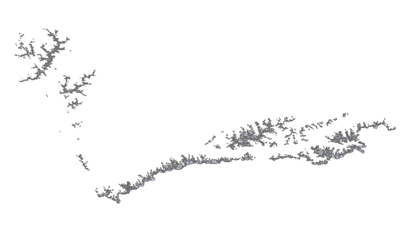
The comprehensive baseline information on the glaciers of the HKH region was generated semi-automatically using more than 200 Landsat 7 ETM+ images of 2005 ± 3 years with minimum cloud and snow cover..
The comprehensive baseline information on the glaciers of the HKH region was generated semi-automatically using more than 200 Landsat 7 ETM+ images of 2005 ± 3 years with minimum cloud and snow cover..
Digital polygon data of Status of Glaciers in Kabul Basin during 2005 ± 3 (2002-2008) years. This dataset is created using Landsat ETM+ imageries of respective years. The glacier outlines was derived..
The comprehensive baseline information on the glaciers of the HKH region was generated semi-automatically using more than 200 Landsat 7 ETM+ images of 2005 ± 3 years with minimum cloud and snow cover..
Digital polygon data of Status of Glaciers in Amochu Basin during 2005 ± 3 (2002-2008) years. This dataset is created using Landsat ETM+ imageries of respective years. The glacier outlines was derive..
Digital polygon data of Status of Glaciers in Wakhan Basin during 2005 ± 3 (2002-2008) years. This dataset is created using Landsat ETM+ imageries of respective years. The glacier outlines was derive..
Digital polygon data of Status of Glaciers in Tista Basin during 2005 ± 3 (2002-2008) years. This dataset is created using Landsat ETM+ imageries of respective years. The glacier outlines was derived..