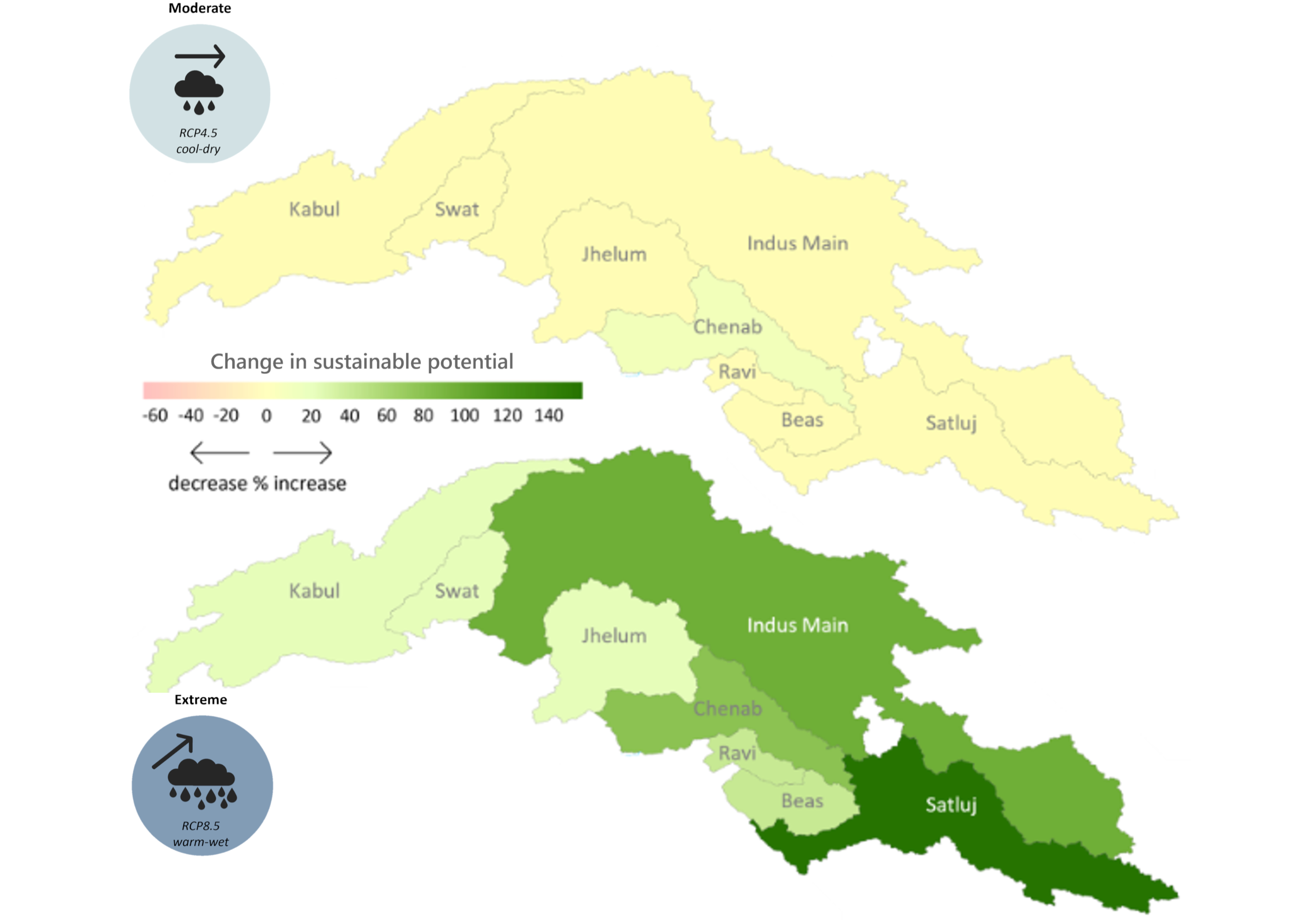
The hydropower potential in the upper Indus basin under future hydro-climatology was prepared using the Hydropower Potential Exploration (HyPE) as part of Work Package 2 in the SustainIndus project. ..
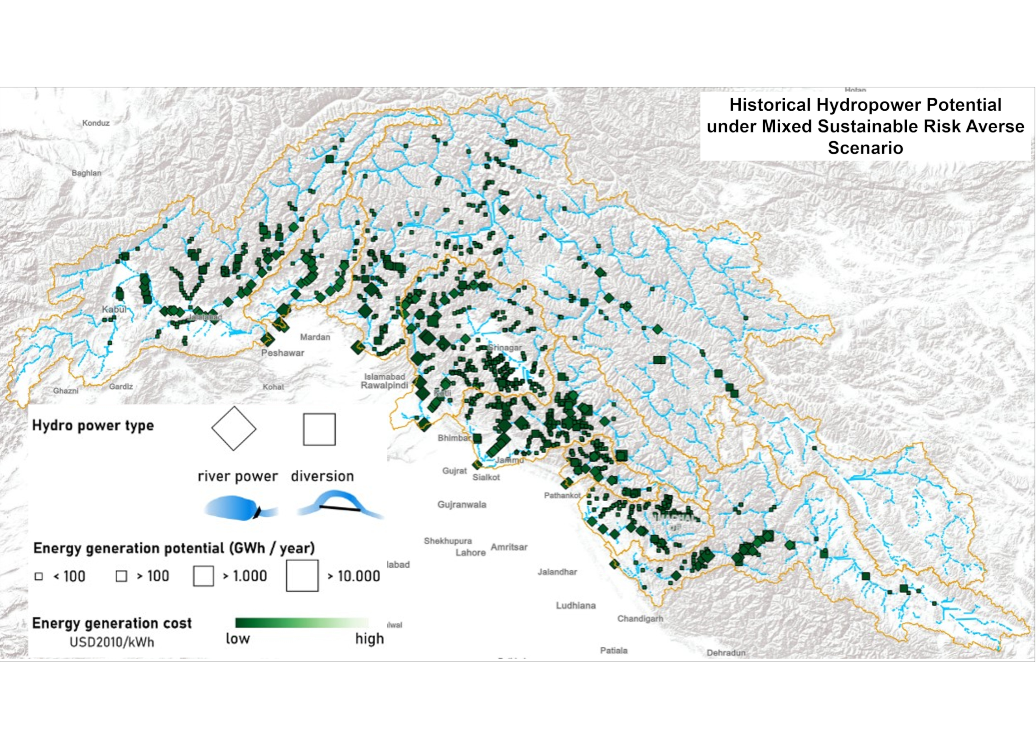
The hydropower potential in the upper Indus basin under historical hydro-climatology was prepared using the Hydropower Potential Exploration (HyPE) model. Under historical hydro-climatology, the HyPE..
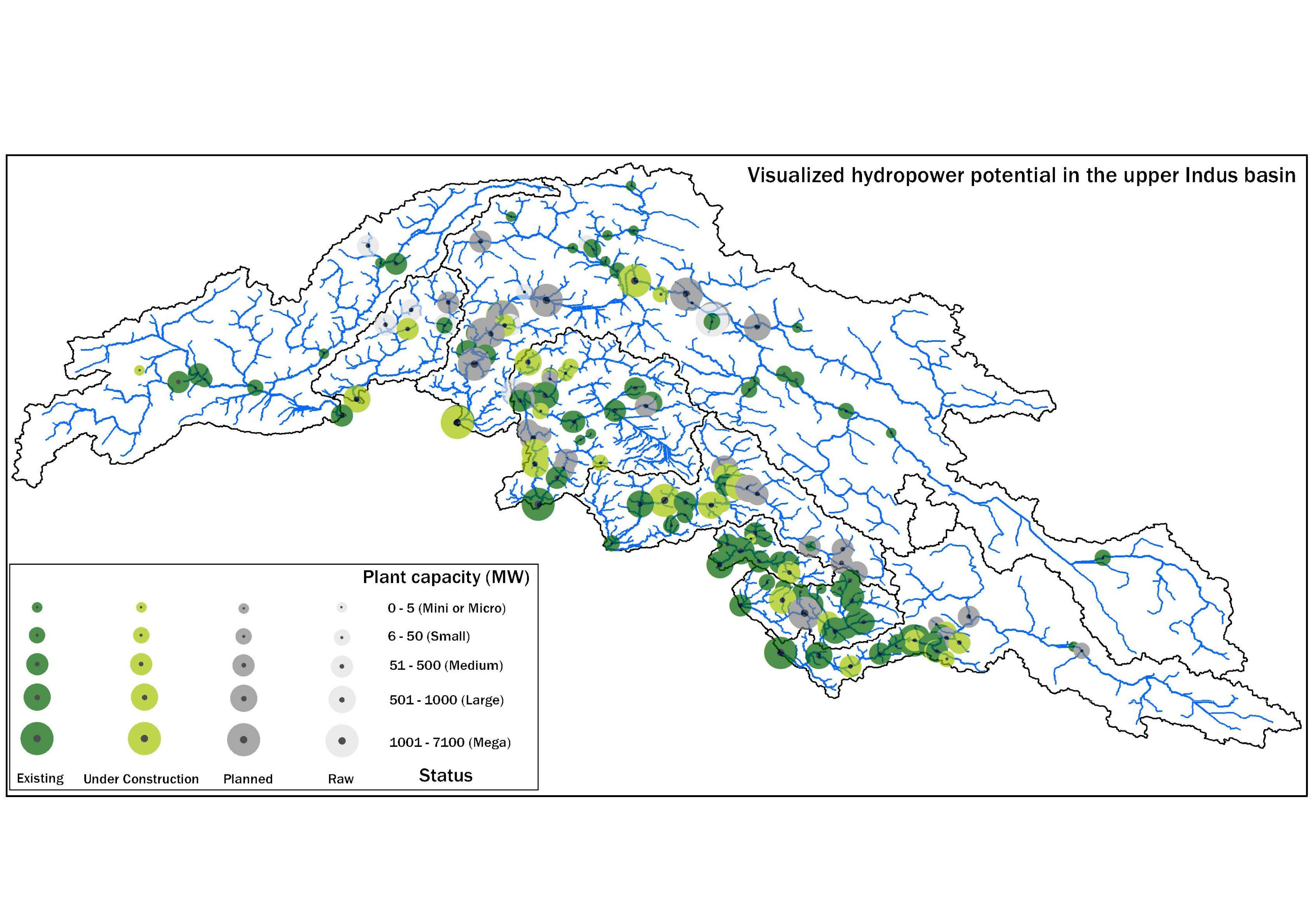
This database was compiled under WP-2 of the SustainIndus project between August 2019 and August 2021 to consolidate publicly available information on hydropower projects in various stages of develop..
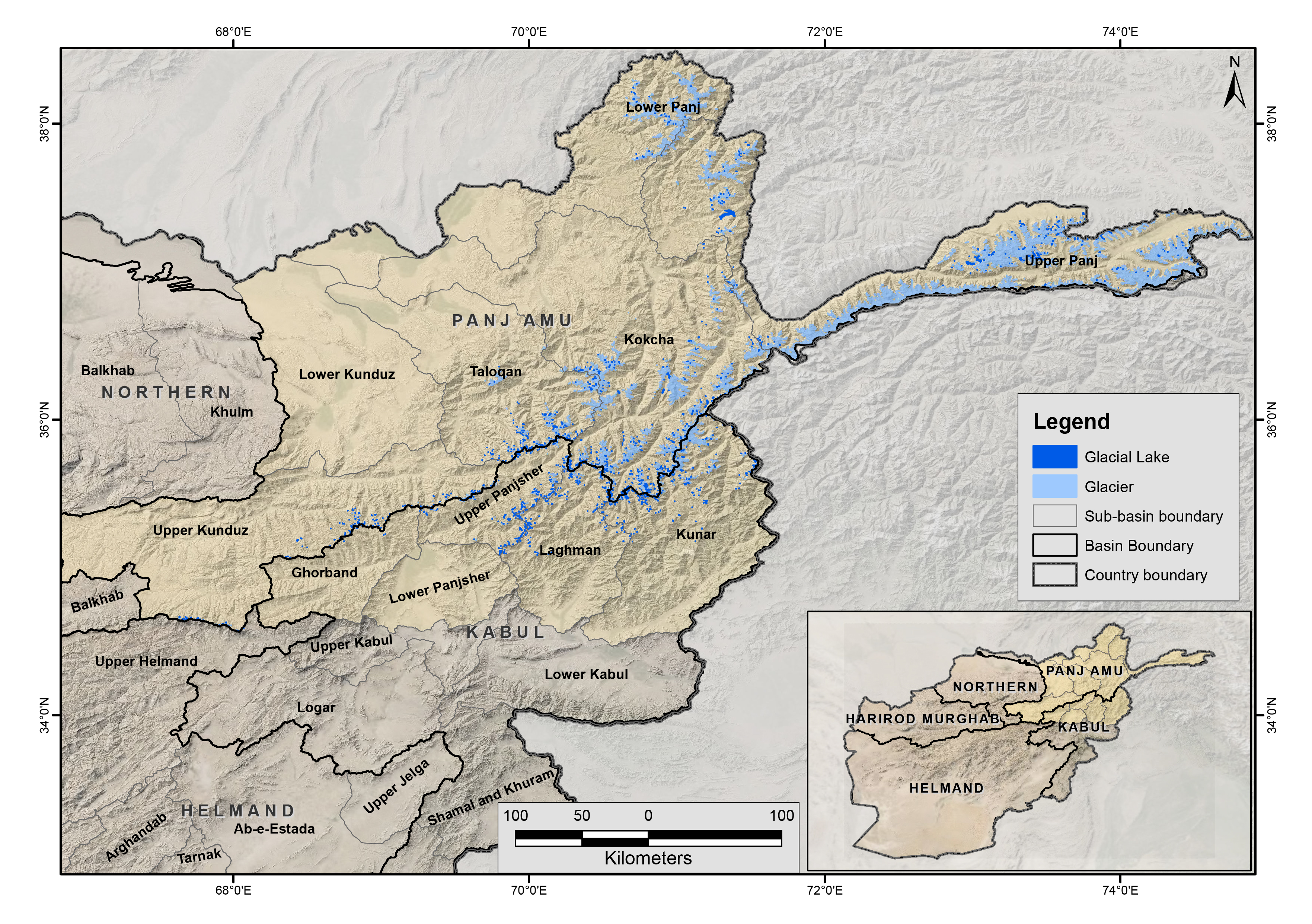
The glacial lakes of Afghanistan were mapped using Landsat image that were selected based in a one-year buffer surrounding a representative year. For instance, the Landsat images from 2014 to 2016 we..
The glacial lakes of Afghanistan were mapped using Landsat image that were selected based in a one-year buffer surrounding a representative year. For instance, the Landsat images from 2009 to 2011 we..
The glacial lakes of Afghanistan were mapped using Landsat image that were selected based in a one-year buffer surrounding a representative year. For instance, the Landsat images from 1999 to 2001 we..
The glacial lakes of Afghanistan were mapped using Landsat image that were selected based in a one-year buffer surrounding a representative year. For instance, the Landsat images from 1989 to 1991 we..
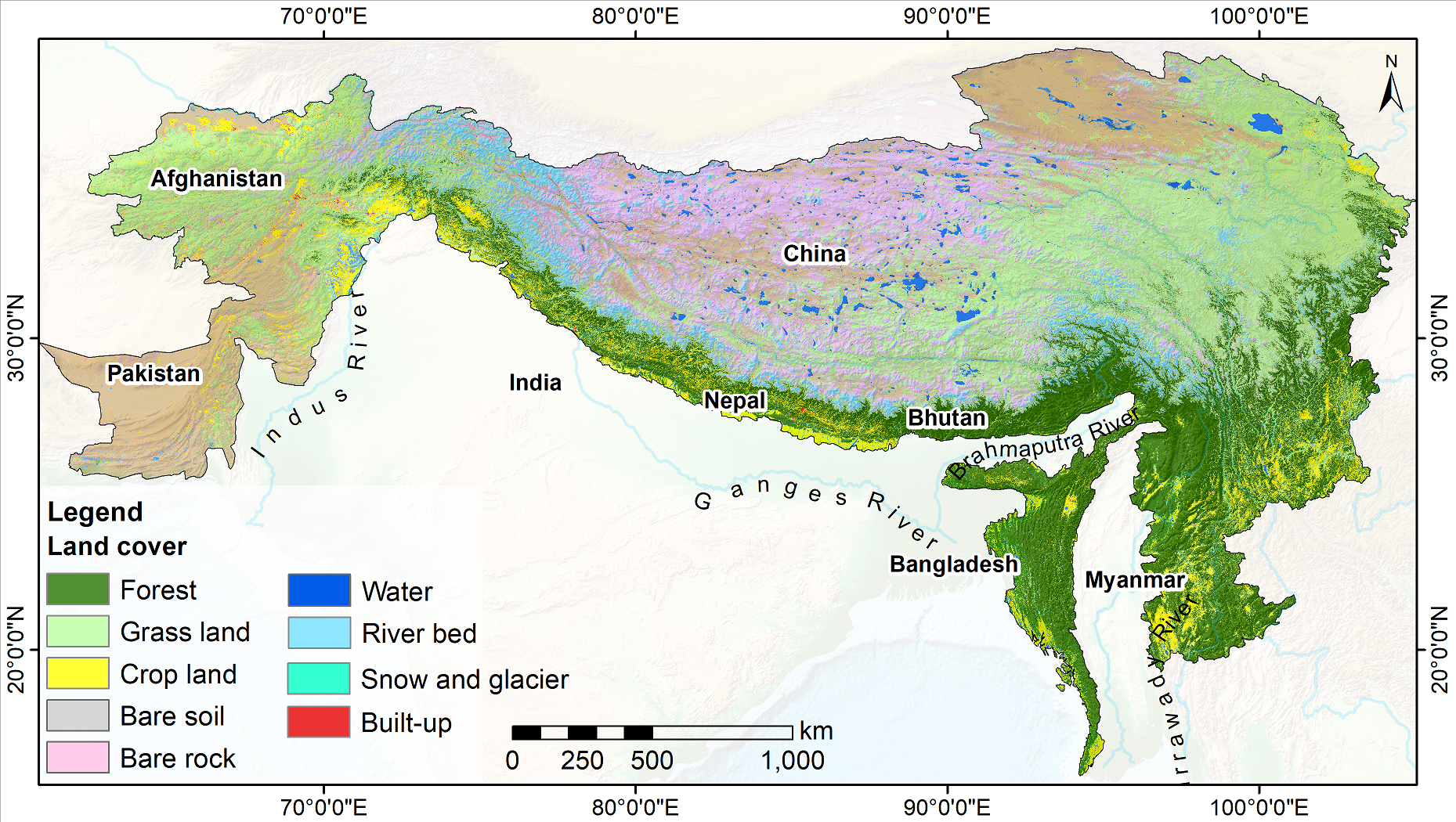
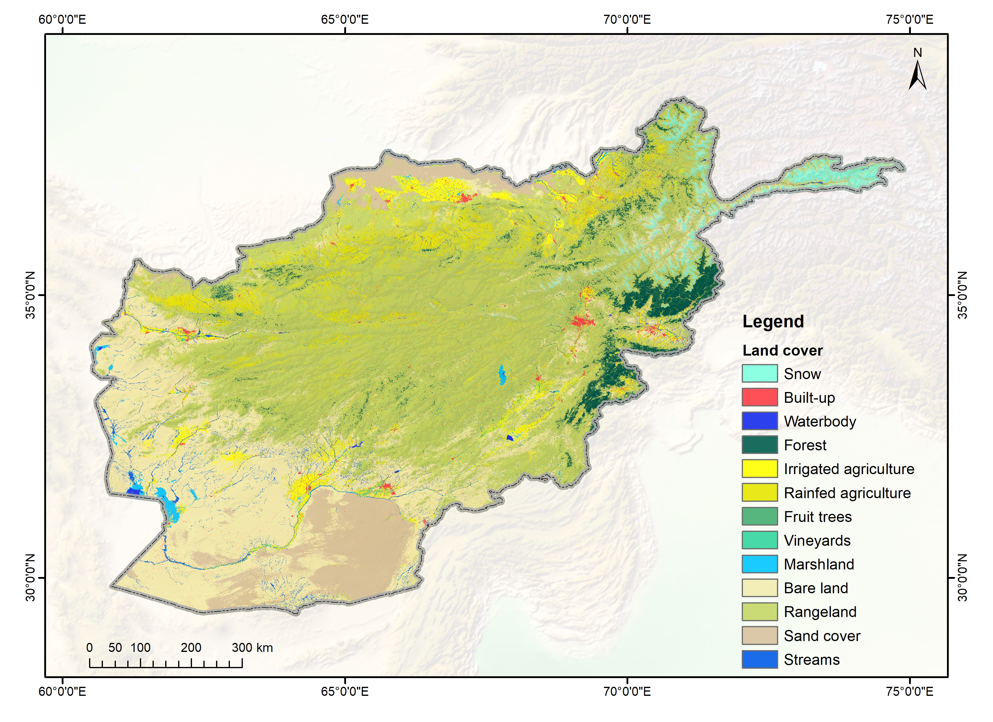
Land cover change is a significant contributor to environmental change. The degradation of forests and conversion of natural areas, forests, and farmlands to other land use impact ecosystem services ..
The annual land cover data of Afghanistan (2000-2018) have been created through the National Land Cover Monitoring System (NLCMS) for Afghanistan. The system uses freely available remote-sensing data..
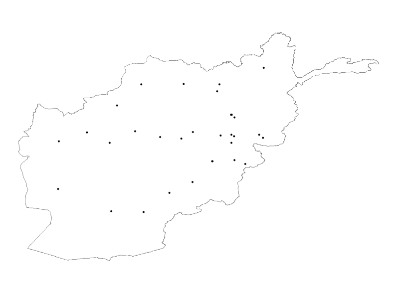
Digital point dataset of Meteorological Stations of Afghanistan. This dataset is basic Vector layer derived from Afghanistan Information Management Systems (AIMS), Afghanistan.