'%3e%3cg%3e%3cpath%20fill='%23036cb6'%20d='M0%200h134v33H0z'/%3e%3c/g%3e%3c/g%3e%3c/g%3e%3c/g%3e%3c/g%3e%3c/svg%3e)
Data Explore
Discover and explore datasets from the Hindu Kush Himalaya region
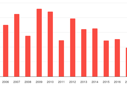
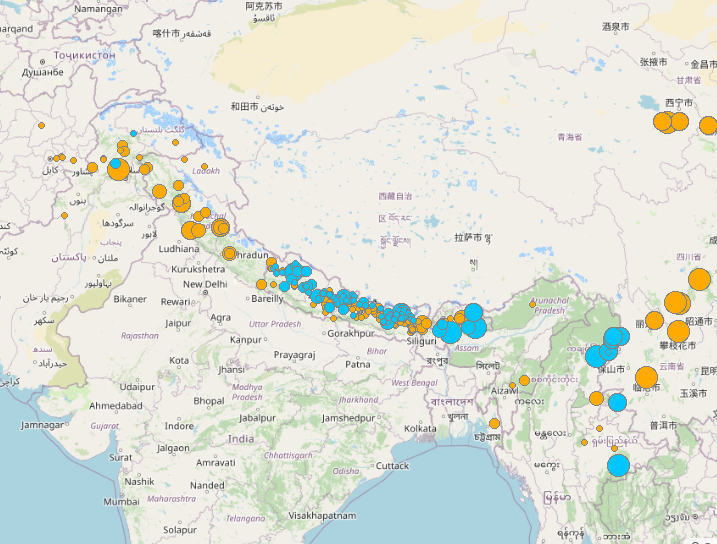
Earthquake in HKH
This dataset provides information on the earthquake incidents with Magnitude > 5.0 occurring in the HKH region between 1971 and 2024. The da...
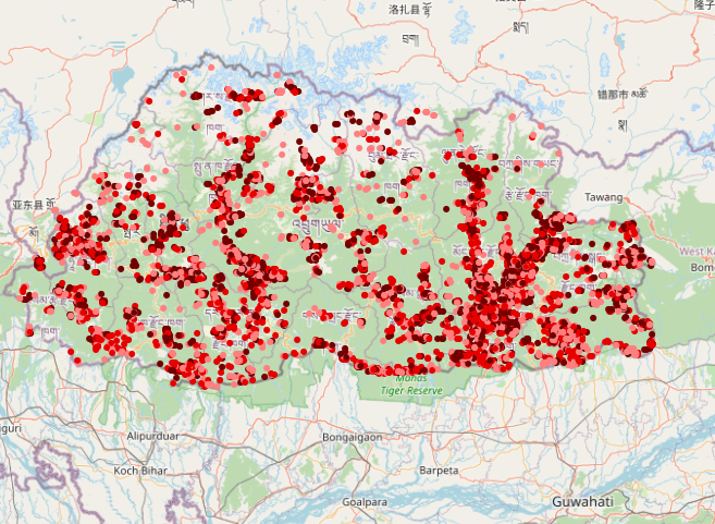
Forest Fires in Bhutan
This dataset showcases forest fire incidents in Bhutan from 2001 to 2024. The MODIS sensor on board Terra and Aqua satellites of NASA which ...
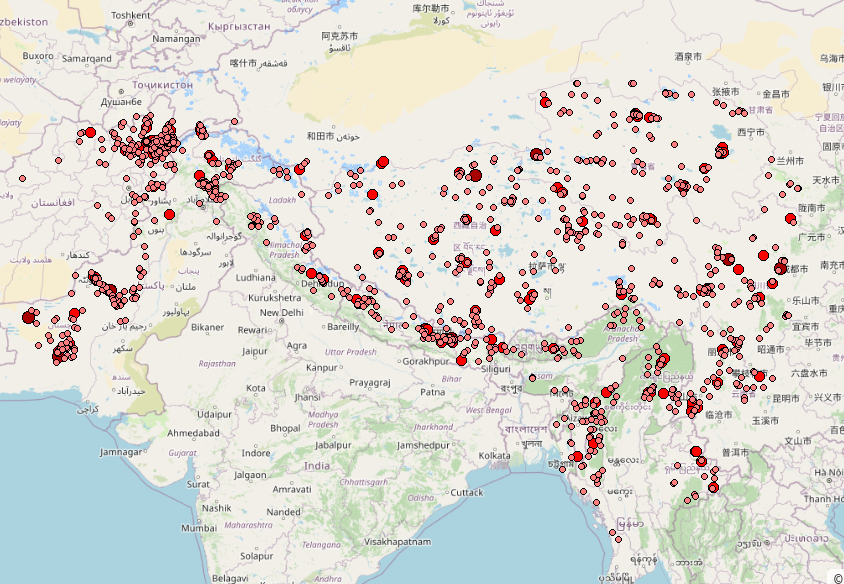
Forest Fires in HKH
This dataset showcases forest fire incidents in the HKH region from 2001 to 2023. The MODIS sensor on board Terra and Aqua satellites of NAS...
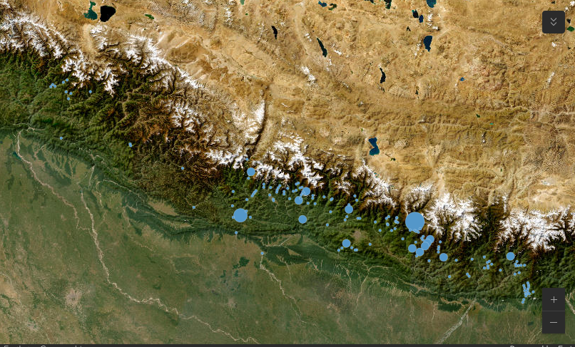
Glacial Lake Outburst Floods (GLOFs in the High Mountain Asia)
Glacier lake outburst floods (GLOFs) have been intensely investigated in High Mountain Asia (HMA) in recent years and are the most well-know...
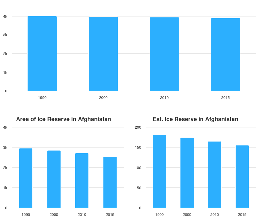
Glacier Dynamics in Afghanistan
This dataset provides information on glacier dynamics in Afghanistan between 1990 and 2015. The glacier data for 1990, 2000, 2010, and 2015 ...
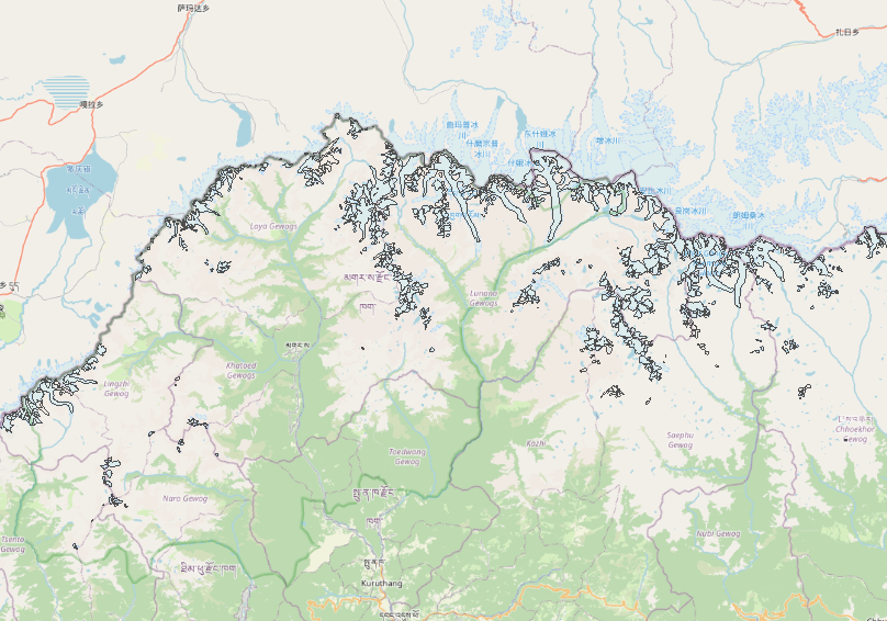
Glacier Dynamics in Bhutan
This dataset maps glaciers in Bhutan as of 2010, created using Landsat TM and ETM+ imagery. The glacier outlines were derived through a semi...
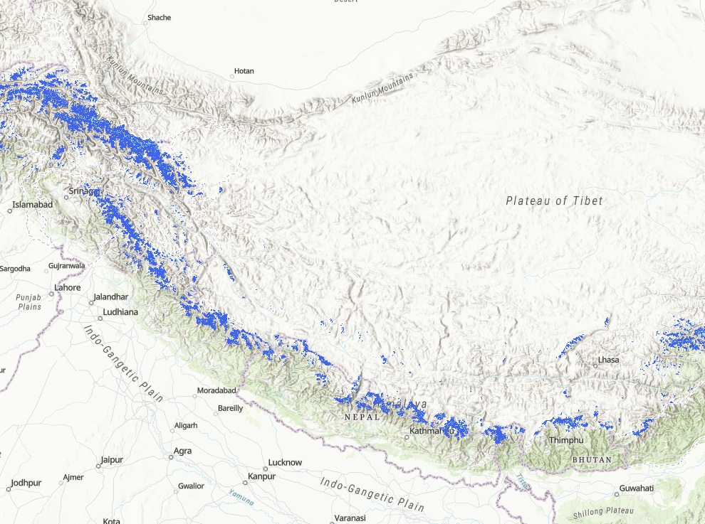
Glacier in the HKH 2020
This dataset provides information on the status of glaciers in the Hindu Kush Himalaya (HKH) region for the period 2005 ± 3 years (2002-2008...
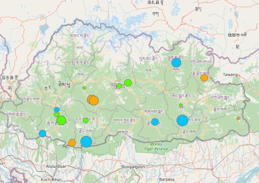
Hydropower Plants in Bhutan
The dataset provides information on hydropower plants in Bhutan with capacity greater than 1MW categorized into three types: operational, un...
Hydropower Plants in HKH
This dataset provides information on hydropower plants in the HKH region, classified into three categories: operational (currently in operat...
Hydropower Plants in Nepal
This dataset provides information about hydropower plants with capacity greater than 1MW in Nepal, categorized into three types: operational...
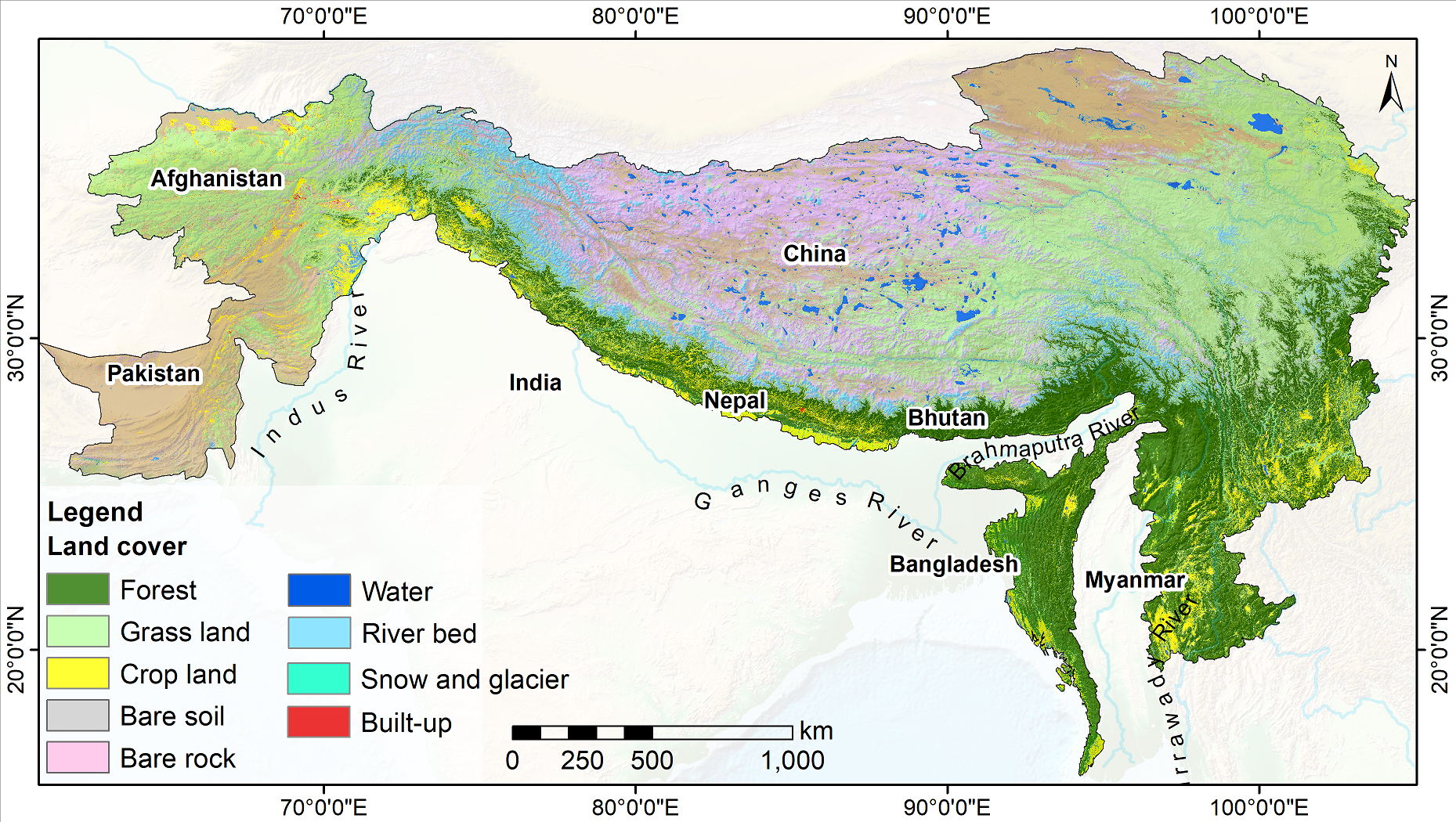
Land Cover of HKH 2022
The dataset showcases the land cover of Hindu Kush Himalaya (HKH) region for 2022. The dataset is part of the annual land cover datasets (20...
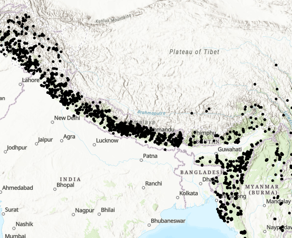
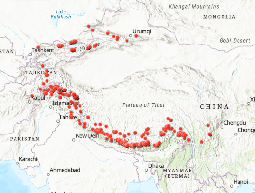
Landslides in HKH
The dataset showcases the landslide incidents occurring in the HKH region between 2014 and 2024. The dataset has been compiled from NASA's g...