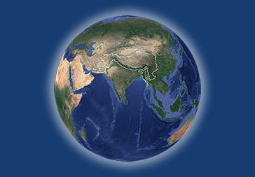
Digital polygon data of Glaciers of Bhutan in 1980, 1990, 2000 and 2010. This dataset is created using Landsat MSS, TM and ETM+ imageries of respective years. The glacier outlines was derived semi-automatically using object-based image classification (OBIC ) method separately for clean ice and debris cover and further editing and validation was done carefully by draping over the high resolution images from Google Earth.

| Schema | iso19139 |
| Purpose | Glacier inventory and status of glaciers in Bhutan from 1980 to 2010 |
| Descriptive Keyword | Glacier, Glacial Area change, Himala, Cryosphere (theme) Bhutan (place) |
| Metadata Record Info | |
|---|---|
| Language | eng |
| Charset | utf8 |
| Hierarchy Level | dataset |
| Date | 2026-01-20T14:52:32 |
| Standard Name | North American Profile of ISO 19115:2003 |
| Contact | |||
|---|---|---|---|
| Name | Mr. Sudan Bikash Maharjan | Sudan.Maharjan@icimod.org | |
| Organization Name | ICIMOD | Voice | |
| Position name | Research Associate RS/GIS | Address | |
| Role | author | ||
| Identification Info | |
|---|---|
| Title | Glacier Area Change in Bhutan 1980 - 2010 |
| Date | 2014-02-04 |
| Date Type | publication |
| Abstract | Digital polygon data of Glaciers of Bhutan in 1980, 1990, 2000 and 2010. This dataset is created using Landsat MSS, TM and ETM+ imageries of respective years. The glacier outlines was derived semi-automatically using object-based image classification (OBIC ) method separately for clean ice and debris cover and further editing and validation was done carefully by draping over the high resolution images from Google Earth. |
| Purpose | Glacier inventory and status of glaciers in Bhutan from 1980 to 2010 |
| Status | completed |
| Charset | utf8 |
| Topic Category | geoscientificInformation |
| Spatial Representation Type | vector |
| Equivalent Scale | 50000 |
| Cited Responsible Parties | |||
|---|---|---|---|
| Name | Mr. Samjwal Ratna Bajracharya | metadata@icimod.org | |
| Organization Name | ICIMOD | Voice | 977-1-5275222 |
| Position name | Remote Sensing Specialist | Address | Nepal |
| Role | author | ||
| Name | Mr. Sudan Bikash Maharjan | Sudan.Maharjan@icimod.org | |
| Organization Name | ICIMOD | Voice | 977-1-5275222 |
| Position name | Research Associate RS/GIS | Address | Nepal |
| Role | author |
| Name | Ms. Finu Shrestha | Finu.Shrestha@icimod.org | |
| Organization Name | ICIMOD | Voice | 977-1-5275222 |
| Position name | Research Associate GIS | Address | Nepal |
| Role | author |
| Geographic Extent | |||
|---|---|---|---|
| Geographic Extent East | 91.61100000000002 | Geographic Extent West | 89.166 |
| Geographic Extent North | 28.245 | Geographic Extent South | 27.579 |
| Resource Maintenance Information | |
|---|---|
| Maintenance and update frequency | notPlanned |
| User Defined Maintenance Frequency | |
| Date of Next Update | |
| Legal Constraints | |
|---|---|
| Use Limitation | Creative Commons Attribution 4.0 International (CC BY 4.0) |
| Access Constraints | copyright |
| Use Constraints | |
| Reference System Information | |
|---|---|
| Code | WGS 1984 |
| Data Quality Info | |
|---|---|
| Hierarchy level | dataset |
| Distributor Info | |||
|---|---|---|---|
| metadata@icimod.org | Organization Name | ICIMOD | |
| Voice | 977-1-5275222 | Position name | Senior GIS Specialist |
| Address | Role | distributor | |
| Transfer Option |
|---|