'%3e%3cg%3e%3cpath%20fill='%23036cb6'%20d='M0%200h134v33H0z'/%3e%3c/g%3e%3c/g%3e%3c/g%3e%3c/g%3e%3c/g%3e%3c/svg%3e)
Crop data of Barisal, Dinajpur and Rangpur districts of Bangladesh - 2019
Published date: 2019-12-16
Description
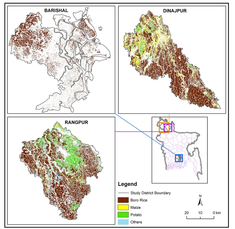
Raster data of Crop type maps of three pilot district of Bangladesh in 2019. This dataset was created using Sentinel 1 and 2 time series images from November 2018- April 2019. Boro-rice, Maize, Potato were the crops mapped in three districts of Bangladesh (Dinajpur, Rangpur, Barisal). Decision tree classification along with machine learning classifier was used for the classification. The maps were validated from the collected field samples.
Access & Use Constraints
Creative Commons Attribution 4.0 International (CC BY 4.0)
Suggested Citation
ICIMOD. (2020). Crop data of Barisal, Dinajpur and Rangpur districts of Bangladesh - 2019 [Data set]. ICIMOD. https://doi.org/10.26066/RDS.36029