'%3e%3cg%3e%3cpath%20fill='%23036cb6'%20d='M0%200h134v33H0z'/%3e%3c/g%3e%3c/g%3e%3c/g%3e%3c/g%3e%3c/g%3e%3c/svg%3e)
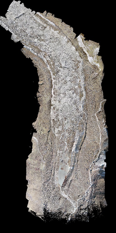
Lirung UAV-derived orthomosaic, October 2013
Published date: 2016-06-02
Description
Orthomosaic of Lirung Glacier produced from unmanned aerial vehicle imagery using the Structure from Motion algorithm. The data is georeferenced using ground control points measured with differential GPS.
Access & Use Constraints
Creative Commons Attribution 4.0 International (CC BY 4.0)
Suggested Citation
ICIMOD. (2016). Lirung UAV-derived orthomosaic, October 2013 [Data set]. ICIMOD. https://doi.org/10.26066/RDS.27309