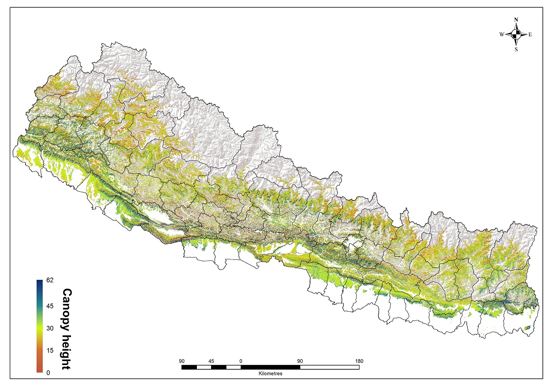
Leaf Area Index (LAI) generated based on Landsat-8 the OLI cloud free images. To generate tree canopy height map, a density scatter graph between the Geoscience Laser Altimeter System (GLAS) on the Ice, Cloud, and Land Elevation Satellite (ICESat) estimated maximum height and Landsat LAI nearest to the center coordinates of the GLAS shots show a moderate but significant exponential correlation (31.211*LAI0.4593, R2= 0.33, RMSE=13.25 m).

| Schema | iso19139 |
| Purpose | The purpose of the Maximum Tree Canopy Height map - Nepal was to assess using open sopurce satellite data (Landsat & GLAS). |
| Descriptive Keyword | Forest Hotspots, Forest Loss, Maximum Tree Canopy Height, servircat, icimod-servir, geo-ecosystems (theme) Nepal (place) |
| Metadata Record Info | |
|---|---|
| Language | eng |
| Charset | utf8 |
| Hierarchy Level | dataset |
| Date | 2026-02-02T14:36:44 |
| Standard Name | North American Profile of ISO 19115:2003 |
| Contact | |||
|---|---|---|---|
| Name | Mr. Hammad Gilani | metadata@icimod.org | |
| Organization Name | ICIMOD, SERVIR Himalaya | Voice | |
| Position name | Associate Remote Sensing Specialist | Address | |
| Role | author | ||
| Identification Info | |
|---|---|
| Title | Maximum Tree Canopy Height data of Nepal |
| Date | 2015-09-22 |
| Date Type | publication |
| Abstract | Leaf Area Index (LAI) generated based on Landsat-8 the OLI cloud free images. To generate tree canopy height map, a density scatter graph between the Geoscience Laser Altimeter System (GLAS) on the Ice, Cloud, and Land Elevation Satellite (ICESat) estimated maximum height and Landsat LAI nearest to the center coordinates of the GLAS shots show a moderate but significant exponential correlation (31.211*LAI0.4593, R2= 0.33, RMSE=13.25 m). |
| Purpose | The purpose of the Maximum Tree Canopy Height map - Nepal was to assess using open sopurce satellite data (Landsat & GLAS). |
| Status | completed |
| Charset | utf8 |
| Topic Category | geoscientificInformation |
| Spatial Representation Type | grid |
| Equivalent Scale | 5000 |
| Cited Responsible Parties | |||
|---|---|---|---|
| Name | Mr. Hammad Gilani | metadata@icimod.org | |
| Organization Name | ICIMOD | Voice | 977-1-5275222 |
| Position name | Associate Remote Sensing Specialist | Address | Nepal |
| Role | author | ||
| Geographic Extent | |||
|---|---|---|---|
| Geographic Extent East | 88.3904 | Geographic Extent West | 79.8862 |
| Geographic Extent North | 30.5175 | Geographic Extent South | 26.2307 |
| Resource Maintenance Information | |
|---|---|
| Maintenance and update frequency | asNeeded |
| User Defined Maintenance Frequency | |
| Date of Next Update | |
| Legal Constraints | |
|---|---|
| Use Limitation | Creative Commons Attribution 4.0 International (CC BY 4.0) |
| Use Limitation | Users are permitted to copy, use, adapt, and redistribute SERVIR data without limitations. SERVIR encourages users to keep any adapted or redistributed versions of this data freely available for public use. |
| Access Constraints | license |
| Use Constraints | license |
| Reference System Information | |
|---|---|
| Code | WGS 1984 |
| Data Quality Info | |
|---|---|
| Hierarchy level | dataset |
| Distributor Info | |||
|---|---|---|---|
| metadata@icimod.org | Organization Name | ICIMOD | |
| Voice | Position name | ||
| Address | Role | distributor | |
| Transfer Option | |
|---|---|
| Online Resource | Above Ground Biomass in Nepal |