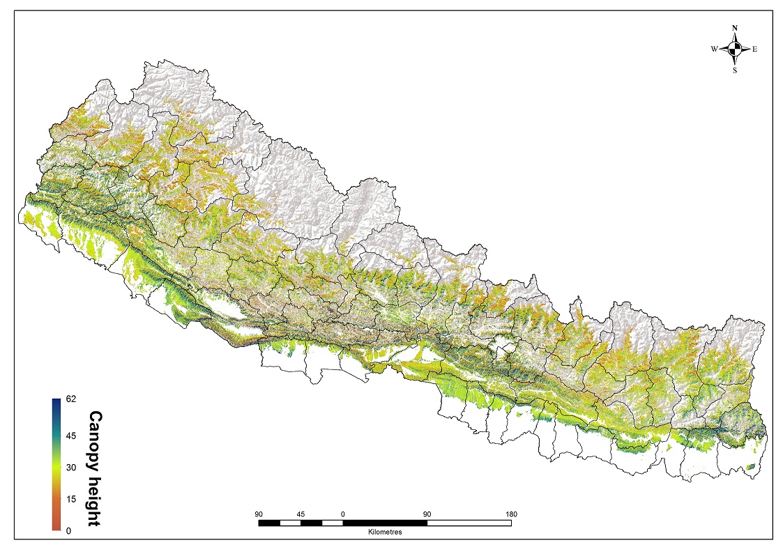
Leaf Area Index (LAI) generated based on Landsat-8 the OLI cloud free images. To generate tree canopy height map, a density scatter graph between the Geoscience Laser Altimeter System (GLAS) on the Ice, Cloud, and Land Elevation Satellite (ICESat) estimated maximum height and Landsat LAI nearest to the center coordinates of the GLAS shots show a moderate but significant exponential correlation (31.211*LAI0.4593, R2= 0.33, RMSE=13.25 m).