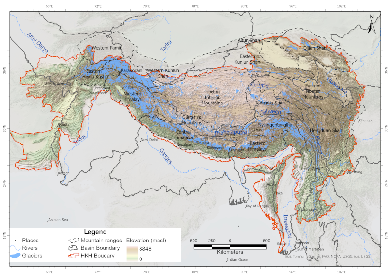
Glaciers are an indispensable component of the Hindu Kush Himalayan (HKH) region, acting as a vast “water tower” that stores large volumes of freshwater and sustains Asia’s ten major river systems, supporting ecosystems, communities, and livelihoods across the continent. This study presents a decadal glacier change dataset for the HKH region developed using a semi-automatic mapping approach to ensure high accuracy and enable reliable comparison of glacier changes over time. The dataset was generated using consistent data sources and methods, with Landsat imagery from 1990, 2000, 2010, and 2020, maintaining a narrow temporal window (±1 year from the base year) and a uniform spatial resolution. Glacier outlines were mapped at a scale of 1:50,000 with a minimum area threshold of 0.02 km². Glacier area and associated topographic parameters were derived using the Albers Equal Area projection and the global void-filled SRTM DEM v4. This dataset represents a first-of-its-kind, region-wide glacier inventory created using a consistent methodology and data source, providing a comprehensive assessment of glacier distribution and decadal change across the entire HKH region.