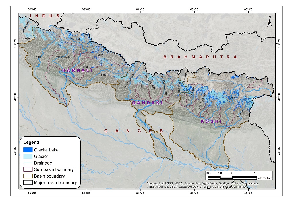
The data on glacial lakes in 2015 were derived through a semi-automatic method using Landsat imagery from 2015 to 2016. The Normalized Difference Water Index threshold value was used for classification. Further, the lake boundary was revised or manually updated by incorporating those lakes that were missed because of atmospheric and physical processes such as being frozen, covered under snow, or obstructed by shadows and clouds. The mapped glacial lakes were validated and modified where necessary by overlaying the Landsat imagery over previous inventory datasets. They were also cross-checked with high-resolution Google Earth imagery. The attributes of glacial lakes were derived from SRTM DEM, and the data were projected in the WGS UTM projection system. This dataset was prepared to support the Green Climate Fund project proposal formulated by UNDP Nepal.