A broad set of climate-related variables were considered for inclusion in a quantitative model, which partitions geographic space into bioclimate
regions.
The dataset provides first level river basin boundaries of ten major river basins in the Hindu Kush Himalaya (HKH) region – the Amu Darya, Brahmaputra (Yarlungtsanpo), Ganges, Indus, Irrawaddy, Mekon..
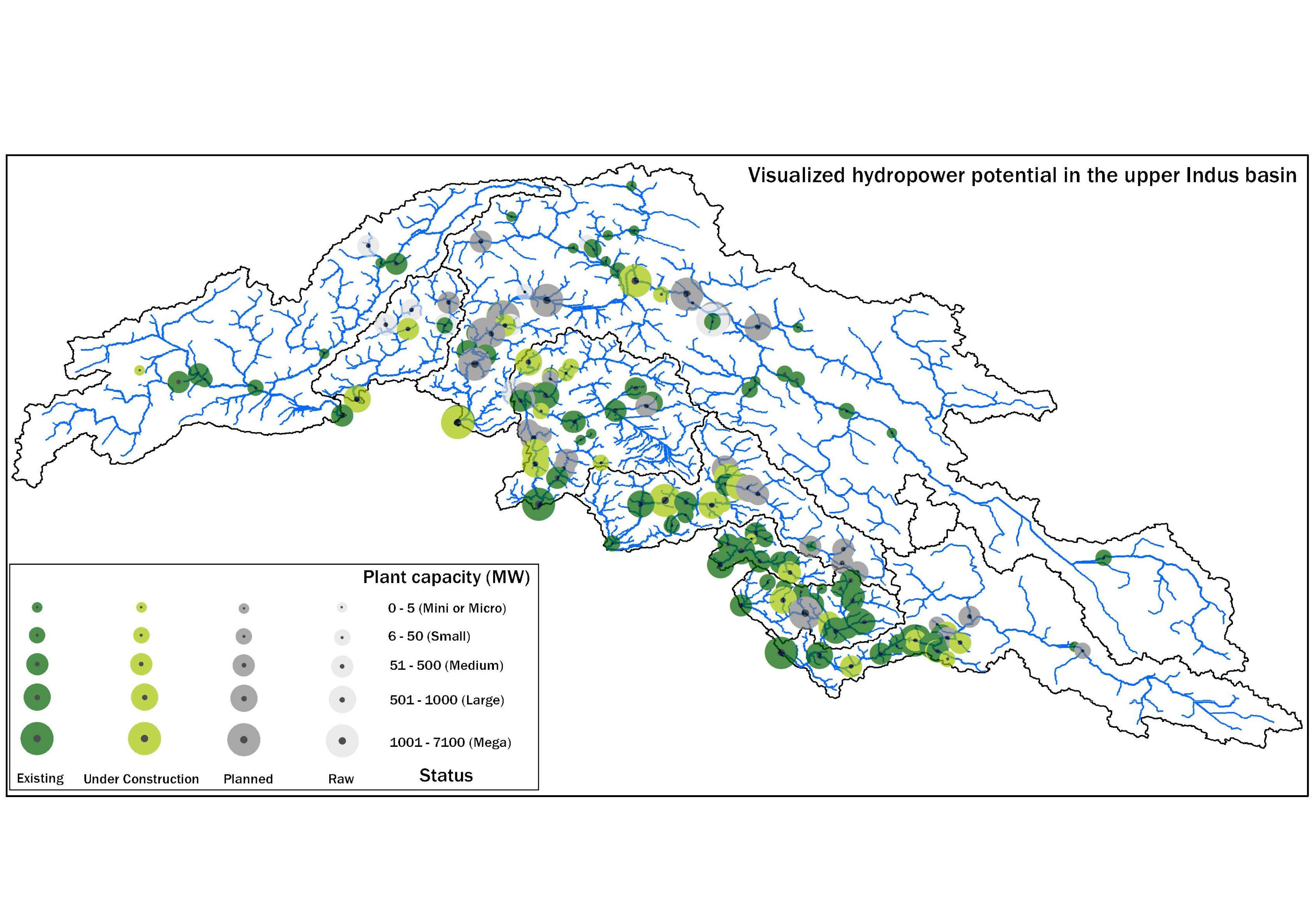
This database was compiled under WP-2 of the SustainIndus project between August 2019 and August 2021 to consolidate publicly available information on hydropower projects in various stages of develop..
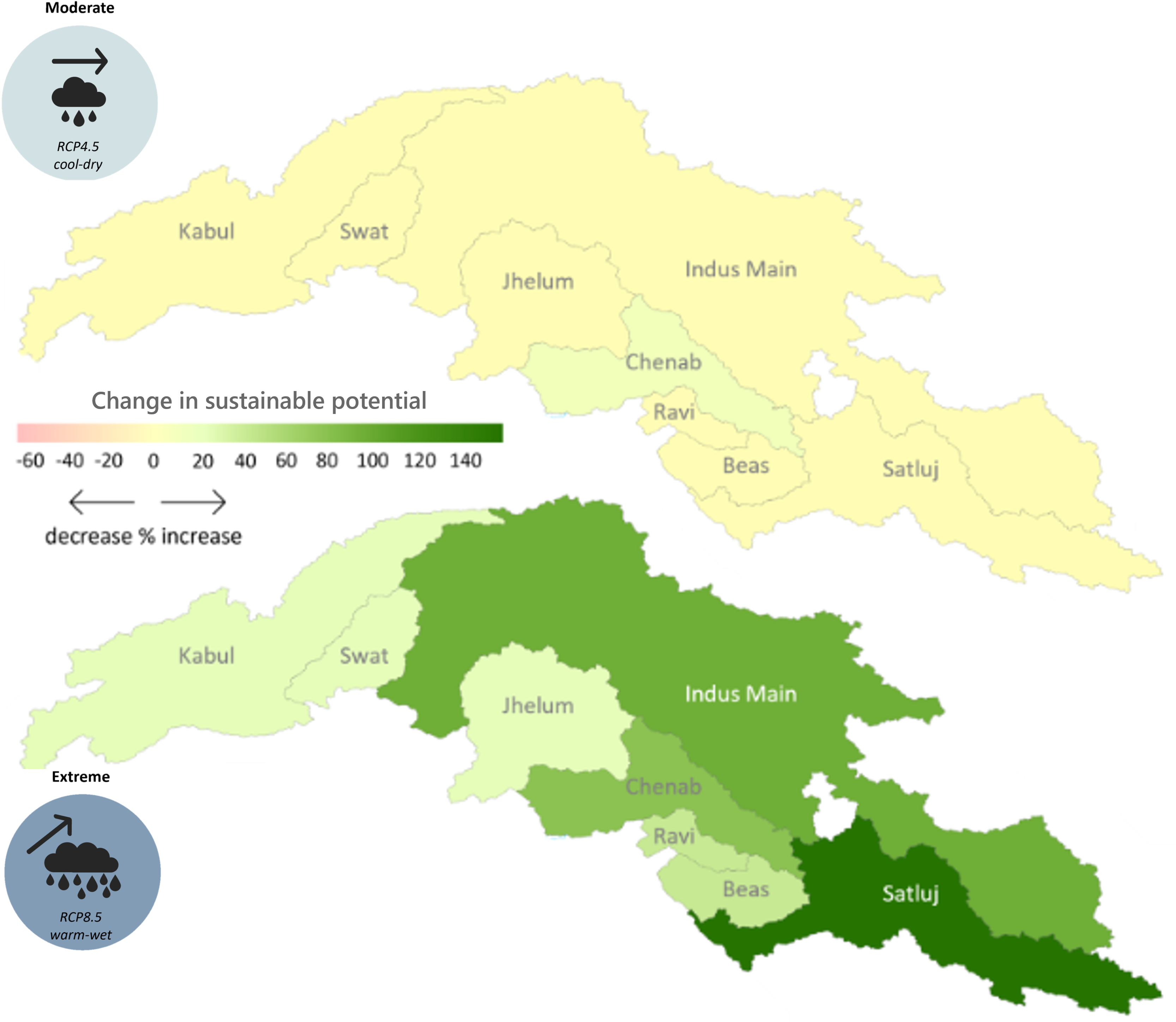
The hydropower potential in the upper Indus basin under future hydro-climatology was prepared using the Hydropower Potential Exploration (HyPE) as part of Work Package 2 in the SustainIndus project. ..
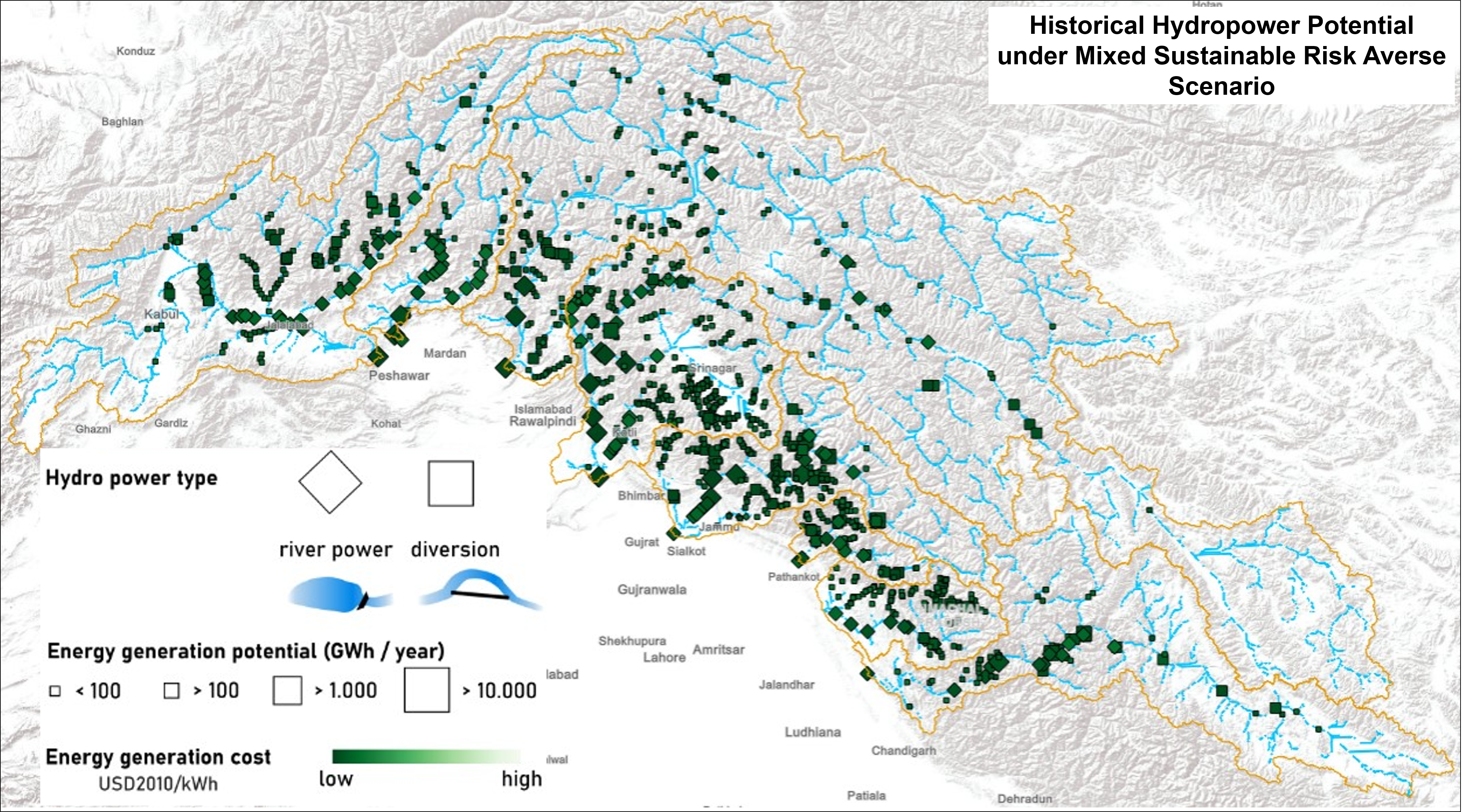
The hydropower potential in the upper Indus basin under historical hydro-climatology was prepared using the Hydropower Potential Exploration (HyPE) model. Under historical hydro-climatology, the HyPE..
Poverty and Vulnerability Assessment (PVA) is a district level household survey to understand vulnerability of households to environmental and socioeconomic changes with focus on mountain specificity..
The dataset provides second level or sub-basin river boundaries of ten major river basins in the Hindu Kush Himalaya (HKH) region – the Amu Darya, Brahmaputra (Yarlungtsanpo), Ganges, Indus, Irrawadd..
The dataset provides third level river basin boundaries of ten major river basins in the Hindu Kush Himalaya (HKH) region – the Amu Darya, Brahmaputra (Yarlungtsanpo), Ganges, Indus, Irrawaddy, Mekon..