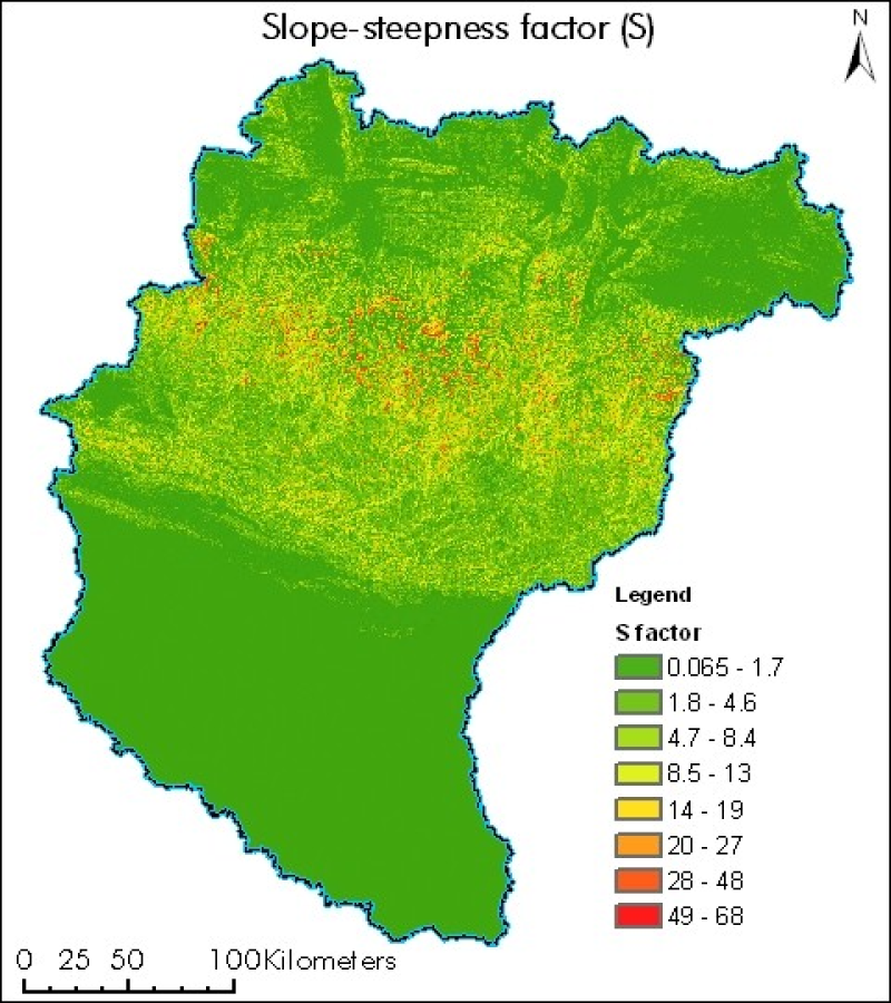
Digital grid dataset of Slope Steepness factor (S) of Koshi basin. It represents the effect of slope steepness on erosion. Soil loss increases more rapidly with slope steepness than it does with slope length. Slope steepness is derived from SRTM DEM 90 meter spatial resolution data.