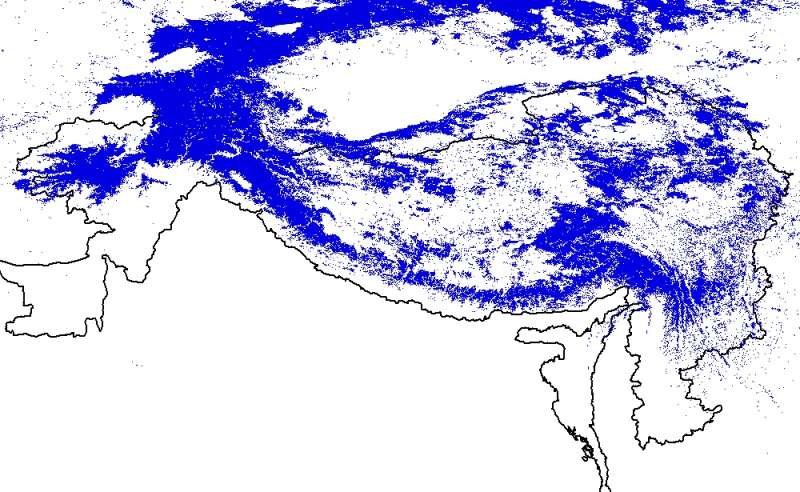
Digital polygon dataset of snow cover area of Hindu Kush Himalayan (HKH) Region. This dataset is generated from 8-day composite 500 m resolution Terra satellite image from MODIS and using global standard MODIS snow product after implementing cloud filtering techniques.