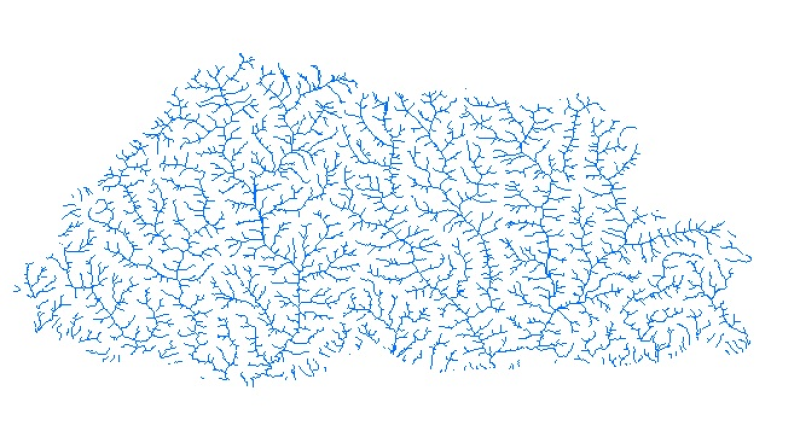
Digital line dataset of River Network of the Bhutan. This dataset is extracted using the SRTM DEM. The dataset is refined using LandSat images of 30m resolution and available higher resolution satellite images.
Schema
iso19139
Purpose
Topographic base data and for Water Resource Management and Planning applications.
Descriptive Keyword
River Network, Drainage network, Water Resource Management (theme) Bhutan (place)
Digital line dataset of River Network of the Bhutan. This dataset is extracted using the SRTM DEM. The dataset is refined using LandSat images of 30m resolution and available higher resolution satellite images.
Purpose
Topographic base data and for Water Resource Management and Planning applications.
The content of this website can be accessed, printed and downloaded in an unaltered form (altered including being stretched, compressed, coloured or altered in any way so as to distort content from its original proportions or format) with copyright acknowledged, on a temporary basis for personal study that is not for a direct or indirect commercial use and any non-commercial use. Any content printed or downloaded may not be sold, licensed, transferred, copied or reproduced in whole or in part in any manner or in or on any media to any person without the prior written consent of the ICIMOD