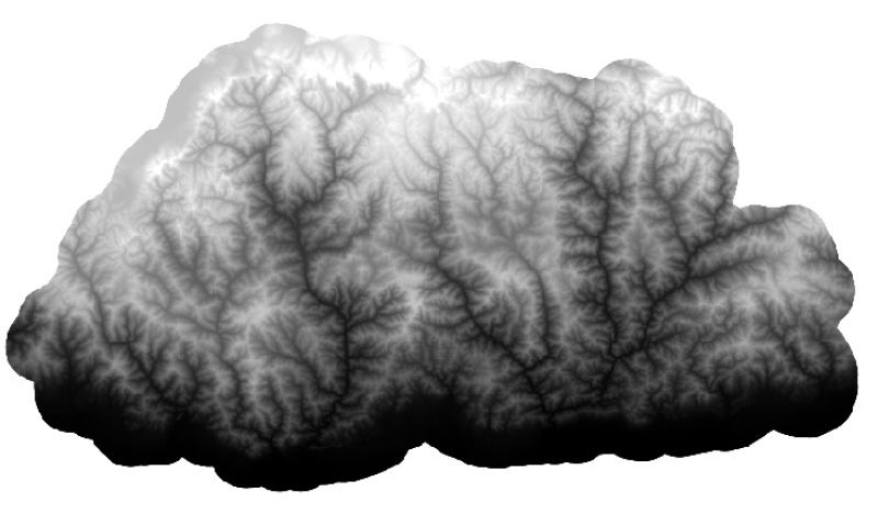
Digital Elevation Model (DEM) of Bhutan. This dataset is created using ASTER image with 30 m spatial resolution. The data was prepared for the analysis of attitudinal Variation and Land Cover Classes.
Schema
iso19139
Purpose
Topographic base data general purpose and for analysis of attitudinal Variation
Descriptive Keyword
Digital Elevation Model, Altitude, Slope, Topography (theme) Bhutan (place)
Digital Elevation Model (DEM) of Bhutan. This dataset is created using ASTER image with 30 m spatial resolution. The data was prepared for the analysis of attitudinal Variation and Land Cover Classes.
Purpose
Topographic base data general purpose and for analysis of attitudinal Variation
The content of this website can be accessed, printed and downloaded in an unaltered form (altered including being stretched, compressed, coloured or altered in any way so as to distort content from its original proportions or format) with copyright acknowledged, on a temporary basis for personal study that is not for a direct or indirect commercial use and any non-commercial use. Any content printed or downloaded may not be sold, licensed, transferred, copied or reproduced in whole or in part in any manner or in or on any media to any person without the prior written consent of the ICIMOD