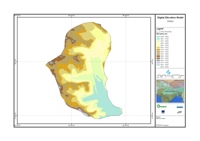
Digital Elevation Model of Gyoko, Nepal is based on Topographic map scale 1:25,000/50,000 acquired from National Geographic Information Infrastructure Project (NGIIP), Dept. of Survey Kathmandu Nepal.
Schema
iso19139
Purpose
Topographic base data for visualization and analysis purpose
Descriptive Keyword
Digital Elevation Model, Topography, Digital Terrain Model (theme) Nepal (place)
Metadata Record Info
Language
eng
Charset
utf8
Hierarchy Level
Date
2020-09-08T13:59:53
Standard Name
ISO 19115:2003/19139
Contact
Name
Email
metadata@icimod.org
Organization Name
ICIMOD
Voice
977-1-5275222
Position name
Address
Khumaltar Lalitpur Kathmandu 3226 Nepal
Role
distributor
Identification Info
Title
Digital Elevation Model for Gokyo Nepal
Date
2011-07-15T11:00:00
Date Type
publication
Abstract
Digital Elevation Model of Gyoko, Nepal is based on Topographic map scale 1:25,000/50,000 acquired from National Geographic Information Infrastructure Project (NGIIP), Dept. of Survey Kathmandu Nepal.
Purpose
Topographic base data for visualization and analysis purpose
Status
onGoing
Charset
utf8
Topic Category
elevation
Spatial Representation Type
vector
Equivalent Scale
50000
Point Of Contact
Individual Name
Email
metadata@icimod.org
Organization Name
ICIMOD
Voice
977-1-5275222
Position name
Address
Khumaltar Lalitpur Kathmandu 3226 Nepal
Role
originator
Geographic Extent
Geographic Extent East
86.44
Geographic Extent West
86.36
Geographic Extent North
28.40
Geographic Extent South
27.56
Resource Maintenance Information
Maintenance and update frequency
asNeeded
User Defined Maintenance Frequency
Date of Next Update
Legal Constraints
Use Limitation
The content of this website can be accessed, printed and downloaded in an unaltered form (altered including being stretched, compressed, coloured or altered in any way so as to distort content from its original proportions or format) with copyright acknowledged, on a temporary basis for personal study that is not for a direct or indirect commercial use and any non-commercial use. Any content printed or downloaded may not be sold, licensed, transferred, copied or reproduced in whole or in part in any manner or in or on any media to any person without the prior written consent of the ICIMOD