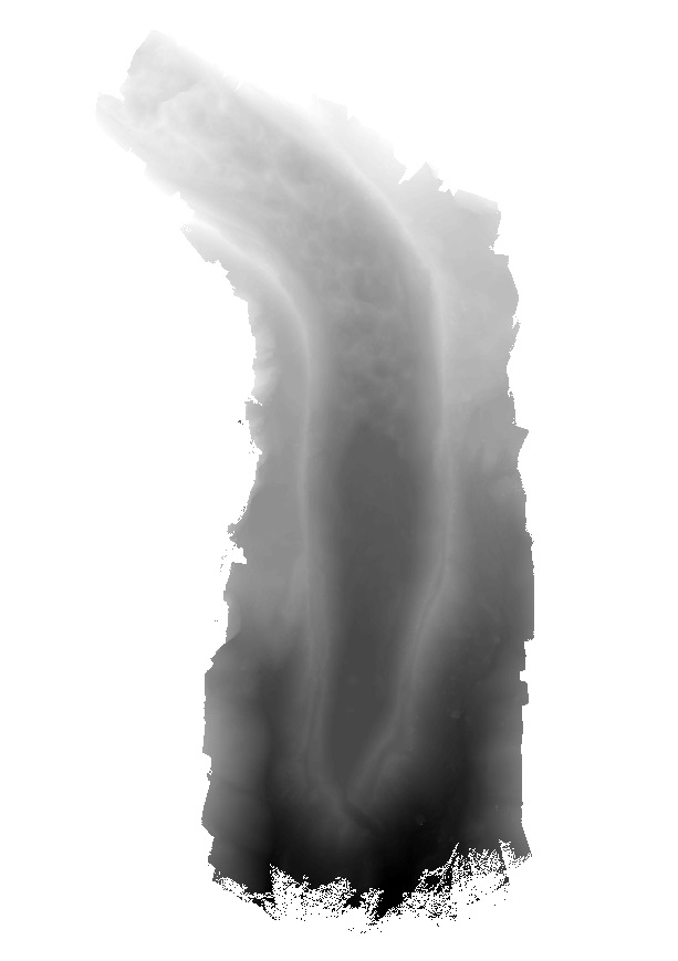
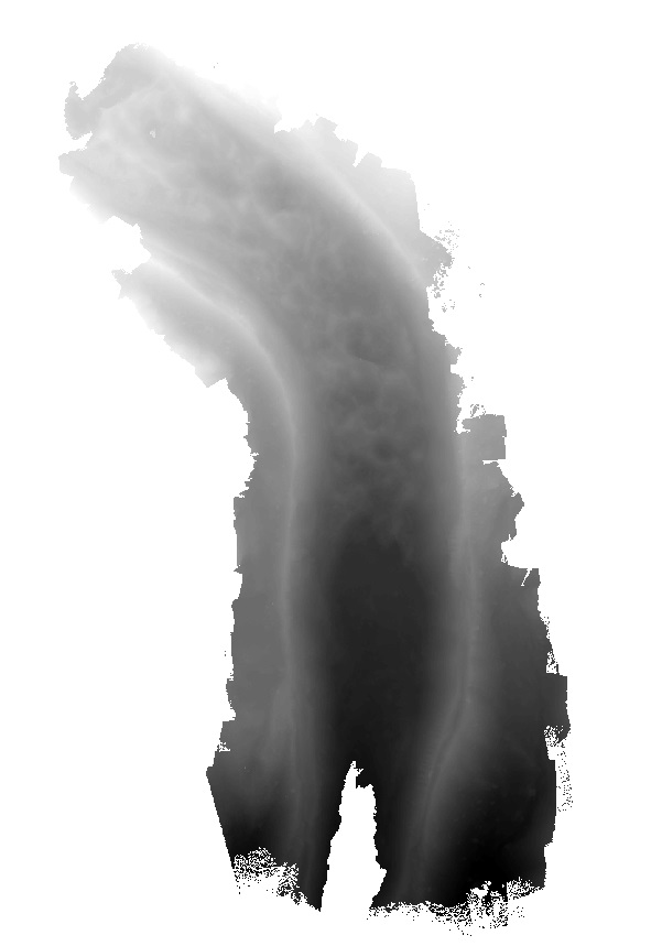
Elevation model of Lirung Glacier produced from unmanned aerial vehicle imagery using the Structure from Motion algorithm. The data is georeferenced using ground control points measured with differen..
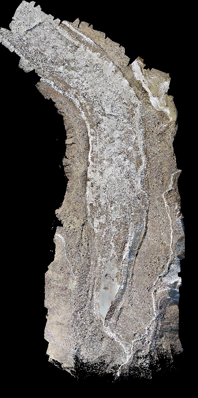
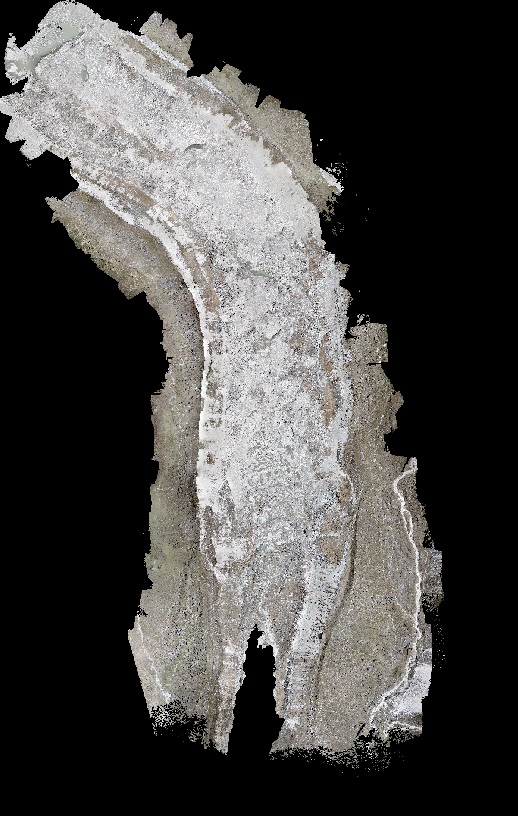
Orthomosaic of Lirung Glacier produced from unmanned aerial vehicle imagery using the Structure from Motion algorithm. The data is georeferenced using ground control points measured with differential..
Orthomosaic of Lirung Glacier produced from unmanned aerial vehicle imagery using the Structure from Motion algorithm. The data is georeferenced using ground control points measured with differential..
Elevation model of Lirung Glacier produced from unmanned aerial vehicle imagery using the Structure from Motion algorithm. The data is georeferenced using ground control points measured with differen..