 Metadata Catalogue
dataset
Type of resources
Available actions
Topics
Keywords
Contact for the resource
Provided by
Years
Formats
Representation types
Update frequencies
status
Scale
Resolution
-

The past few decades have seen high levels of deforestation and forest degradation in the Hindu Kush Himalayan (HKH) region. In this context, under SERVIR Himalaya programme, ICIMOD has developed forest cover monitoring system to identify forest change hotspot areas which need critical forest management attention in four pilot areas. This forest cover data of Paro, Bhutan for 2013 has been developed using LandSat 8 data in a semi-automated manner as part of the forest cover monitoring system.
-

Landslide data of Koshi basin is digitized from topo sheets published in 1990s.
-
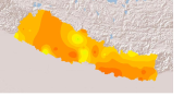
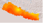
Monthly maximum temperature for 12 months for Nepal where actual averages are used for calculation. Monthly maximum temperature data set consists of 12 raster files, one for each month, showing mean values derived from monthly temperature readings.
-
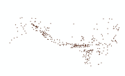
Digital point data of Important Habitat Area of bird species of Hindu Kush Himalayan (HKH) Region. This dataset is acquired from IUCN, Nepal.
-

The past few decades have seen high levels of deforestation and forest degradation in the Hindu Kush Himalayan (HKH) region. In this context, under SERVIR Himalaya programme, ICIMOD has developed forest cover monitoring system to identify forest change hotspot areas which need critical forest management attention in four pilot areas. This forest loss data of Swath, Pakistan between 2013 and 2014 has been developed using LandSat 8 data in a semi-automated manner as part of the forest cover monitoring system.
-
Daily mean sunshine duration of January 2001 of Nepal. This dataset is created using actual daily sunshine averages using Win-surfer and GIS-arc/info software packages. The mean values were derived from daily sunshine readings.
-
Daily mean sunshine duration of March 2001 of Nepal. This dataset is created using actual daily sunshine averages using Win-surfer and GIS-arc/info software packages. The mean values were derived from daily sunshine readings.
-
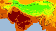
Digital grid dataset of monthly maximum temperature (May) for the period of 1950-2000 of Hindu Kush Himalayan (HKH) Region. The dataset is derived from WorldClim (http://www.worldclim.org/), and major climate databases compiled by the Global Historical Climatology Network (GHCN), the FAO, the WMO, the International Center for Tropical Agriculture (CIAT), R-HYdronet. Monthly maximum temperature data set consists of 12 raster files, one for each month, showing mean values derived from monthly temperature readings. The data layers were generated through interpolation of average monthly climate data from weather stations on a 30 arc-second resolution grid.
-
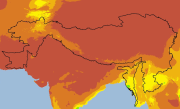
Digital grid dataset of monthly precipitation (November) for the period of 1950-2000 of Hindu Kush Himalayan (HKH) Region. The dataset is derived from WorldClim (http://www.worldclim.org/), and major climate databases compiled by the Global Historical Climatology Network(GHCN),the FAO, the WMO, the International Center for Tropical Agriculture (CIAT), R-HYdronet. Monthly Precipitation data set consists of 12 raster files, one for each month, showing mean values derived from monthly precipitation readings. The data layers were generated through interpolation of average monthly climate data from weather stations on a 30 arc-second resolution grid.
-
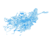
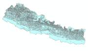
Digital polygon dataset of Drainage System of Afghanistan. This dataset is acquired from ESRI Data and Maps 2001.