 Metadata Catalogue
inlandWaters
Type of resources
Available actions
Topics
Keywords
Contact for the resource
Provided by
Years
Representation types
Update frequencies
status
Scale
Resolution
-
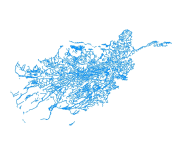
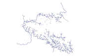
Digital polygon dataset of Drainage System of Afghanistan. This dataset is acquired from ESRI Data and Maps 2001.
-
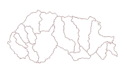
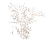
Digital polygon dataset of Sub Watershed boundaries of Bhutan. This dataset is extracted using the SRTM DEM. The boundaries were refined using LandSat images of 30m resolution. The watershed boundaries were further divided into sub-watershed boundaries in the glaciated region.
-

River Systems Vector digital data prepared based on map of Gorkha District (1:125,000), published by Suspension Bridge Division (SBD) 1989.
-
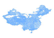
Digital line dataset of River system of China. This dataset is basic vector layer acquired from USGS.
-
This river (line) vector digital data of Gorkha District was prepared by ICIMOD based on Indian toposheet (1:50,000),1950s.
-
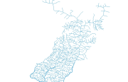
Digital line dataset of drainage network of Central Karakoram National Park(CKNP) area, Pakistan. The dataset is compiled through GPS based field survey conducted in year 2008.
-

Digital line data of River Network of Ludhi Khola Watershed, Gorkha, Nepal. This dataset is created using Topographic sheet data at scale of 25,000/50,000, of 1995 acquired from National Geographic Information Infrastructure Project (NGIIP), Dept. of Survey, Kathmandu, Nepal. The data was prepared for the Reducing Emission from Deforestation and Forest Degradation (REDD) Pilot Project. This is a joint project of ICIMOD with Asian Network for Sustainable Agriculture and Bio-resources (ANSAB) and Federation of Community for Forest Users of Nepal (FECOFUN) funded by NORAD.
-
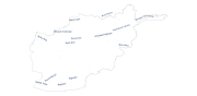
Annotation of River names of of Afghanistan. This dataset is basic Vector layer derived from Afghanistan Information Management Systems (AIMS), Afghanistan.
-
Digital line data of River Network of Sagarmatha National Park, Nepal. This dataset is created using Topographic sheet data at scale of 25,000/50,000, of 1995 acquired from National Geographic Information Infrastructure Project (NGIIP), Dept. of Survey, Nepal.
-
Digital polygon dataset of Watersheds of Afghanistan. This dataset is basic vector layer acquired from ESRI Data and Maps 2001.