 Metadata Catalogue
geoscientificInformation
Type of resources
Available actions
Topics
Keywords
Contact for the resource
Provided by
Years
Formats
Representation types
Update frequencies
status
Scale
Resolution
-

The past few decades have seen high levels of deforestation and forest degradation in the Hindu Kush Himalayan (HKH) region. In this context, under SERVIR Himalaya programme, ICIMOD has developed forest cover monitoring system to identify forest change hotspot areas which need critical forest management attention in four pilot areas. This forest cover data of Paro, Bhutan for 2013 has been developed using LandSat 8 data in a semi-automated manner as part of the forest cover monitoring system.
-

Landslide data of Koshi basin is digitized from topo sheets published in 1990s.
-

The past few decades have seen high levels of deforestation and forest degradation in the Hindu Kush Himalayan (HKH) region. In this context, under SERVIR Himalaya programme, ICIMOD has developed forest cover monitoring system to identify forest change hotspot areas which need critical forest management attention in four pilot areas. This forest loss data of Swath, Pakistan between 2013 and 2014 has been developed using LandSat 8 data in a semi-automated manner as part of the forest cover monitoring system.
-
As part of climate change impact monitoring program on biodiversity, Ugyen Wangchuck Institute for Conservation and Environment Research (UWICER) has initiated HEROES program in 2015. 17 schools covering different altitudinal gradient and geographic region were selected as monitoring sites. In each school, weather station was installed that logs weather data such as temperature, precipitation, solar radiation, soil moisture, wind speed and wind direction every 10 minutes. Also, at the same location, the project monitor and records phenological events and its timing such as budburst, flowering and fruiting on an yearly basis. This dataset consists of daily and monthly temperature and precipitation data for 2015-2020 period derived from weather station data collected at 10 minute interval at Tendruk School in Samtse, Bhutan.
-

Deforestation layer gives information about the dependence of local communities for deforestation on forest ecosystems in Chitwan Annapurna Landscape.
-

Glacier data of Afghanistan were prepared on the basis of Landsat imageries from 2010. The glacier outlines were derived semi-automatically using object-based image classification (OBIC) separately for clean-ice and debris-covered glaciers and further manual editing for quality assurance. The attributes of glacier data were derived from SRTM DEM. This dataset was jointly prepared by the Ministry of Energy and Water (MEW), Government of Afghanistan, and ICIMOD under the SERVIR-HKH Initiative.
-

Large landslide dams are one of the most disastrous natural phenomena in mountainous regions all over the world Such dams are formed most commonly in tectonically active settings where high mountains border narrow and steep valleys and earthquakes occur frequently. Landslide dams are very diverse in terms of their formation, geotechnical characteristics, longevity, stability, and flood hazard. The two major causes of landslide dam formation are precipitation and earthquake. About 50% of dam-forming landslides are brought about by rainstorms and snowmelts, 40% by earthquakes, and 10% by other factors Geometry of valley in relation to geometry and volume of debris and discharge of damming river are some of the factors which are responsible for the development of landslide dams. Schuster et al. (1998) mentioned four groups of governing factors responsible for the spatial distribution of landslide dams. They are i) seismic intensity, ii) slope gradient and topography, iii) lithology and weathering properties, and iv) soil moisture and groundwater content. Landslide dams are generated by various types of mass movements, which range from rock falls and rockslides in steep walled, narrow canyons to earth slumps in flat river lowlands. Managing landslide-dam hazards requires an understanding of the temporal and spatial scales on which such phenomena occur. Many previous works on landslide dams have been mainly descriptive in character, and have produced a multitude of documented case studies and inventories (e.g. Costa and Schuster, 1988; Costa and Schuster, 1991). More recent work is focused on quantitative methods of determining the post-formation development, in particular, the controls on dam longevity.
-
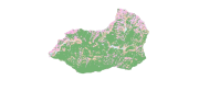
Digital dataset of Land cover of Ludhi Khola Watershed, Gorkha, Nepal. This dataset is created using GeoEye 0.5 meter spatial resolution satellite image of November 2009 and field verified in 2010. The data was prepared for the Reducing Emission from Deforestation and Forest Degradation (REDD) Pilot Project. This is a joint project of ICIMOD with Asian Network for Sustainable Agriculture and Bioresources (ANSAB) and Federation of Community for Forest Users of Nepal (FECOFUN) funded by NORAD.
-
Evapotranspiration layer gives information about the impacts of evapotranspiration on forest ecosystems in Chitwan Annapurna Landscape.
-

Digital point dataset of Graveyards of Central Karakoram National Park(CKNP)area, Pakistan. This dataset is compiled through GPS based field survey conducted in year 2008.