 Metadata Catalogue
biota
Type of resources
Topics
Keywords
Contact for the resource
Provided by
Years
Representation types
Update frequencies
status
Scale
Resolution
-
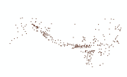
Digital point data of Important Habitat Area of bird species of Hindu Kush Himalayan (HKH) Region. This dataset is acquired from IUCN, Nepal.
-
This is a list of seed plants (angiosperms and gymnosperms) of the Senchal Wildlife Sanctuary in India.
-
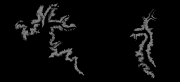
Digital dataset of Musk Deer habitat area of Central Karakoram National Park (CKNP) area, Pakistan. This dataset is compiled through GPS based field survey conducted in year 2008 based on baseline study volume II, draft report, by Hagler Bailly (2005) and TJ Roberts. Habitat area is identified based on the GPS survey, baseline report and potential habitat area modeling using variables like land cover, slope, DEM etc through ENFA.
-
This is a list of seed plants (angiosperms and gymnosperms) recorded from the Mahananda Wildlife sanctuary.
-
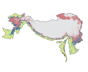
Digital polygon dataset of Honey Bee Dominant Zones of Hindu Kush Himalayan (HKH) Region created by ICIMOD.
-
This checklist contains a total of 42 rhododendron species documented from the Kangchenjunga Landscape. This information has been collated from the Kangchenjunga Landscape country level feasibility assessment reports of Bhutan, India and Nepal.
-
This checklist contains a total of 8 mammal species documented from the China part of Kailash Sacred Landscape. This information has been collated from feasibility assessment report of the Kailash Sacred Landscape Conservation and Development Initiative and from IUCN websites.
-
The dataset shows medicinal plant species found in the Khunjerab National Park and the use of medicinal plant by inhabitants of KNP.
-
This is a list of seed plants (gymnosperms and angiosperms) recored from the Singhalila Senchal corridor.
-
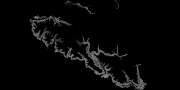
Digital dataset of Himalayan Wolf habitat area of Central Karakoram National Park (CKNP) area, Pakistan. This dataset is compiled through GPS based field survey conducted in year 2008 based on baseline study volume II, draft report, by Hagler Bailly (2005) and TJ Roberts. Habitat area is identified based on the GPS survey, baseline report and potential habitat area modeling using variables like land cover, slope, DEM etc through ENFA.