 Metadata Catalogue
20000 m
Type of resources
Topics
Keywords
Contact for the resource
Provided by
Representation types
Update frequencies
status
Resolution
-

Digital polygon data of Floodplains of Central Karakoram National Park(CKNP) area, Pakistan. This dataset is compiled using water indices from satellite imagery
-
Digital polygon dataset of Villages of Central Karakoram National Park(CKNP) area, Pakistan. This dataset is created using topographic sheet maps at scale of 20000.
-

Digital point dataset of Veterinary Hospitals of Central Karakoram National Park (CKNP) area, Pakistan. This dataset is compiled through GPS based field survey conducted in year 2008.
-

Digital point dataset of Camping sites locations of Central Karakoram National Park(CKNP) area, Pakistan. This dataset is compiled through GPS based field survey conducted in year 2008.
-
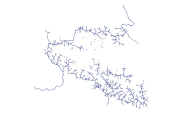
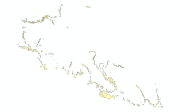
Digital line dataset of drainage network of Central Karakoram National Park(CKNP) area, Pakistan. The dataset is compiled through GPS based field survey conducted in year 2008.
-

Digital point dataset of Post Office locations of Central Karakoram National Park (CKNP) area, Pakistan. This dataset is compiled through GPS based field survey conducted in year 2008.
-

Digital point dataset of Gemstone Mine locations of Central Karakoram National Park(CKNP) area, Pakistan. This dataset is compiled through GPS based field survey conducted in year 2008.
-

Digital line dataset of K2 Peak Mountaineering attempts Treks of Central Karakoram National Park (CKNP) area, Pakistan.
-

Digital point dataset of Hotels of Central Karakoram National Park(CKNP) area, Pakistan. This dataset is compiled through GPS based field survey conducted in year 2008.
-

Digital point dataset of Archaeological sites of Central Karakoram National Park(CKNP) area, Pakistan. This dataset is compiled through GPS based field survey conducted in year 2008.