servircat
Type of resources
Available actions
Topics
Keywords
Contact for the resource
Provided by
Years
Representation types
Update frequencies
status
Scale
Resolution
-

Land cover data of Hindu Kush Himalayan region of Myanmar for 2010. This dataset is created using the LandSat 30 meter spatial resolution satellite image of 2010 and includes land cover information for Chin, Kachin, Rakhine and Shan states of Myanmar.
-

Land cover data of Hindu Kush Himalayan region of Pakistan for 2000. This dataset is created using the LandSat 30 meter spatial resolution satellite image of 2000.
-
Points representing individual houses as an exposure elements while doing flood risk analysis.
-
The Gorkha earthquake (M 7.8) on 25 April 2015 and later aftershocks struck South Asia, killing 9,000 and damaging a large region. Supported by a large campaign of responsive satellite data acquisitions over the earthquake disaster zone, our team undertook a satellite image survey of the earthquakes’ induced geohazards in Nepal and China and an assessment of the geomorphic, tectonic, and geologic controls on quake-induced landslides. Timely analysis and communication aided response and recovery and informed decision makers. We mapped 4312 co-seismic and post-seismic landslides and surveyed 491 glacier lakes for earthquake damage, but found only 9 landslide-impacted lakes and no visible satellite evidence of outbursts. Landslide densities are correlated with slope, peak ground acceleration, surface downdrop, and specific metamorphic lithologies and large plutonic intrusions.
-

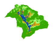
Digital dataset of Land Cover of Phobjikha, Bhutan. This dataset is derived from 2.5m SPOT5 satellite image.
-

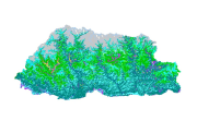
Land cover data of Bhutan for 2010. This dataset is created using the LandSat 30 meter spatial resolution satellite image of 2010.
-

Land cover data of Hindu Kush Himalayan region of Pakistan for 2010. This dataset is created using the LandSat 30 meter spatial resolution satellite image of 2010.
-
The Gorkha earthquake (M 7.8) on 25 April 2015 and later aftershocks struck South Asia, killing 9,000 and damaging a large region. Supported by a large campaign of responsive satellite data acquisitions over the earthquake disaster zone, our team undertook a satellite image survey of the earthquakes’ induced geohazards in Nepal and China and an assessment of the geomorphic, tectonic, and geologic controls on quake-induced landslides. Timely analysis and communication aided response and recovery and informed decision makers. We mapped 4312 co-seismic and post-seismic landslides and surveyed 491 glacier lakes for earthquake damage, but found only 9 landslide-impacted lakes and no visible satellite evidence of outbursts. Landslide densities are correlated with slope, peak ground acceleration, surface downdrop, and specific metamorphic lithologies and large plutonic intrusions.
-

Land cover data of Hindu Kush Himalayan region of Pakistan for 1990. This dataset is created using the LandSat 30 meter spatial resolution satellite image of 1990.
-

The land cover data for the years 1990 have been derived from Landsat TM 30m images using object based image analysis. The study estimated that 45.15% of Nepal is covered by forests and 25.41% by agriculture.
 Metadata Catalogue