 Metadata Catalogue
Keyword
Watershed Boundary
Type of resources
Available actions
Topics
Keywords
Contact for the resource
Provided by
Representation types
Update frequencies
status
Scale
From
1
-
2
/
2
-
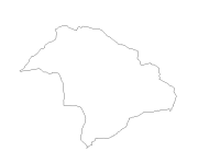
Digital line dataset of Watershed Boundary of Phobjikha Valley, Bhutan. This dataset is created using topographic sheet maps at scale of 50000 and prepared by ICIMOD.
-
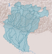
Digital polygon dataset of Sub Basin Boundary of Koshi Basin. This dataset is created using Topographic sheet data at scale of 25,000/50,000 of 1995 acquired from National Geographic Information Infrastructure Project (NGIIP), Dept. of Survey, Kathmandu, Nepal and ESRI Global dataset.