 Metadata Catalogue
Water resource management
Type of resources
Available actions
Topics
Keywords
Contact for the resource
Provided by
Years
Representation types
Update frequencies
status
Scale
-
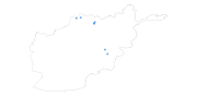
Digital point dataset of Water Resource Features (springs, well and Dams) of Afghanistan. This dataset is basic vector layer acquired from USGS.
-
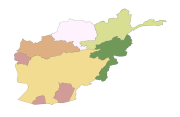
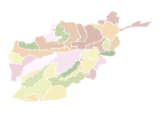
Digital polygon dataset of Major River Basins of Afghanistan. This dataset is created using 1:1,000,000 scale map of Afghanistan and derived from AIMS, Afghanistan.
-
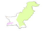
Digital polygon dataset of Major River Basins of Pakistan. This dataset is Basic Vector layer derived from ESRI Map & Data 2001.
-
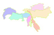
Digital polygon dataset of Major watersheds of Hindu Kush Himalayan (HKH) Region. This dataset is Basic Vector layer derived from ESRI Map & Data 2001.
-
Digital polygon dataset of River Basins of Afghanistan. This dataset is basic vector layer derived from Afghanistan Information Management Systems (AIMS), Afghanistan.
-
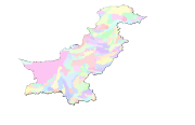
Digital polygon dataset of River Basins of Pakistan. This dataset is Basic Vector layer derived from ESRI Map & Data 2001.
-
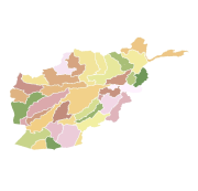
Digital polygon dataset of Watersheds of Afghanistan. This dataset is basic vector layer acquired from ESRI Data and Maps 2001.
-
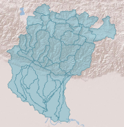
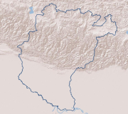
Digital polygon dataset of Sub Basin Boundary of Koshi Basin. This dataset is created using Topographic sheet data at scale of 25,000/50,000 of 1995 acquired from National Geographic Information Infrastructure Project (NGIIP), Dept. of Survey, Kathmandu, Nepal and ESRI Global dataset.
-
Digital line dataset of Basin Boundary of Koshi Basin. This dataset is created using Topographic sheet data at scale of 25,000/50,000, of 1995 acquired from National Geographic Information Infrastructure Project (NGIIP), Dept. of Survey, Kathmandu, Nepal and ESRI Global dataset.