 Metadata Catalogue
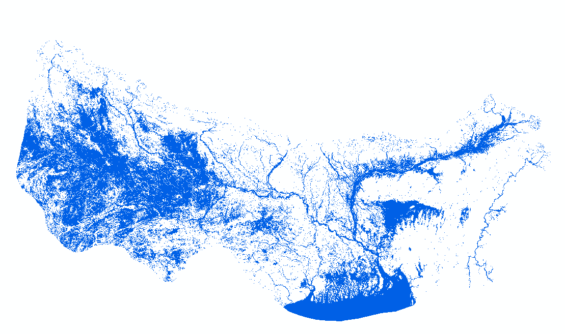
Water area
Type of resources
Topics
Keywords
Contact for the resource
Provided by
Update frequencies
status
Resolution
-

Nepal is one of the most flood affected country in the world. The frequency, intensity and duration of floods has been increased during last few decades. Due to increased population settlements in floodplains and irregular development damage of infrastructure, crop and property has increased creating severe impact on lives and livelihood. Understanding the severity and identification of extent and types of flood damage is highly important to plan effective response. The aim of this study was to develop appropriate methodology to determine extent of flood and damaged areas in near real time basis to support operational response. We have used Sentinel-1 synthetic aperture radar (SAR) images to generate flood extend data for the year 2017.
-

Bangladesh is one of the most flood affected country in the world. The frequency, intensity and duration of floods has been increased during last few decades. Due to increased population settlements in floodplains and irregular development damage of infrastructure, crop and property has increased creating severe impact on lives and livelihood. Understanding the severity and identification of extent and types of flood damage is highly important to plan effective response. The aim of this study was to develop appropriate methodology to determine extent of flood and damaged areas in near real time basis to support operational response. We have used Sentinel-1 synthetic aperture radar (SAR) images to generate flood extend data for the year 2017.
-

Nepal is one of the most flood affected country in the world. The frequency, intensity and duration of floods has been increased during last few decades. Due to increased population settlements in floodplains and irregular development damage of infrastructure, crop and property has increased creating severe impact on lives and livelihood. Understanding the severity and identification of extent and types of flood damage is highly important to plan effective response. The aim of this study was to develop appropriate methodology to determine extent of flood and damaged areas in near real time basis to support operational response. We have used Sentinel-1 synthetic aperture radar (SAR) images to generate flood extend data for the year 2017.
-
HydroSAR Hydro30 Surface Water Extent Product provides Radiometric Terrain Corrected (RTC) surface water extent over flood-prone regions in the Hindu Kush Himalaya (HKH) for the 2022 monsoon season. The data are generated from Sentinel-1 SAR imagery processed by ASF DAAC HyP3 using the hyp3_gamma plugin version 5.1.7 running GAMMA release 20210701.
-

Bangladesh is one of the most flood affected country in the world. The frequency, intensity and duration of floods has been increased during last few decades. Due to increased population settlements in floodplains and irregular development damage of infrastructure, crop and property has increased creating severe impact on lives and livelihood. Understanding the severity and identification of extent and types of flood damage is highly important to plan effective response. The aim of this study was to develop appropriate methodology to determine extent of flood and damaged areas in near real time basis to support operational response. We have used Sentinel-1 synthetic aperture radar (SAR) images to generate flood extend data for the year 2017.