 Metadata Catalogue
VDC
Type of resources
Available actions
Topics
Keywords
Contact for the resource
Provided by
Representation types
Update frequencies
status
Scale
-
Digital point data of VDC centroid locations of Nepal. This dataset is created using Topographic sheet maps of 25000/50000 scale published by Department of Survey Nepal in 1995 & onward and is in geographic coordinates. Attribute data includes National census 2001 variables at VDC level.
-
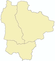
Digital polygon dataset of Village Development Committee, VDC Boundaries of Sagarmatha National Park, Nepal. This dataset is created using Topographic sheet data at scale of 25,000/50,000, of 1995 acquired from National Geographic Information Infrastructure Project (NGIIP), Dept. of Survey, Nepal.
-
Digital polygon dataset of Village Development Committee, VDC Boundaries of Charnawati River Watershed, Dolakha, Nepal. This dataset is created using Topographic sheet data at scale of 25,000/50,000, of 1995 acquired from National Geographic Information Infrastructure Project (NGIIP), Dept. of Survey, Nepal. The data was prepared for the Reducing Emission from Deforestation and Forest Degradation (REDD) Pilot Project. This is a joint project of ICIMOD with Asian Network for Sustainable Agriculture and Bio-resources (ANSAB) and Federation of Community for Forest Users of Nepal (FECOFUN) funded by NORAD.
-
Hazard, vulnerability and risk due to flood are calculated at Village Development Committee (VDC) level of Nepal. Hazard index has been calculated as an arithmetic sum of flood frequency, height above nearest drainage (HAND), river density and forest density. Vulnerability index is the function of population as an Exposure, Sensitivity (sex ratio, dependency ratio and child women ratio) and Resilience (road density, population in abroad, literacy, transport facility, etc). Then risk is the sum of hazard and vulnerability index.