 Metadata Catalogue
Utilities communication
Type of resources
Topics
Keywords
Contact for the resource
Provided by
Representation types
Update frequencies
status
Scale
-
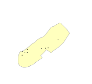
Digital point data of Electric Pole locations of RDT Centre of Bhutan. This dataset is prepared by ICIMOD based on ground survey 2008.
-

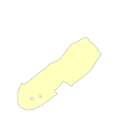
Digital point dataset of PCO location in Central Karakoram National Park (CKNP) area, Pakistan. This dataset is compiled through GPS based field survey conducted in year 2008.
-

Digital point dataset of Mobile Tower in Central Karakoram National Park(CKNP) area, Pakistan. This dataset is compiled through GPS based field survey conducted in year 2008.
-
Digital point data of Telephone Pole locations of RDT Centre of Bhutan. This dataset is prepared by ICIMOD based on ground survey 2008.
-

Digital point dataset of Internet facility in Central Karakoram National Park(CKNP) area, Pakistan. This dataset is compiled through GPS based field survey conducted in year 2008.
-

Digital line dataset of Utilities (Power Line, underground pipeline and above ground Pipeline) of Hindu Kush Himalayan (HKH) Region. This dataset is Basic Vector layer derived from ESRI Map & Data 2001.
-

Digital line dataset of utilities of Charnawati River Watershed, Dolakha, Nepal. This dataset is created using Topographic sheet data at scale of 25,000/50,000, of 1995 acquired from National Geographic Information Infrastructure Project (NGIIP), Dept. of Survey, Nepal. The data was prepared for the Reducing Emission from Deforestation and Forest Degradation (REDD) Pilot Project. This is a joint project of ICIMOD with Asian Network for Sustainable Agriculture and Bio-resources (ANSAB) and Federation of Community for Forest Users of Nepal (FECOFUN) funded by NORAD.