 Metadata Catalogue
Keyword
Transportation network
Type of resources
Topics
Keywords
Contact for the resource
Provided by
Representation types
Update frequencies
status
Scale
From
1
-
5
/
5
-
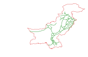
Digital line dataset of RailRoad Network of Pakistan. This dataset is Basic Vector layer derived from ESRI Map & Data 2001.
-
Digital line dataset of Road network of Afghanistan. This dataset is derived from Afghanistan Information Management Systems (AIMS), Afghanistan and ESRI Data and Maps 2001.
-
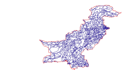
Digital line dataset of Road Network of Pakistan. This dataset is Basic Vector layer derived from ESRI Map & Data 2001.
-
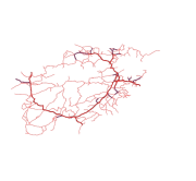
Digital line dataset of Road Network of Lamjung district, Nepal. This dataset is created using Central Service Map of 1:125,000 scale, published by Suspension Bridge Division (SBD), Kathmandu, Nepal in 1989.
-

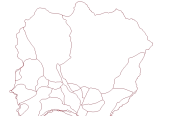
Digital line data of Road Network of RDT Centre of Bhutan. This dataset is prepared by ICIMOD based on ground survey 2008.